
Magnitude |
:4.2 |
| Date & Time (UTC) | 2005-08-26 02:21:40.5 |
| Date & Time (Local) | 1384/6/4 06:51:40.5 |
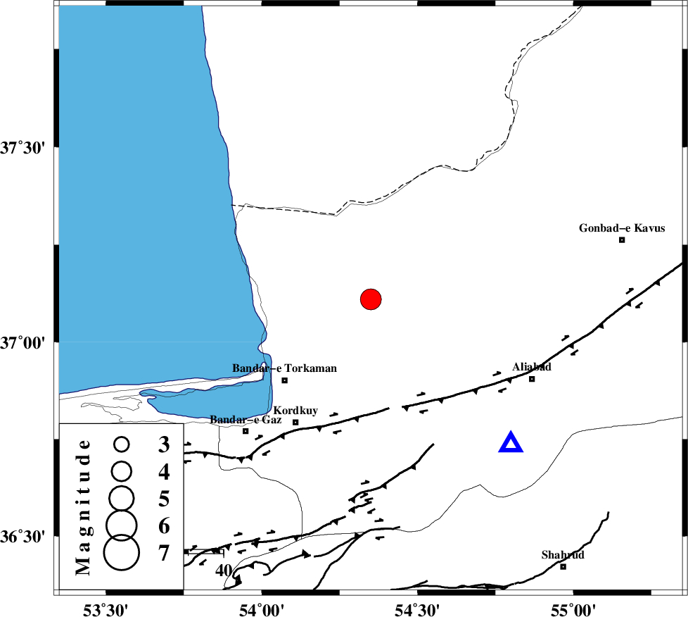
| Location | Lat:37.11 Lon: 54.35 |
| Region | |
Nearest Cities |
|
| 14 km North West of Aq Qaleh, Golestan Province | |
| 15 km North East of Banavar, Golestan Province | |
| 17 km North West of Qanqarmeh, Golestan Province | |
| 24 km North East of Gomishtappeh, Golestan Province | |
| 26 km North West of Nodeh malek, Golestan Province | |
| Depth | 16 km |
| Agency | |
Faults within 150 km: |
|
| KHAZAR_F (Length: 523 km) , Distance to epicenter: 32 km | |
| N_ALBORZ_F (Length: 360 km) , Distance to epicenter: 56 km | |
| SHAVAR_F (Length: 87 km) , Distance to epicenter: 60 km | |
| Number of Phases | 10 |
| RMS | 0.1 |
| Number of Stations | 6 |
| Error in Latitude | >2.9 km |
| Error in Longitude | 3 km |
| Error in Depth | 3.8 km |
Download waveform in seisan format
to download seisan software Click here
to access information about IIEES stations Click here
Amplitude | ||||||||
| UID | Agency | Station | Component | Amplitude | Period | Arrival Time | Proccessing Time | Signal Clip |
| 9789 | IIEES | DAMV | N | 2226.9 | 0.53 | 2005-08-26 02:23:05 | 2006-01-09 11:55:00 | n |
| 9790 | IIEES | ASAO | E | 165.5 | 0.63 | 2005-08-26 02:24:16 | 2006-01-09 11:55:00 | n |
Phase | ||||||||||||
| Agency | Station | Component | Phase Type | Phase Quality | First Motion | Observed Arrival Time | Time Residual | Loc. Flag | Input Weight | Distance | Azimuth | |
| IIEES | DAMV | Z | PN | E | 2005-08-26 02:22:21 | 0.2 | y | 269 | 233 | |||
| IIEES | DAMV | N | SG | E | 2005-08-26 02:22:56 | 0 | y | 269 | 233 | |||
| IIEES | THKV | Z | PN | E | 2005-08-26 02:22:30 | 0 | y | 338 | 248 | |||
| IIEES | ASAO | Z | PN | E | 2005-08-26 02:22:48 | 0.1 | y | 483 | 235 | |||
| IIEES | ASAO | N | SG | E | 2005-08-26 02:23:55 | -0.1 | y | 483 | 235 | |||
| IIEES | NASN | Z | PN | E | 2005-08-26 02:22:49 | -0.3 | y | 498 | 197 | |||
| IIEES | NASN | E | SN | 2005-08-26 02:23:41 | 0 | y | 498 | 197 | ||||
| IIEES | SNGE | Z | PN | E | 2005-08-26 02:23:11 | -0.1 | y | 669 | 253 | |||
| IIEES | KRBR | Z | PN | E | 2005-08-26 02:23:30 | -0.1 | y | 821 | 163 | |||
| IIEES | KRBR | N | SG | E | 2005-08-26 02:25:28 | 0.2 | y | 821 | 163 | |||