
Magnitude |
:2.8 |
| Date & Time (UTC) | 2005-08-14 19:05:02.1 |
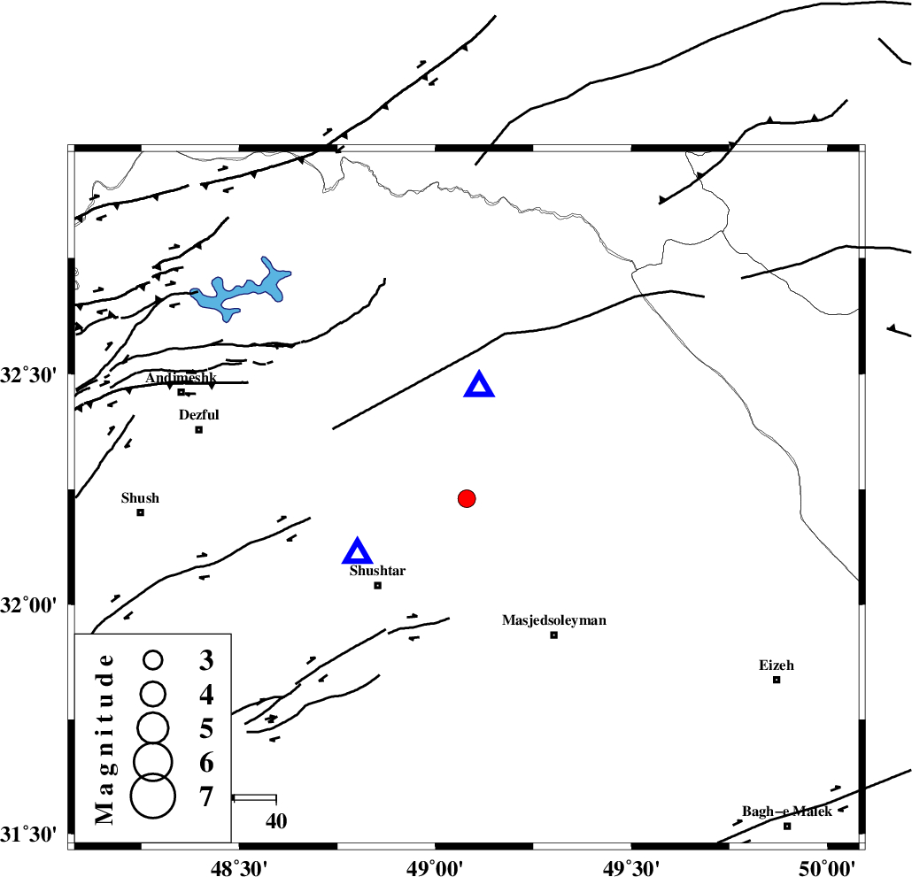
| Date & Time (Local) | 1384/5/23 23:35:02.1 |
| Location | Lat:32.23 Lon: 49.08 |
| Region | |
Nearest Cities |
|
| 6 km of Jaefarabad, Khoozestan Province | |
| 11 km North of Haft shahidan, Khoozestan Province | |
| 18 km South of Lali, Khoozestan Province | |
| 22 km North East of Samaleh, Khoozestan Province | |
| 25 km East of Gatvand, Khoozestan Province | |
| Depth | 5 km |
| Agency | |
Faults within 150 km: |
|
| DEZFUL_EMBAYMENT (Length: 228 km) , Distance to epicenter: 9 km | |
| MFF2 (Length: 205 km) , Distance to epicenter: 29 km | |
| BALARUD_F_Z2 (Length: 58 km) , Distance to epicenter: 54 km | |
| Number of Phases | 6 |
| RMS | 0 |
| Number of Stations | 4 |
| Error in Latitude | >1.9 km |
| Error in Longitude | 1.6 km |
| Error in Depth | 0 km |
Download waveform in seisan format
to download seisan software Click here
to access information about IIEES stations Click here
Amplitude | ||||||||
| UID | Agency | Station | Component | Amplitude | Period | Arrival Time | Proccessing Time | Signal Clip |
| 9702 | IIEES | SHGR | N | 2126.2 | 0.6 | 2005-08-14 19:05:12 | 2006-01-09 11:55:00 | n |
| 9703 | IIEES | SNGE | N | 16.3 | 0.72 | 2005-08-14 19:06:51 | 2006-01-09 11:55:00 | n |
Phase | ||||||||||||
| Agency | Station | Component | Phase Type | Phase Quality | First Motion | Observed Arrival Time | Time Residual | Loc. Flag | Input Weight | Distance | Azimuth | |
| IIEES | SHGR | Z | PG | E | 2005-08-14 19:05:07 | 0 | y | 29.4 | 244 | |||
| IIEES | SHGR | N | SG | E | 2005-08-14 19:05:11 | 0 | y | 29.4 | 244 | |||
| IIEES | NASN | Z | PN | E | 2005-08-14 19:05:55 | 0 | y | 356 | 79 | |||
| IIEES | SNGE | Z | PN | E | 2005-08-14 19:05:55 | 0 | y | 356 | 334 | |||
| IIEES | DAMV | Z | PN | E | 2005-08-14 19:06:08 | -0.1 | y | 463 | 34 | |||
| IIEES | DAMV | E | SN | 2005-08-14 19:06:56 | 0 | y | 463 | 34 | ||||