
Magnitude |
:3.4 |
| Date & Time (UTC) | 2005-07-31 00:20:18.9 |
| Date & Time (Local) | 1384/5/9 04:50:18.9 |
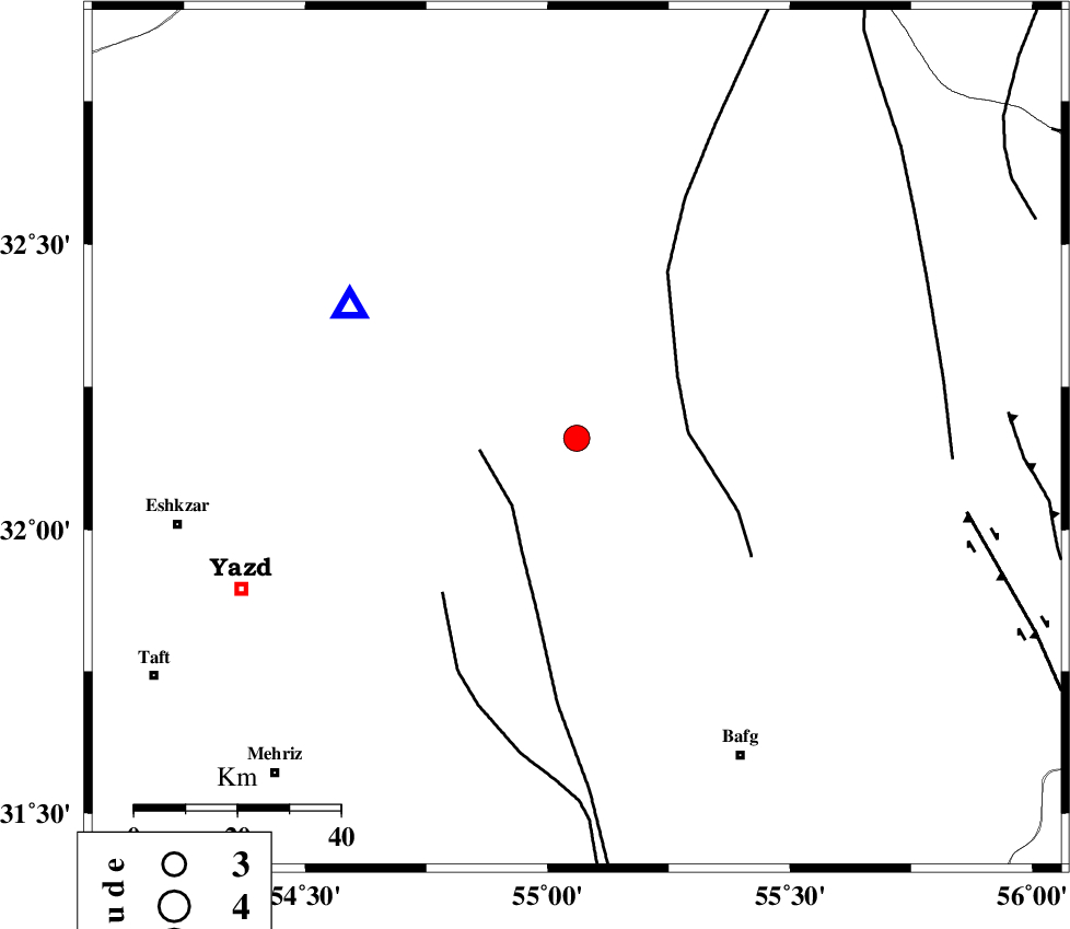
| Location | Lat:32.16 Lon: 55.06 |
| Region | |
Nearest Cities |
|
| 42 km South East of Kharaneq, Yazd Province | |
| 69 km North West of Mobarake, Yazd Province | |
| 70 km North West of Bafq, Yazd Province | |
| 72 km North East of Yazd, Yazd Province | |
| 73 km North East of Mohammadabad, Yazd Province | |
| Depth | 14 km |
| Agency | |
Faults within 150 km: |
|
| ANAR_F (Length: 91 km) , Distance to epicenter: 18 km | |
| POSHT_E_BADAM_F (Length: 128 km) , Distance to epicenter: 22 km | |
| ANAR_F (Length: 127 km) , Distance to epicenter: 40 km | |
| Number of Phases | 6 |
| RMS | 0.2 |
| Number of Stations | 5 |
| Error in Latitude | >5.7 km |
| Error in Longitude | 5.7 km |
| Error in Depth | 6.1 km |
Download waveform in seisan format
to download seisan software Click here
to access information about IIEES stations Click here
Amplitude | ||||||||
| UID | Agency | Station | Component | Amplitude | Period | Arrival Time | Proccessing Time | Signal Clip |
| 9589 | IIEES | KRBR | N | 312.5 | 0.53 | 2005-07-31 00:21:44 | 2006-01-09 11:55:00 | n |
| 9590 | IIEES | ZHSF | N | 7.7 | 0.71 | 2005-07-31 00:23:29 | 2006-01-09 11:55:00 | n |
Phase | ||||||||||||
| Agency | Station | Component | Phase Type | Phase Quality | First Motion | Observed Arrival Time | Time Residual | Loc. Flag | Input Weight | Distance | Azimuth | |
| IIEES | NASN | Z | PG | E | 2005-07-31 00:20:55 | 0 | y | 223 | 289 | |||
| IIEES | KRBR | Z | PN | E | 2005-07-31 00:21:03 | 0.3 | y | 290 | 146 | |||
| IIEES | KRBR | E | SG | E | 2005-07-31 00:21:40 | 0 | y | 290 | 146 | |||
| IIEES | GHIR | Z | PN | E | 2005-07-31 00:21:25 | 0.1 | y | 473 | 205 | |||
| IIEES | BNDS | Z | PN | E | 2005-07-31 00:21:33 | -0.4 | y | 538 | 168 | |||
| IIEES | ZHSF | Z | Pn | E | 2005-07-31 00:21:42 | -0.2 | y | 615 | 116 | |||