
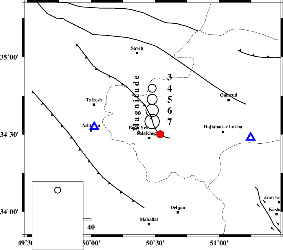
Magnitude |
:3.7 |
| Date & Time (UTC) | 2005-07-11 10:42:52.5 |
| Date & Time (Local) | 1384/4/20 15:12:52.5 |
| Location | Lat:34.6 Lon: 50.48 |
| Region | |
Nearest Cities |
|
| 14 km North East of Bagh yek, Qom Province | |
| 14 km North of Salafchegan, Qom Province | |
| 20 km South of Gazran, Qom Province | |
| 22 km North East of Dastjerd, Qom Province | |
| 35 km South East of Qareh chay, Markazi Province | |
| Depth | 14 km |
| Agency | |
Faults within 150 km: |
|
| INDES_F (Length: 98 km) , Distance to epicenter: 3 km | |
| TAFRESH_F (Length: 117 km) , Distance to epicenter: 50 km | |
| KUSHK_E_NOSRAT_F (Length: 230 km) , Distance to epicenter: 52 km | |
| Number of Phases | 6 |
| RMS | 0.2 |
| Number of Stations | 4 |
| Error in Latitude | >10.9 km |
| Error in Longitude | 6.5 km |
| Error in Depth | 11.8 km |
Download waveform in seisan format
to download seisan software Click here
to access information about IIEES stations Click here
Amplitude | ||||||||
| UID | Agency | Station | Component | Amplitude | Period | Arrival Time | Proccessing Time | Signal Clip |
| 9486 | IIEES | ASAO | N | 8398.3 | 0.34 | 2005-07-11 10:43:08 | 2006-01-09 11:55:00 | n |
| 9487 | IIEES | DAMV | N | 864.8 | 0.65 | 2005-07-11 10:43:53 | 2006-01-09 11:55:00 | n |
| 9488 | IIEES | GRMI | N | 48 | 0.83 | 2005-07-11 10:45:24 | 2006-01-09 11:55:00 | n |
Phase | ||||||||||||
| Agency | Station | Component | Phase Type | Phase Quality | First Motion | Observed Arrival Time | Time Residual | Loc. Flag | Input Weight | Distance | Azimuth | |
| IIEES | ASAO | Z | PG | E | 2005-07-11 10:43:00 | 0.3 | y | 42.3 | 263 | |||
| IIEES | ASAO | E | Sg | E | 2005-07-11 10:43:06 | -0.2 | y | 42.3 | 263 | |||
| IIEES | THKV | Z | PG | E | 2005-07-11 10:43:17 | -0.2 | y | 151 | 14 | |||
| IIEES | DAMV | Z | PG | E | 2005-07-11 10:43:21 | -0.2 | y | 178 | 49 | |||
| IIEES | DAMV | N | Sg | E | 2005-07-11 10:43:43 | 0.2 | y | 178 | 49 | |||
| IIEES | GRMI | Z | PN | E | 2005-07-11 10:44:05 | 0.3 | y | 521 | 334 | |||