
Magnitude |
:3 |
| Date & Time (UTC) | 2025-11-26 21:22:09.9 |
| Date & Time (Local) | 1404/9/6 00:52:09.9 |
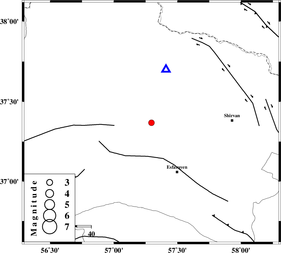
| Location | Lat:37.368 Lon: 57.296 |
| Region | Khorasan(north) Province, 12 km South of Bojnurd |
Nearest Cities |
|
| 12 km South of Bojnurd, Khorasan(north) Province | |
| 12 km South of Void, Khorasan(north) Province | |
| 23 km South West of Hesar-egarmkhanh, Khorasan(north) Province | |
| 29 km North East of Cheharborj, Khorasan(north) Province | |
| 30 km North West of Eraj, Khorasan(north) Province | |
| Depth | 12 km |
| Agency | |
Faults within 150 km: |
|
| ESFARAYEN_F (Length: 111 km) , Distance to epicenter: 23 km | |
| ROBATE_QARABIL_F (Length: 168 km) , Distance to epicenter: 26 km | |
| JAJARAM_F (Length: 77 km) , Distance to epicenter: 57 km | |
| Number of Phases | 9 |
| RMS | 0.4 |
| Number of Stations | 9 |
| Error in Latitude | >2.6 km |
| Error in Longitude | 2.6 km |
| Error in Depth | 5.3 km |
Download waveform in seisan format
to download seisan software Click here
to access information about IIEES stations Click here
Amplitude | ||||||||
| UID | Agency | Station | Component | Amplitude | Period | Arrival Time | Proccessing Time | Signal Clip |
| 200544 | IIEES SC | TABS | Z | 0.04 | 1 | 2025-11-26 21:23:09 | 2025-12-13 07:33:00 | n |
| 200545 | IIEES SC | SHRT | Z | 0.02 | 1 | 2025-11-26 21:23:18 | 2025-12-13 07:33:00 | n |
| 200546 | IIEES SC | CHTH | Z | 0.009 | 1 | 2025-11-26 21:23:30 | 2025-12-13 07:33:00 | n |
Phase | ||||||||||||
| Agency | Station | Component | Phase Type | Phase Quality | First Motion | Observed Arrival Time | Time Residual | Loc. Flag | Input Weight | Distance | Azimuth | |
| IIEES SC | BJRD | Z | EPg | E | 2025-11-26 21:22:16 | -0.3 | y | 0 | 38 | 15 | ||
| IIEES SC | BJRD | Z | ESg | E | 2025-11-26 21:22:22 | -0.2 | y | 0 | 38 | 15 | ||
| IIEES SC | SHRO | Z | EPg | E | 2025-11-26 21:22:40 | -0.8 | y | 0 | 190 | 217 | ||
| IIEES SC | ABGH | Z | EPn | E | 2025-11-26 21:22:46 | 0 | y | 0 | 233 | 252 | ||
| IIEES SC | KAGH | Z | EPn | E | 2025-11-26 21:22:48 | 0.2 | y | 0 | 241 | 101 | ||
| IIEES SC | TABS | Z | EPn | E | 2025-11-26 21:23:09 | 0.6 | y | 0 | 413 | 182 | ||
| IIEES SC | SHRT | Z | EPn | E | 2025-11-26 21:23:18 | -0.6 | y | 0 | 494 | 147 | ||
| IIEES SC | CHTH | Z | EPn | E | 2025-11-26 21:23:30 | 0.7 | y | 0 | 575 | 254 | ||
| IIEES SC | BSRN | Z | EPn | E | 2025-11-26 21:23:28 | -6.3 | n | 4 | 622 | 164 | ||