
Magnitude |
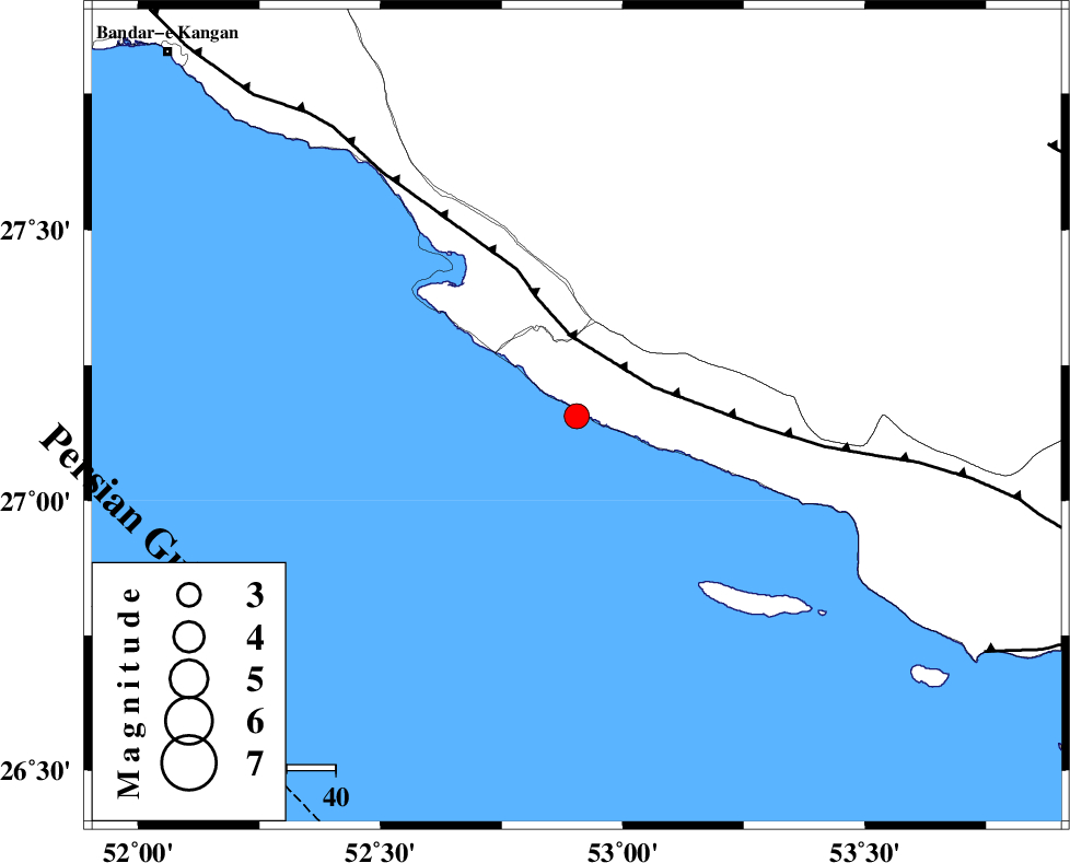
:3.2 |
| Date & Time (UTC) | 2025-11-05 15:36:21.6 |
| Date & Time (Local) | 1404/8/14 19:06:21.6 |
| Location | Lat:27.156 Lon: 52.905 |
| Region | Persian Gulf, 44 km South of Mehr |
Nearest Cities |
|
| 25 km South East of Chah-e mobarak, Bushehr Province | |
| 33 km South West of Lamerd, Fars Province | |
| 33 km South of Khoozi, Fars Province | |
| 44 km South of Mehr, Fars Province | |
| 46 km South East of Bandar-e asaluyeh, Bushehr Province | |
| Depth | 12 km |
| Agency | |
Faults within 150 km: |
|
| MFF3 (Length: 292 km) , Distance to epicenter: 16 km | |
| ZFF1 (Length: 165 km) , Distance to epicenter: 96 km | |
| LAR_F (Length: 99 km) , Distance to epicenter: 111 km | |
| Number of Phases | 7 |
| RMS | 0.6 |
| Number of Stations | 7 |
| Error in Latitude | >10.7 km |
| Error in Longitude | 10.7 km |
| Error in Depth | 31.4 km |
Download waveform in seisan format
to download seisan software Click here
to access information about IIEES stations Click here
Amplitude | ||||||||
| UID | Agency | Station | Component | Amplitude | Period | Arrival Time | Proccessing Time | Signal Clip |
| 200007 | IIEES SC | UOSS | Z | 0.02 | 1 | 2025-11-05 15:37:20 | 2025-11-09 06:06:00 | n |
| 200008 | IIEES SC | KRBR | Z | 0.05 | 1 | 2025-11-05 15:37:31 | 2025-11-09 06:06:00 | n |
| 200009 | IIEES SC | IRSR | Z | 0.005 | 1 | 2025-11-05 15:38:06 | 2025-11-09 06:06:00 | n |
| 200010 | IIEES SC | TABS | Z | 0.01 | 1 | 2025-11-05 15:38:13 | 2025-11-09 06:06:00 | n |
Phase | ||||||||||||
| Agency | Station | Component | Phase Type | Phase Quality | First Motion | Observed Arrival Time | Time Residual | Loc. Flag | Input Weight | Distance | Azimuth | |
| IIEES SC | GHIR | Z | EPg | E | 2025-11-05 15:36:42 | -0.3 | y | 0 | 125 | 4 | ||
| IIEES SC | UOSS | Z | EPn | E | 2025-11-05 15:37:20 | 0.2 | y | 0 | 411 | 127 | ||
| IIEES SC | KRBR | Z | EPn | E | 2025-11-05 15:37:31 | 0.7 | y | 0 | 490 | 50 | ||
| IIEES SC | MEH | Z | EPn | E | 2025-11-05 15:37:36 | 5 | n | 4 | 498 | 19 | ||
| IIEES SC | IRSR | Z | EPn | E | 2025-11-05 15:38:06 | -0.9 | y | 0 | 790 | 91 | ||
| IIEES SC | TABS | Z | EPn | E | 2025-11-05 15:38:13 | 1.1 | y | 0 | 826 | 29 | ||
| IIEES SC | GHVR | Z | EPn | E | 2025-11-05 15:38:12 | -0.2 | y | 0 | 827 | 349 | ||