
Magnitude |
:3.1 |
| Date & Time (UTC) | 2025-11-08 02:56:49.4 |
| Date & Time (Local) | 1404/8/17 06:26:49.4 |
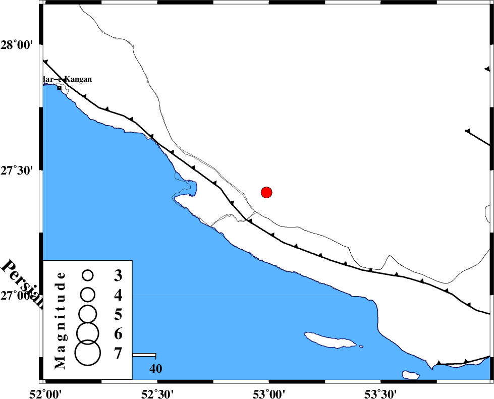
| Location | Lat:27.41 Lon: 52.988 |
| Region | Fars Province, 18 km South of Mehr |
Nearest Cities |
|
| 4 km of Khoozi, Fars Province | |
| 18 km South of Mehr, Fars Province | |
| 20 km North West of Lamerd, Fars Province | |
| 20 km North East of Chah-e mobarak, Bushehr Province | |
| 24 km South of Alamarvdasht, Fars Province | |
| Depth | 12 km |
| Agency | |
Faults within 150 km: |
|
| MFF3 (Length: 292 km) , Distance to epicenter: 15 km | |
| LAR_F (Length: 99 km) , Distance to epicenter: 92 km | |
| QIR_F (Length: 130 km) , Distance to epicenter: 100 km | |
| Number of Phases | 7 |
| RMS | 0.4 |
| Number of Stations | 7 |
| Error in Latitude | >4.5 km |
| Error in Longitude | 4.5 km |
| Error in Depth | 12 km |
Download waveform in seisan format
to download seisan software Click here
to access information about IIEES stations Click here
Amplitude | ||||||||
| UID | Agency | Station | Component | Amplitude | Period | Arrival Time | Proccessing Time | Signal Clip |
| 199982 | IIEES SC | UOSS | Z | 0.03 | 1 | 2025-11-08 02:57:49 | 2025-11-08 09:37:00 | n |
| 199983 | IIEES SC | KRBR | Z | 0.1 | 1 | 2025-11-08 02:57:56 | 2025-11-08 09:37:00 | n |
| 199984 | IIEES SC | MEH | Z | 0.01 | 1 | 2025-11-08 02:57:56 | 2025-11-08 09:37:00 | n |
| 199985 | IIEES SC | IRSR | Z | 0.005 | 1 | 2025-11-08 02:58:34 | 2025-11-08 09:37:00 | n |
Phase | ||||||||||||
| Agency | Station | Component | Phase Type | Phase Quality | First Motion | Observed Arrival Time | Time Residual | Loc. Flag | Input Weight | Distance | Azimuth | |
| IIEES SC | GHIR | Z | EPg | E | 2025-11-08 02:57:05 | -0.2 | y | 0 | 97 | 360 | ||
| IIEES SC | UOSS | Z | EPn | E | 2025-11-08 02:57:49 | -0.1 | y | 0 | 422 | 130 | ||
| IIEES SC | KRBR | Z | EPn | E | 2025-11-08 02:57:56 | 0.7 | y | 0 | 466 | 52 | ||
| IIEES SC | MEH | Z | EPn | E | 2025-11-08 02:57:56 | 0.3 | y | 0 | 468 | 20 | ||
| IIEES SC | IRSR | Z | EPn | E | 2025-11-08 02:58:34 | -0.2 | y | 0 | 782 | 94 | ||
| IIEES SC | TABS | Z | EPn | E | 2025-11-08 02:58:35 | -0.8 | y | 0 | 797 | 30 | ||
| IIEES SC | ASAO | Z | EPn | E | 2025-11-08 02:58:42 | 0.6 | y | 0 | 840 | 340 | ||