
Magnitude |
:3.4 |
| Date & Time (UTC) | 2025-10-20 06:15:14.1 |
| Date & Time (Local) | 1404/7/28 09:45:14.1 |
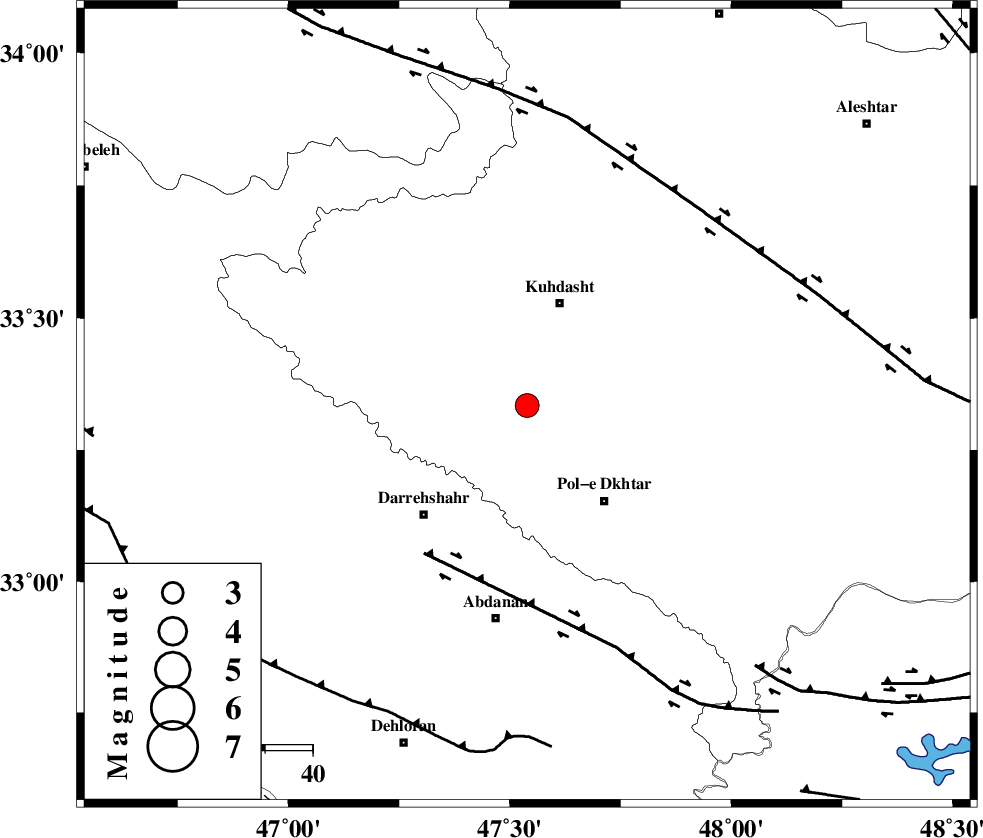
| Location | Lat:33.334 Lon: 47.539 |
| Region | Lorestan Province, 23 km South of Kuhdasht |
Nearest Cities |
|
| 9 km North of Chaqabol, Lorestan Province | |
| 9 km North of Suri, Lorestan Province | |
| 18 km South of Ashtarheh golgol, Lorestan Province | |
| 20 km North West of Morani, Lorestan Province | |
| 20 km East of Kunani, Lorestan Province | |
| Depth | 12 km |
| Agency | |
Faults within 150 km: |
|
| BALARUD_F_Z1 (Length: 87 km) , Distance to epicenter: 38 km | |
| HZF4 (Length: 492 km) , Distance to epicenter: 55 km | |
| MFF6 (Length: 144 km) , Distance to epicenter: 70 km | |
| Number of Phases | 8 |
| RMS | 0.1 |
| Number of Stations | 8 |
| Error in Latitude | >0.5 km |
| Error in Longitude | 0.5 km |
| Error in Depth | 108.6 km |
Download waveform in seisan format
to download seisan software Click here
to access information about IIEES stations Click here
Amplitude | ||||||||
| UID | Agency | Station | Component | Amplitude | Period | Arrival Time | Proccessing Time | Signal Clip |
| 199758 | IIEES SC | ASAO | Z | 0.4 | 1 | 2025-10-20 06:15:55 | 2025-10-21 07:26:00 | n |
| 199759 | IIEES SC | SRSL | Z | 0.2 | 1 | 2025-10-20 06:16:08 | 2025-10-21 07:26:00 | n |
| 199760 | IIEES SC | CHTH | Z | 0.05 | 1 | 2025-10-20 06:16:16 | 2025-10-21 07:26:00 | n |
| 199761 | IIEES SC | NASN | Z | 0.03 | 1 | 2025-10-20 06:16:23 | 2025-10-21 07:26:00 | n |
Phase | ||||||||||||
| Agency | Station | Component | Phase Type | Phase Quality | First Motion | Observed Arrival Time | Time Residual | Loc. Flag | Input Weight | Distance | Azimuth | |
| IIEES SC | ASAO | Z | EPn | E | 2025-10-20 06:15:55 | -0.1 | y | 0 | 266 | 60 | ||
| IIEES SC | BSR2 | Z | EPn | E | 2025-10-20 06:16:03 | 0.1 | y | 0 | 337 | 179 | ||
| IIEES SC | GHVR | Z | EPn | E | 2025-10-20 06:16:07 | 0.1 | y | 0 | 366 | 70 | ||
| IIEES SC | SRSL | Z | EPn | E | 2025-10-20 06:16:08 | 0 | y | 0 | 373 | 329 | ||
| IIEES SC | CHTH | Z | EPn | E | 2025-10-20 06:16:16 | 0.6 | y | 0 | 436 | 49 | ||
| IIEES SC | DAMV | Z | EPn | E | 2025-10-20 06:16:22 | 0.2 | y | 0 | 480 | 58 | ||
| IIEES SC | NASN | Z | EPn | E | 2025-10-20 06:16:23 | -0.1 | y | 0 | 496 | 97 | ||
| IIEES SC | GLO | Z | EPn | E | 2025-10-20 06:16:45 | -0.2 | y | 0 | 674 | 59 | ||