
Magnitude |
:3.5 |
| Date & Time (UTC) | 2025-07-29 22:52:29.4 |
| Date & Time (Local) | 1404/5/8 02:22:29.4 |
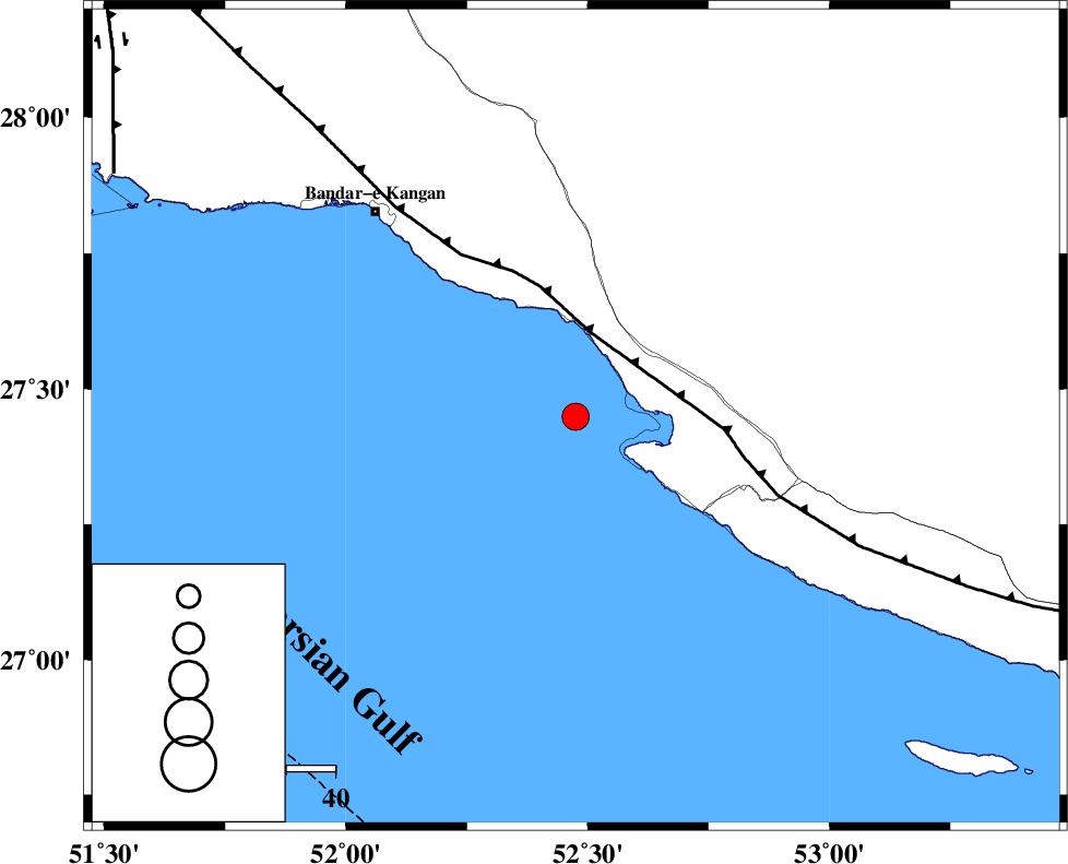
| Location | Lat:27.449 Lon: 52.475 |
| Region | Persian Gulf, 42 km -West of Mehr |
Nearest Cities |
|
| 13 km West of Bandar-e asaluyeh, Bushehr Province | |
| 27 km South East of Bandar-e taheri, Bushehr Province | |
| 30 km South West of Gallehdar, Fars Province | |
| 33 km North West of Chah-e mobarak, Bushehr Province | |
| 36 km South West of Ardavan-e olia, Fars Province | |
| Depth | 12 km |
| Agency | |
Faults within 150 km: |
|
| MFF3 (Length: 292 km) , Distance to epicenter: 18 km | |
| BORAZJAN_F (Length: 168 km) , Distance to epicenter: 106 km | |
| QIR_F (Length: 130 km) , Distance to epicenter: 115 km | |
| Number of Phases | 10 |
| RMS | 0.2 |
| Number of Stations | 10 |
| Error in Latitude | >1 km |
| Error in Longitude | 1 km |
| Error in Depth | 6.7 km |
Download waveform in seisan format
to download seisan software Click here
to access information about IIEES stations Click here
Amplitude | ||||||||
| UID | Agency | Station | Component | Amplitude | Period | Arrival Time | Proccessing Time | Signal Clip |
| 199180 | IIEES SC | NASN | Z | 0.01 | 1 | 2025-07-29 22:53:51 | 2025-09-17 08:29:00 | n |
| 199181 | IIEES SC | GHVR | Z | 0.02 | 1 | 2025-07-29 22:54:15 | 2025-09-17 08:29:00 | n |
| 199182 | IIEES SC | BSRN | Z | 0.01 | 1 | 2025-07-29 22:54:18 | 2025-09-17 08:29:00 | n |
| 199183 | IIEES SC | RAYN | Z | 0.02 | 1 | 2025-07-29 22:54:19 | 2025-09-17 08:29:00 | n |
Phase | ||||||||||||
| Agency | Station | Component | Phase Type | Phase Quality | First Motion | Observed Arrival Time | Time Residual | Loc. Flag | Input Weight | Distance | Azimuth | |
| IIEES SC | GHIR | Z | EPg | E | 2025-07-29 22:52:47 | 0 | y | 0 | 106 | 29 | ||
| IIEES SC | UOSS | Z | EPn | E | 2025-07-29 22:53:35 | 0.1 | y | 0 | 465 | 127 | ||
| IIEES SC | KRBR | Z | EPn | E | 2025-07-29 22:53:36 | -3.4 | n | 4 | 504 | 56 | ||
| IIEES SC | BSR2 | Z | EPn | E | 2025-07-29 22:53:48 | 0.3 | y | 0 | 569 | 304 | ||
| IIEES SC | YZKH | Z | EPn | E | 2025-07-29 22:53:39 | -10.2 | n | 4 | 585 | 20 | ||
| IIEES SC | NASN | Z | EPn | E | 2025-07-29 22:53:51 | 0 | y | 0 | 594 | 3 | ||
| IIEES SC | GHVR | Z | EPn | E | 2025-07-29 22:54:15 | 0.1 | y | 0 | 788 | 351 | ||
| IIEES SC | BSRN | Z | EPn | E | 2025-07-29 22:54:18 | -0.5 | y | 0 | 815 | 52 | ||
| IIEES SC | RAYN | Z | EPn | E | 2025-07-29 22:54:19 | -0.2 | y | 0 | 825 | 238 | ||
| IIEES SC | SRSL | Z | EPn | E | 2025-07-29 22:55:03 | 0.1 | y | 0 | 1178 | 326 | ||