
Magnitude |
:2.6 |
| Date & Time (UTC) | 2025-09-11 22:47:16.4 |
| Date & Time (Local) | 1404/6/21 02:17:16.4 |
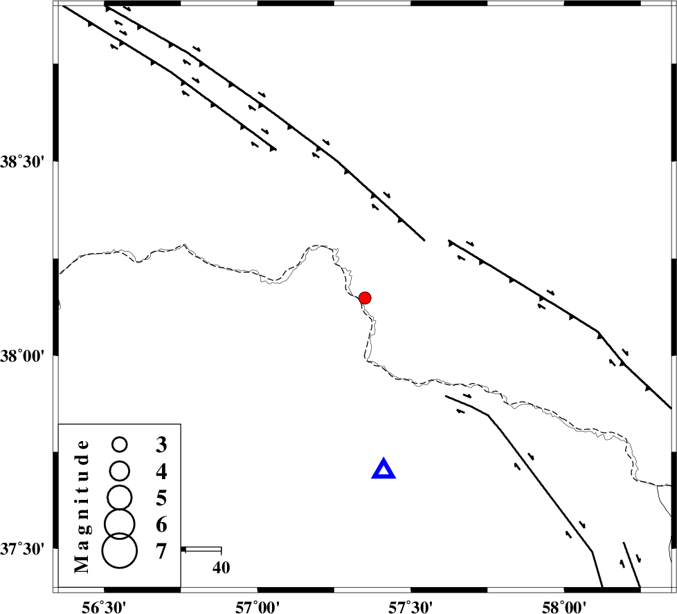
| Location | Lat:38.148 Lon: 57.35 |
| Region | , 75 km North of Bojnurd |
Nearest Cities |
|
| 30 km North West of Gifan olia, Khorasan(north) Province | |
| 31 km North East of Raz, Khorasan(north) Province | |
| 42 km North East of Tangehzar, Khorasan(north) Province | |
| 55 km East of Yekehsoud-e paeen, Khorasan(north) Province | |
| 57 km North West of Yangi ghale-ye bala, Khorasan(north) Province | |
| Depth | 12 km |
| Agency | |
Faults within 150 km: |
|
| MAIN_KOPEHDAGH_F2 (Length: 131 km) , Distance to epicenter: 24 km | |
| MAIN_KOPEHDAGH_F3 (Length: 96 km) , Distance to epicenter: 29 km | |
| BAGHAN_GERMAB_F (Length: 79 km) , Distance to epicenter: 36 km | |
| Number of Phases | 5 |
| RMS | 0.7 |
| Number of Stations | 5 |
| Error in Latitude | >18.9 km |
| Error in Longitude | 18.9 km |
| Error in Depth | 999 km |
Download waveform in seisan format
to download seisan software Click here
to access information about IIEES stations Click here
Amplitude | ||||||||
| UID | Agency | Station | Component | Amplitude | Period | Arrival Time | Proccessing Time | Signal Clip |
| 199080 | IIEES SC | SHRO | Z | 0.04 | 1 | 2025-09-11 22:47:56 | 2025-09-13 08:46:00 | n |
| 199081 | IIEES SC | KAGH | Z | 0.04 | 1 | 2025-09-11 22:47:57 | 2025-09-13 08:46:00 | n |
| 199082 | IIEES SC | TABS | Z | 0.01 | 1 | 2025-09-11 22:48:27 | 2025-09-13 08:46:00 | n |
Phase | ||||||||||||
| Agency | Station | Component | Phase Type | Phase Quality | First Motion | Observed Arrival Time | Time Residual | Loc. Flag | Input Weight | Distance | Azimuth | |
| IIEES SC | SHRO | Z | EPn | E | 2025-09-11 22:47:56 | -1 | y | 0 | 266 | 207 | ||
| IIEES SC | KAGH | Z | EPn | E | 2025-09-11 22:47:57 | -0.5 | y | 0 | 267 | 120 | ||
| IIEES SC | ABGH | Z | EPn | E | 2025-09-11 22:47:59 | 0.9 | y | 0 | 275 | 235 | ||
| IIEES SC | TABS | Z | EPn | E | 2025-09-11 22:48:27 | 0.7 | y | 0 | 500 | 182 | ||
| IIEES SC | SHRT | Z | EPn | E | 2025-09-11 22:48:34 | 0.2 | y | 0 | 566 | 152 | ||