
Magnitude |
:2.9 |
| Date & Time (UTC) | 2025-08-16 12:51:27.9 |
| Date & Time (Local) | 1404/5/25 16:21:27.9 |
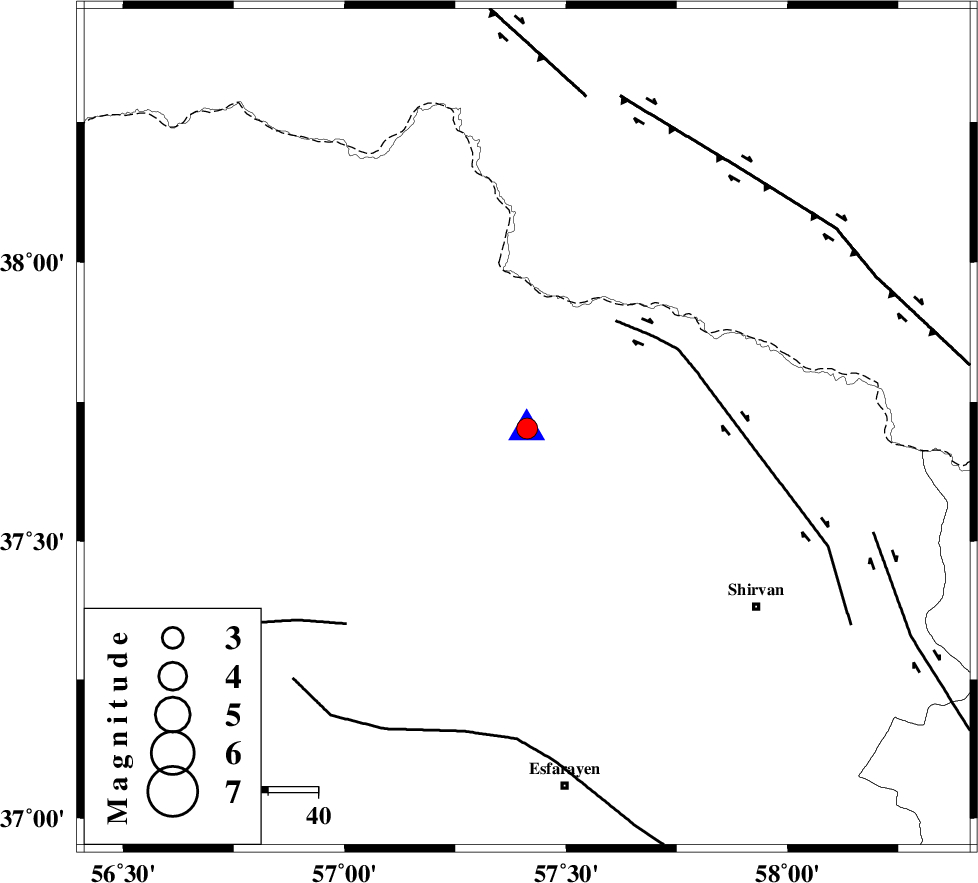
| Location | Lat:37.702 Lon: 57.412 |
| Region | Khorasan(north) Province, 27 km North of Bojnurd |
Nearest Cities |
|
| 22 km North of Hesar-egarmkhanh, Khorasan(north) Province | |
| 23 km South of Gifan olia, Khorasan(north) Province | |
| 27 km North of Bojnurd, Khorasan(north) Province | |
| 27 km North of Void, Khorasan(north) Province | |
| 30 km West of Yangi ghale-ye bala, Khorasan(north) Province | |
| Depth | 9 km |
| Agency | |
Faults within 150 km: |
|
| BAGHAN_GERMAB_F (Length: 79 km) , Distance to epicenter: 28 km | |
| ROBATE_QARABIL_F (Length: 168 km) , Distance to epicenter: 53 km | |
| ESFARAYEN_F (Length: 111 km) , Distance to epicenter: 62 km | |
| Number of Phases | 6 |
| RMS | 0.3 |
| Number of Stations | 6 |
| Error in Latitude | >7.7 km |
| Error in Longitude | 7.7 km |
| Error in Depth | 3.8 km |
Download waveform in seisan format
to download seisan software Click here
to access information about IIEES stations Click here
Amplitude | ||||||||
| UID | Agency | Station | Component | Amplitude | Period | Arrival Time | Proccessing Time | Signal Clip |
| 198865 | IIEES SC | TABS | Z | 0.02 | 1 | 2025-08-16 12:52:32 | 2025-08-17 09:09:00 | n |
| 198866 | IIEES SC | SHRT | Z | 0.01 | 1 | 2025-08-16 12:52:40 | 2025-08-17 09:09:00 | n |
Phase | ||||||||||||
| Agency | Station | Component | Phase Type | Phase Quality | First Motion | Observed Arrival Time | Time Residual | Loc. Flag | Input Weight | Distance | Azimuth | |
| IIEES SC | BJRD | Z | EPg | E | 2025-08-16 12:51:29 | 0.1 | y | 0 | 0 | 218 | ||
| IIEES SC | SHRO | Z | EPn | E | 2025-08-16 12:51:50 | -13.9 | n | 4 | 226 | 214 | ||
| IIEES SC | KAGH | Z | EPn | E | 2025-08-16 12:52:06 | 0.1 | y | 0 | 241 | 111 | ||
| IIEES SC | ABGH | Z | EPn | E | 2025-08-16 12:52:07 | -0.1 | y | 0 | 256 | 245 | ||
| IIEES SC | TABS | Z | EPn | E | 2025-08-16 12:52:32 | 0.4 | y | 0 | 450 | 183 | ||
| IIEES SC | SHRT | Z | EPn | E | 2025-08-16 12:52:40 | -0.5 | y | 0 | 520 | 150 | ||