
Magnitude |
:3 |
| Date & Time (UTC) | 2025-08-01 20:02:09.8 |
| Date & Time (Local) | 1404/5/10 23:32:09.8 |
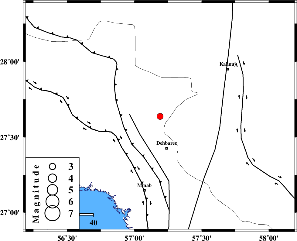
| Location | Lat:27.638 Lon: 57.191 |
| Region | Hormozgan Province, 24 km North of Dehbarez |
Nearest Cities |
|
| 12 km South of Ziaratali, Hormozgan Province | |
| 22 km South of Fariab, Hormozgan Province | |
| 23 km North of Balashahr, Hormozgan Province | |
| 24 km North of Dehbarez, Hormozgan Province | |
| 27 km North West of Bejogan, Kerman Province | |
| Depth | 12 km |
| Agency | |
Faults within 150 km: |
|
| ZENDAN_MINAB_F_Z1 (Length: 183 km) , Distance to epicenter: 20 km | |
| MAIN_ZAGROS_R_F (Length: 1106 km) , Distance to epicenter: 28 km | |
| HZF2 (Length: 437 km) , Distance to epicenter: 35 km | |
| Number of Phases | 8 |
| RMS | 0.5 |
| Number of Stations | 8 |
| Error in Latitude | >5.7 km |
| Error in Longitude | 5.7 km |
| Error in Depth | 999 km |
Download waveform in seisan format
to download seisan software Click here
to access information about IIEES stations Click here
Amplitude | ||||||||
| UID | Agency | Station | Component | Amplitude | Period | Arrival Time | Proccessing Time | Signal Clip |
| 198837 | IIEES SC | UOSS | Z | 0.09 | 1 | 2025-08-01 20:02:56 | 2025-08-10 07:52:00 | n |
| 198838 | IIEES SC | IRSR | Z | 0.01 | 1 | 2025-08-01 20:03:03 | 2025-08-10 07:52:00 | n |
| 198839 | IIEES SC | TABS | Z | 0.02 | 1 | 2025-08-01 20:03:39 | 2025-08-10 07:52:00 | n |
Phase | ||||||||||||
| Agency | Station | Component | Phase Type | Phase Quality | First Motion | Observed Arrival Time | Time Residual | Loc. Flag | Input Weight | Distance | Azimuth | |
| IIEES SC | KRBR | Z | EPn | E | 2025-08-01 20:02:41 | -9.4 | n | 4 | 263 | 351 | ||
| IIEES SC | UOSS | Z | EPn | E | 2025-08-01 20:02:56 | -0.2 | y | 0 | 314 | 198 | ||
| IIEES SC | IRSR | Z | EPn | E | 2025-08-01 20:03:03 | 0.1 | y | 0 | 371 | 101 | ||
| IIEES SC | CHBR | Z | EPn | E | 2025-08-01 20:03:07 | 0.5 | y | 0 | 398 | 125 | ||
| IIEES SC | GHIR | Z | EPn | E | 2025-08-01 20:03:10 | 0.6 | y | 0 | 420 | 280 | ||
| IIEES SC | BSRN | Z | EPn | E | 2025-08-01 20:03:04 | -17.5 | n | 4 | 515 | 21 | ||
| IIEES SC | YZKH | Z | EPn | E | 2025-08-01 20:03:13 | -17 | n | 4 | 583 | 335 | ||
| IIEES SC | TABS | Z | EPn | E | 2025-08-01 20:03:39 | -0.8 | y | 0 | 666 | 359 | ||