
Magnitude |
:2.8 |
| Date & Time (UTC) | 2025-08-10 02:47:43.9 |
| Date & Time (Local) | 1404/5/19 06:17:43.9 |
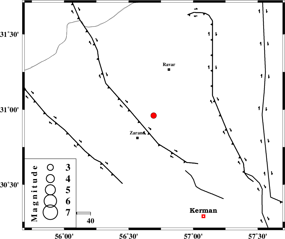
| Location | Lat:30.96 Lon: 56.693 |
| Region | Kerman Province, 20 km North-East of Zarand |
Nearest Cities |
|
| 8 km of Ahmadi, Kerman Province | |
| 15 km North of Hatkan, Kerman Province | |
| 17 km East of Dasht-e khak, Kerman Province | |
| 20 km North East of Zarand, Kerman Province | |
| 24 km North East of Mohammadabad, Kerman Province | |
| Depth | 12 km |
| Agency | |
Faults within 150 km: |
|
| KUHBANAN_F (Length: 189 km) , Distance to epicenter: 19 km | |
| LAKARKUH_F (Length: 138 km) , Distance to epicenter: 46 km | |
| CHATRUD_F (Length: 37 km) , Distance to epicenter: 47 km | |
| Number of Phases | 6 |
| RMS | 0.3 |
| Number of Stations | 6 |
| Error in Latitude | >31 km |
| Error in Longitude | 56.7 km |
| Error in Depth | 12 km |
Download waveform in seisan format
to download seisan software Click here
to access information about IIEES stations Click here
Amplitude | ||||||||
| UID | Agency | Station | Component | Amplitude | Period | Arrival Time | Proccessing Time | Signal Clip |
| 198829 | IIEES SC | KRBR | Z | 0.3 | 1 | 2025-08-10 02:48:02 | 2025-08-10 05:37:00 | n |
| 198830 | IIEES SC | BSRN | Z | 0.09 | 1 | 2025-08-10 02:48:24 | 2025-08-10 05:37:00 | n |
| 198831 | IIEES SC | TABS | Z | 0.1 | 1 | 2025-08-10 02:48:29 | 2025-08-10 05:37:00 | n |
| 198832 | IIEES SC | SHRT | Z | 0.02 | 1 | 2025-08-10 02:48:47 | 2025-08-10 05:37:00 | n |
Phase | ||||||||||||
| Agency | Station | Component | Phase Type | Phase Quality | First Motion | Observed Arrival Time | Time Residual | Loc. Flag | Input Weight | Distance | Azimuth | |
| IIEES SC | KRBR | Z | EPg | E | 2025-08-10 02:48:02 | -0.1 | y | 0 | 109 | 177 | ||
| IIEES SC | YZKH | Z | EPn | E | 2025-08-10 02:47:55 | -28.2 | n | 4 | 255 | 308 | ||
| IIEES SC | BSRN | Z | EPn | E | 2025-08-10 02:48:24 | 0.4 | y | 0 | 257 | 64 | ||
| IIEES SC | TABS | Z | EPn | E | 2025-08-10 02:48:29 | 0.3 | y | 0 | 301 | 8 | ||
| IIEES SC | SHRT | Z | EPn | E | 2025-08-10 02:48:47 | -0.5 | y | 0 | 451 | 49 | ||
| IIEES SC | SHRO | Z | EPn | E | 2025-08-10 02:48:57 | -4.1 | n | 4 | 563 | 354 | ||