
Magnitude |
:3.2 |
| Date & Time (UTC) | 2025-06-20 11:58:41.1 |
| Date & Time (Local) | 1404/3/30 15:28:41.1 |
| Location | Lat:36.9 Lon: 53.596 |
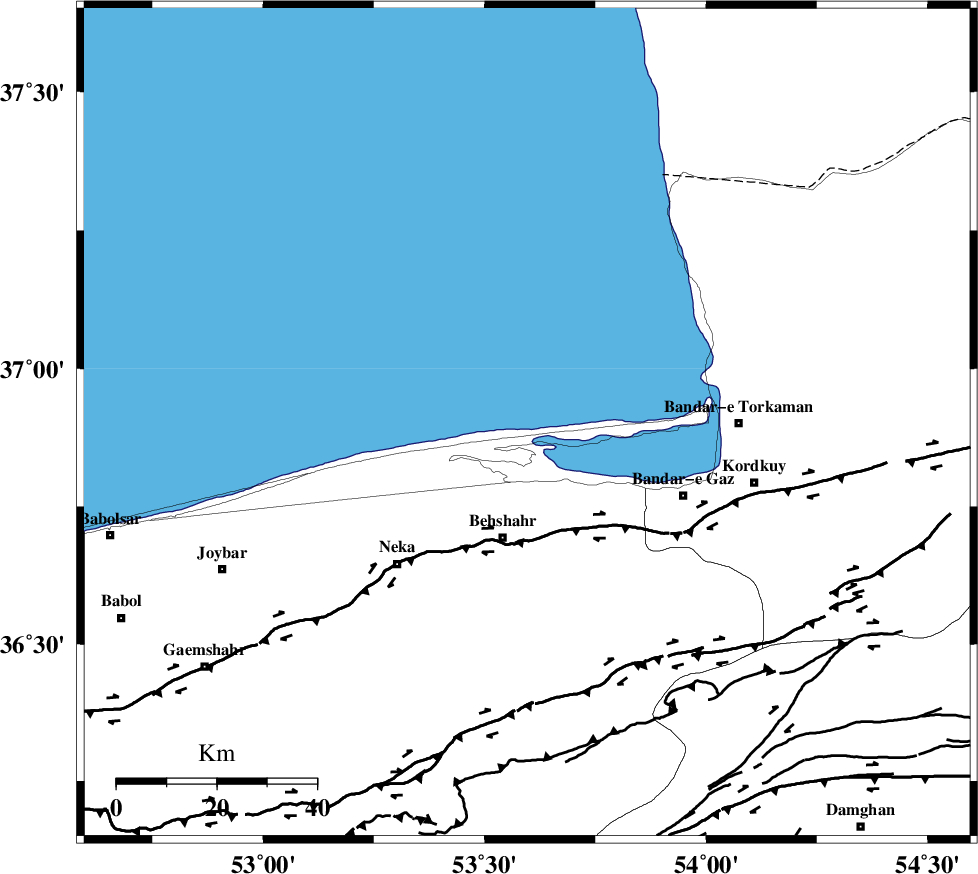
| Region | Caspian Sea, 23 km North of Behshahr |
Nearest Cities |
|
| 23 km North of Behshahr, Mazandaran Province | |
| 24 km North West of Lamrask, Mazandaran Province | |
| 26 km North East of Zaghmarz, Mazandaran Province | |
| 27 km North East of Kuhestan, Mazandaran Province | |
| 27 km North West of Galugah, Mazandaran Province | |
| Depth | 12 km |
| Agency | |
Faults within 150 km: |
|
| KHAZAR_F (Length: 523 km) , Distance to epicenter: 23 km | |
| N_ALBORZ_F (Length: 360 km) , Distance to epicenter: 54 km | |
| ASTANEH_F (Length: 72 km) , Distance to epicenter: 78 km | |
| Number of Phases | 5 |
| RMS | 0.1 |
| Number of Stations | 5 |
| Error in Latitude | >36.9 km |
| Error in Longitude | 53.6 km |
| Error in Depth | 12 km |
Download waveform in seisan format
to download seisan software Click here
to access information about IIEES stations Click here
Amplitude | ||||||||
| UID | Agency | Station | Component | Amplitude | Period | Arrival Time | Proccessing Time | Signal Clip |
| 198508 | IIEES SC | GHVR | Z | 0.1 | 1 | 2025-06-20 11:59:31 | 2025-06-21 05:25:00 | n |
| 198509 | IIEES SC | ASAO | Z | 0.05 | 1 | 2025-06-20 11:59:40 | 2025-06-21 05:25:00 | n |
| 198510 | IIEES SC | NASN | Z | 0.03 | 1 | 2025-06-20 11:59:46 | 2025-06-21 05:25:00 | n |
Phase | ||||||||||||
| Agency | Station | Component | Phase Type | Phase Quality | First Motion | Observed Arrival Time | Time Residual | Loc. Flag | Input Weight | Distance | Azimuth | |
| IIEES SC | MRVT | Z | EPn | E | 2025-06-20 11:59:18 | 0 | y | 0 | 237 | 69 | ||
| IIEES SC | GHVR | Z | EPn | E | 2025-06-20 11:59:31 | 0.2 | y | 0 | 343 | 218 | ||
| IIEES SC | ASAO | Z | EPn | E | 2025-06-20 11:59:40 | -0.1 | y | 0 | 415 | 231 | ||
| IIEES SC | NASN | Z | EPn | E | 2025-06-20 11:59:46 | -0.1 | y | 0 | 461 | 189 | ||
| IIEES SC | YZKH | Z | EPn | E | 2025-06-20 11:59:22 | -30.2 | n | 4 | 509 | 170 | ||