
Magnitude |
:2.7 |
| Date & Time (UTC) | 2025-05-10 21:20:25.4 |
| Date & Time (Local) | 1404/2/21 00:50:25.4 |
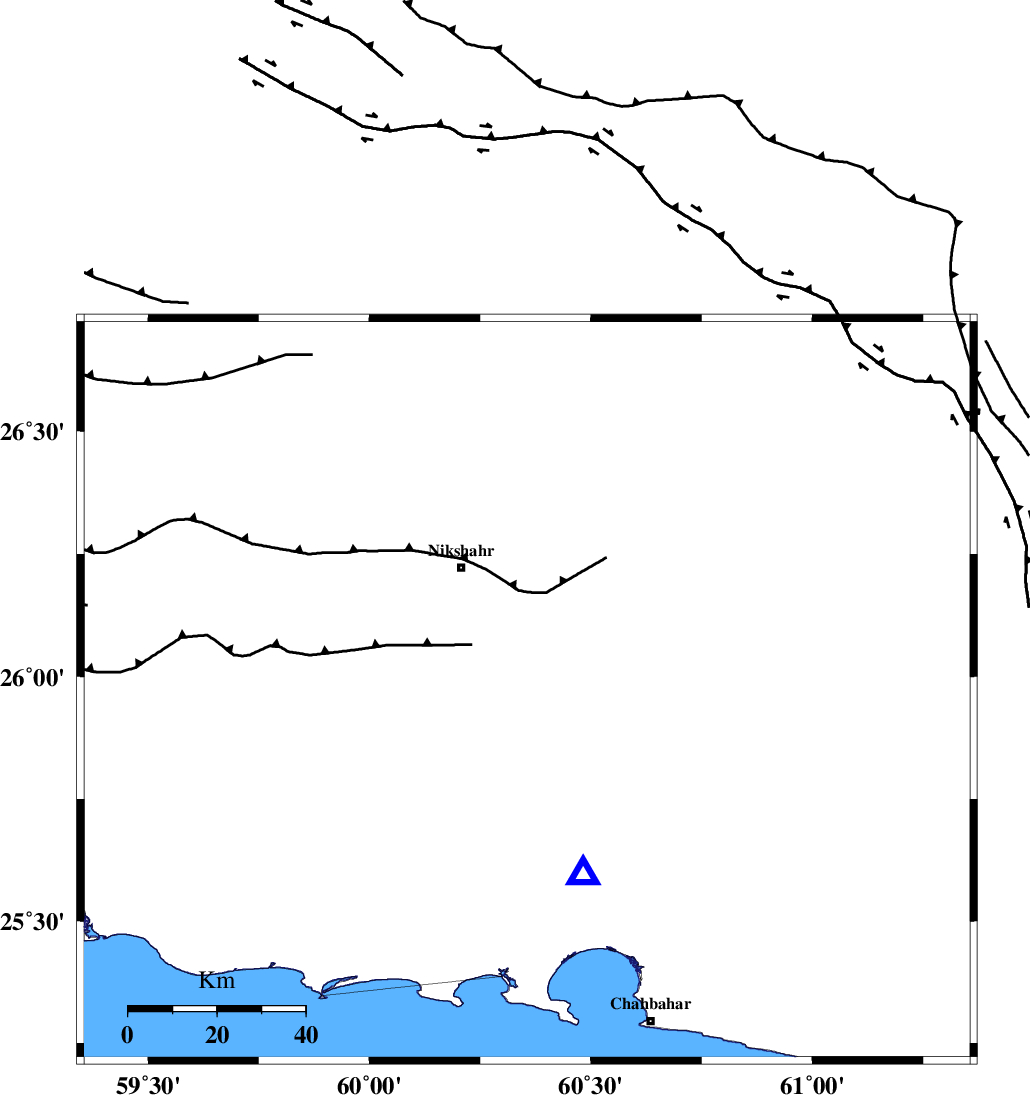
| Location | Lat:25.972 Lon: 60.356 |
| Region | Sistan va Baloochestan Province, 31 km South-East of Nikshahr |
Nearest Cities |
|
| 31 km South East of Nikshahr, Sistan va Baloochestan Province | |
| 32 km South East of Mokht, Sistan va Baloochestan Province | |
| 48 km North East of Kahir, Sistan va Baloochestan Province | |
| 50 km South West of Qasregand, Sistan va Baloochestan Province | |
| 52 km South East of Hichan, Sistan va Baloochestan Province | |
| Depth | 15 km |
| Agency | |
Faults within 150 km: |
|
| GHASR_E_GHAND_F (Length: 180 km) , Distance to epicenter: 41 km | |
| LASHAR_F (Length: 68 km) , Distance to epicenter: 73 km | |
| MAKRAN_F (Length: 414 km) , Distance to epicenter: 73 km | |
| Number of Phases | 6 |
| RMS | 0.6 |
| Number of Stations | 6 |
| Error in Latitude | >2.3 km |
| Error in Longitude | 2.3 km |
| Error in Depth | 5.6 km |
Download waveform in seisan format
to download seisan software Click here
to access information about IIEES stations Click here
Amplitude | ||||||||
| UID | Agency | Station | Component | Amplitude | Period | Arrival Time | Proccessing Time | Signal Clip |
| 198186 | IIEES SC | CHBR | Z | 1 | 1 | 2025-05-10 21:20:33 | 2025-05-11 05:11:00 | n |
| 198187 | IIEES SC | ZHSF | Z | 0.02 | 1 | 2025-05-10 21:21:22 | 2025-05-11 05:11:00 | n |
| 198188 | IIEES SC | GHIR | Z | 0.002 | 1 | 2025-05-10 21:22:09 | 2025-05-11 05:11:00 | n |
| 198189 | IIEES SC | SHRT | Z | 0.007 | 1 | 2025-05-10 21:22:17 | 2025-05-11 05:11:00 | n |
Phase | ||||||||||||
| Agency | Station | Component | Phase Type | Phase Quality | First Motion | Observed Arrival Time | Time Residual | Loc. Flag | Input Weight | Distance | Azimuth | |
| IIEES SC | CHBR | Z | EPg | E | 2025-05-10 21:20:33 | 0.1 | y | 0 | 44 | 163 | ||
| IIEES SC | IRSR | Z | EPg | E | 2025-05-10 21:20:46 | 0.8 | y | 0 | 122 | 24 | ||
| IIEES SC | ZHSF | Z | EPn | E | 2025-05-10 21:21:22 | -0.8 | y | 0 | 405 | 6 | ||
| IIEES SC | BSRN | Z | EPn | E | 2025-05-10 21:21:43 | -13.5 | n | 4 | 675 | 350 | ||
| IIEES SC | GHIR | Z | EPn | E | 2025-05-10 21:22:09 | 0.3 | y | 0 | 774 | 289 | ||
| IIEES SC | SHRT | Z | EPn | E | 2025-05-10 21:22:17 | -0.9 | y | 0 | 851 | 360 | ||