
Magnitude |
:3.1 |
| Date & Time (UTC) | 2025-04-21 09:14:12.4 |
| Date & Time (Local) | 1404/2/1 12:44:12.4 |
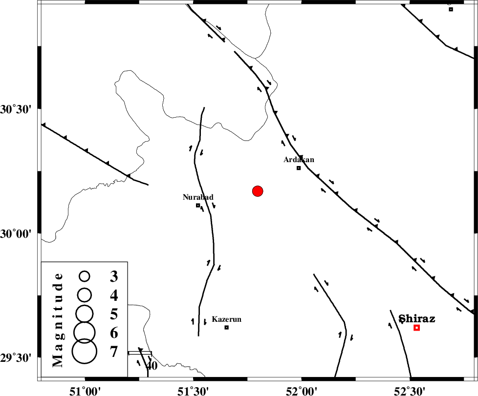
| Location | Lat:30.169 Lon: 51.797 |
| Region | Fars Province, 21 km -West of Ardakan |
Nearest Cities |
|
| 21 km West of Ardakan, Fars Province | |
| 22 km West of Bahrghan, Fars Province | |
| 27 km North East of Gachgaran, Fars Province | |
| 27 km North East of Nurabad, Fars Province | |
| 29 km East of Masiri, Fars Province | |
| Depth | 12 km |
| Agency | |
Faults within 150 km: |
|
| KAZERUN_F (Length: 96 km) , Distance to epicenter: 23 km | |
| HZF3 (Length: 197 km) , Distance to epicenter: 25 km | |
| KAREBASS_F (Length: 98 km) , Distance to epicenter: 45 km | |
| Number of Phases | 4 |
| RMS | 0.2 |
| Number of Stations | 4 |
| Error in Latitude | >30.2 km |
| Error in Longitude | 51.8 km |
| Error in Depth | 12 km |
Download waveform in seisan format
to download seisan software Click here
to access information about IIEES stations Click here
Amplitude | ||||||||
| UID | Agency | Station | Component | Amplitude | Period | Arrival Time | Proccessing Time | Signal Clip |
| 197958 | IIEES SC | NASN | Z | 0.06 | 1 | 2025-04-21 09:14:58 | 2025-04-22 05:02:00 | n |
| 197959 | IIEES SC | YZKH | Z | 0.1 | 1 | 2025-04-21 09:15:05 | 2025-04-22 05:02:00 | n |
| 197960 | IIEES SC | ASAO | Z | 0.03 | 1 | 2025-04-21 09:15:24 | 2025-04-22 05:02:00 | n |
Phase | ||||||||||||
| Agency | Station | Component | Phase Type | Phase Quality | First Motion | Observed Arrival Time | Time Residual | Loc. Flag | Input Weight | Distance | Azimuth | |
| IIEES SC | GHIR | Z | EPn | E | 2025-04-21 09:14:50 | 0.1 | y | 0 | 239 | 151 | ||
| IIEES SC | NASN | Z | EPn | E | 2025-04-21 09:14:58 | -0.5 | y | 0 | 307 | 18 | ||
| IIEES SC | YZKH | Z | EPn | E | 2025-04-21 09:15:05 | 0.1 | y | 0 | 362 | 47 | ||
| IIEES SC | ASAO | Z | EPn | E | 2025-04-21 09:15:24 | 0.2 | y | 0 | 513 | 341 | ||