
Magnitude |
:2.7 |
| Date & Time (UTC) | 2016-02-03 07:17:42.2 |
| Date & Time (Local) | 1394/11/14 10:47:42.2 |
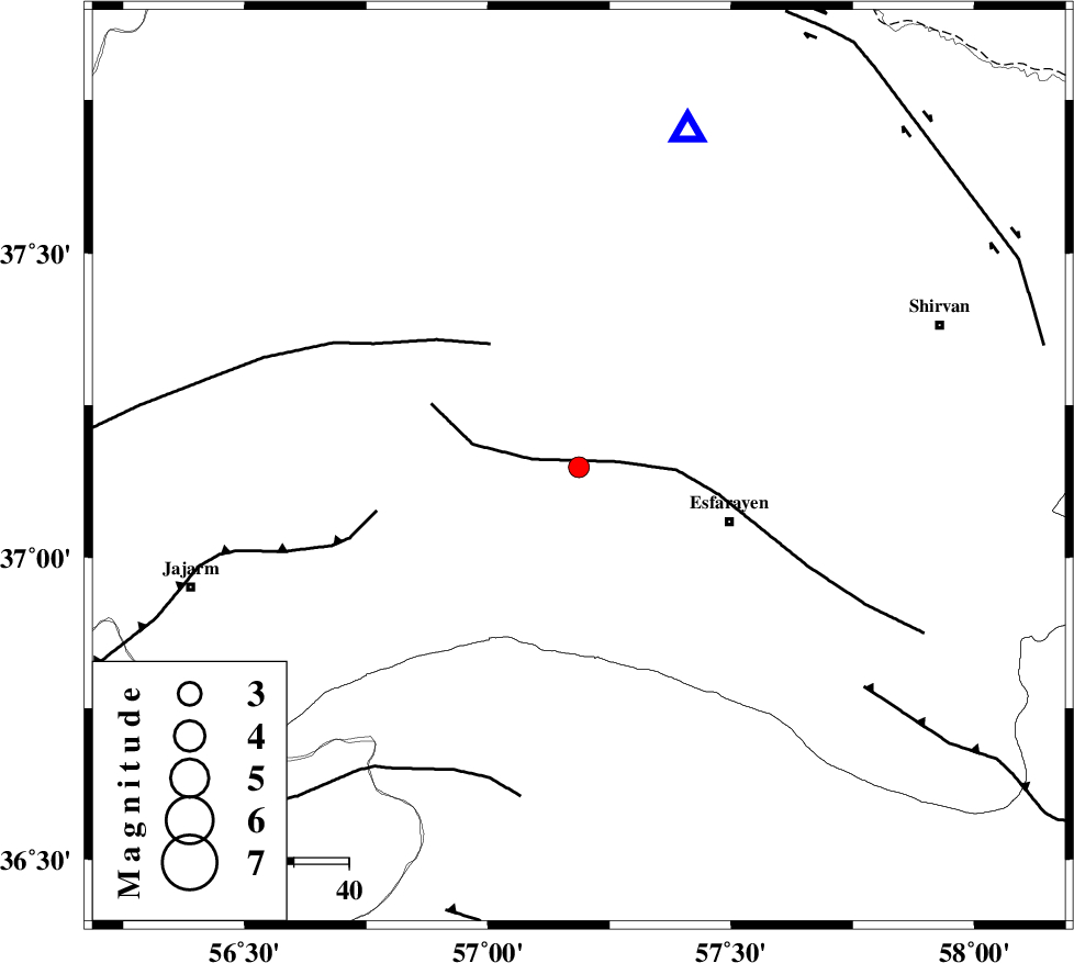
| Location | Lat:37.148 Lon: 57.187 |
| Region | Khorasan(north) Province, 29 km -West of Esfarayen |
Nearest Cities |
|
| 3 km North of Cheharborj, Khorasan(north) Province | |
| 14 km North of Zarqabad, Khorasan(north) Province | |
| 20 km North West of Eraj, Khorasan(north) Province | |
| 29 km North West of Esfarayen, Khorasan(north) Province | |
| 36 km North West of Abbasabad, Khorasan(north) Province | |
| Depth | 15 km |
| Agency | |
Faults within 150 km: |
|
| ESFARAYEN_F (Length: 111 km) , Distance to epicenter: 7 km | |
| ROBATE_QARABIL_F (Length: 168 km) , Distance to epicenter: 28 km | |
| JAJARAM_F (Length: 77 km) , Distance to epicenter: 38 km | |
| Number of Phases | 6 |
| RMS | 0.2 |
| Number of Stations | 5 |
| Error in Latitude | >3.3 km |
| Error in Longitude | 4.2 km |
| Error in Depth | 8.1 km |
Download waveform in seisan format
to download seisan software Click here
to access information about IIEES stations Click here
Amplitude | ||||||||
| UID | Agency | Station | Component | Amplitude | Period | Arrival Time | Proccessing Time | Signal Clip |
| 104188 | IIEES | SHRO | N | 100.1 | 0.42 | 2016-02-03 07:18:33 | 2016-02-03 07:37:00 | n |
| 104189 | IIEES | SHRO | E | 96.7 | 0.52 | 2016-02-03 07:18:34 | 2016-02-03 07:37:00 | n |
Phase | ||||||||||||
| Agency | Station | Component | Phase Type | Phase Quality | First Motion | Observed Arrival Time | Time Residual | Loc. Flag | Input Weight | Distance | Azimuth | |
| IIEES | BJRD | Z | Pg | E | 2016-02-03 07:17:53 | -0.11 | y | 64.3 | 18 | |||
| IIEES | BJRD | E | Sg | E | 2016-02-03 07:18:02 | 0.08 | y | 64.3 | 18 | |||
| IIEES | MRVT | Z | Pg | E | 2016-02-03 07:18:01 | -0.03 | y | 113 | 301 | |||
| IIEES | SHRO | Z | Pg | E | 2016-02-03 07:18:09 | 0.16 | y | 164 | 220 | |||
| IIEES | TABS | Z | Pn | E | 2016-02-03 07:18:37 | -0.31 | y | 388 | 181 | |||
| IIEES | SHRT | Z | Pn | E | 2016-02-03 07:18:49 | 0.21 | y | 480 | 143 | |||