
Magnitude |
:2.5 |
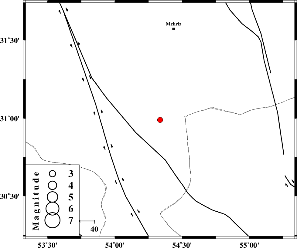
| Date & Time (UTC) | 2015-11-08 08:05:34.9 |
| Date & Time (Local) | 1394/8/17 11:35:34.9 |
| Location | Lat:30.99 Lon: 54.336 |
| Region | Yazd Province, 65 km South-West of Mehriz |
Nearest Cities |
|
| 39 km South East of Arnan, Yazd Province | |
| 41 km South East of Naj, Yazd Province | |
| 51 km South of Zardin, Yazd Province | |
| 58 km North East of Marvast, Yazd Province | |
| 59 km South East of Nir, Yazd Province | |
| Depth | 14 km |
| Agency | |
Faults within 150 km: |
|
| SHAHR_E_BABAK_F2 (Length: 272 km) , Distance to epicenter: 20 km | |
| SHAHR_E_BABAK_F1 (Length: 392 km) , Distance to epicenter: 43 km | |
| ANAR_F (Length: 127 km) , Distance to epicenter: 83 km | |
| Number of Phases | 5 |
| RMS | 0.1 |
| Number of Stations | 3 |
| Error in Latitude | >3.2 km |
| Error in Longitude | 6 km |
| Error in Depth | 5 km |
Download waveform in seisan format
to download seisan software Click here
to access information about IIEES stations Click here
Amplitude | ||||||||
| UID | Agency | Station | Component | Amplitude | Period | Arrival Time | Proccessing Time | Signal Clip |
| 102263 | IIEES | BSRN | N | 6.4 | 0.51 | 2015-11-08 08:08:01 | 2015-11-08 02:06:00 | n |
| 102264 | IIEES | BSRN | E | 5.3 | 0.32 | 2015-11-08 08:08:02 | 2015-11-08 02:06:00 | n |
Phase | ||||||||||||
| Agency | Station | Component | Phase Type | Phase Quality | First Motion | Observed Arrival Time | Time Residual | Loc. Flag | Input Weight | Distance | Azimuth | |
| IIEES | YZKH | Z | Pg | E | 2015-11-08 08:06:01 | -0.05 | y | 157 | 9 | |||
| IIEES | YZKH | E | Sg | E | 2015-11-08 08:06:20 | 0.01 | y | 157 | 9 | |||
| IIEES | KRBR | Z | Pn | E | 2015-11-08 08:06:14 | -0.07 | y | 258 | 115 | |||
| IIEES | KRBR | E | Sg | E | 2015-11-08 08:06:48 | -0.03 | y | 258 | 115 | |||
| IIEES | BSRN | Z | Pn | E | 2015-11-08 08:06:41 | 0.2 | y | 468 | 75 | |||