
Magnitude |
:2.6 |
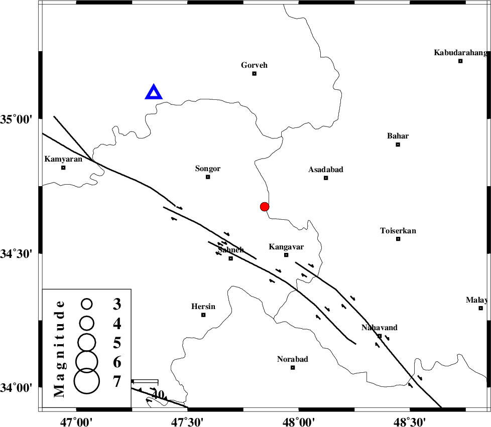
| Date & Time (UTC) | 2015-10-28 00:42:25.4 |
| Date & Time (Local) | 1394/8/6 04:12:25.4 |
| Location | Lat:34.673 Lon: 47.846 |
| Region | Kermanshah Province, 22 km North of Kangavar |
Nearest Cities |
|
| 8 km of Farsinaj, Kermanshah Province | |
| 9 km of Ajin, Hamedan Province | |
| 14 km West of Musaabad, Hamedan Province | |
| 14 km North of Fash, Kermanshah Province | |
| 19 km South of Abbarik-e olia, Kermanshah Province | |
| Depth | 14 km |
| Agency | |
Faults within 150 km: |
|
| DINEHVAR_F (Length: 46 km) , Distance to epicenter: 22 km | |
| NAHAVAND_F (Length: 102 km) , Distance to epicenter: 26 km | |
| SAHANEH_F (Length: 77 km) , Distance to epicenter: 27 km | |
| Number of Phases | 5 |
| RMS | 0.2 |
| Number of Stations | 3 |
| Error in Latitude | >9.3 km |
| Error in Longitude | 5 km |
| Error in Depth | 8.7 km |
Download waveform in seisan format
to download seisan software Click here
to access information about IIEES stations Click here
Amplitude | ||||||||
| UID | Agency | Station | Component | Amplitude | Period | Arrival Time | Proccessing Time | Signal Clip |
| 102077 | IIEES | SNGE | N | 339.7 | 0.24 | 2015-10-28 00:42:47 | 2015-10-28 09:02:00 | n |
Phase | ||||||||||||
| Agency | Station | Component | Phase Type | Phase Quality | First Motion | Observed Arrival Time | Time Residual | Loc. Flag | Input Weight | Distance | Azimuth | |
| IIEES | SNGE | Z | Pg | E | 2015-10-28 00:42:36 | -0.27 | y | 65.1 | 316 | |||
| IIEES | SNGE | N | Sg | E | 2015-10-28 00:42:45 | 0.2 | y | 65.1 | 316 | |||
| IIEES | ASAO | Z | Pn | E | 2015-10-28 00:42:58 | 0.05 | y | 200 | 93 | |||
| IIEES | ASAO | N | Sg | E | 2015-10-28 00:43:22 | -0.01 | y | 200 | 93 | |||
| IIEES | KHMZ | Z | Pn | E | 2015-10-28 00:43:00 | 0.03 | y | 221 | 117 | |||