
Magnitude |
:2.6 |
| Date & Time (UTC) | 2015-10-27 11:46:47.6 |
| Date & Time (Local) | 1394/8/5 15:16:47.6 |
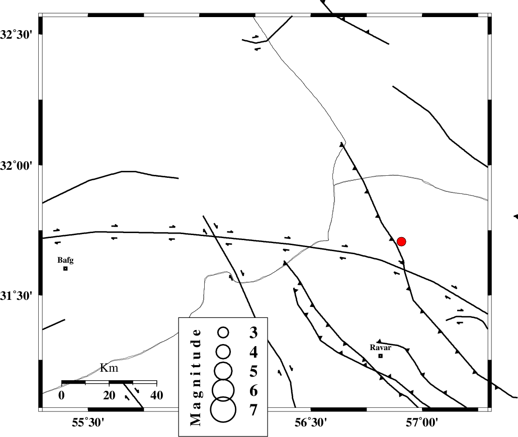
| Location | Lat:31.816 Lon: 56.294 |
| Region | Yazd Province, 78 km North-West of Ravar |
Nearest Cities |
|
| 18 km North of Asfih, Yazd Province | |
| 22 km North East of Benestan, Yazd Province | |
| 26 km East of Behabad, Yazd Province | |
| 44 km North of Kuhbanan, Kerman Province | |
| 48 km North East of Basab, Yazd Province | |
| Depth | 14 km |
| Agency | |
Faults within 150 km: |
|
| JAFARABAD_F (Length: 60 km) , Distance to epicenter: 12 km | |
| KUHBANAN_F (Length: 189 km) , Distance to epicenter: 27 km | |
| SARBALA_F (Length: 92 km) , Distance to epicenter: 55 km | |
| Number of Phases | 5 |
| RMS | 0.1 |
| Number of Stations | 3 |
| Error in Latitude | >2.5 km |
| Error in Longitude | 3.8 km |
| Error in Depth | 7.1 km |
Download waveform in seisan format
to download seisan software Click here
to access information about IIEES stations Click here
Amplitude | ||||||||
| UID | Agency | Station | Component | Amplitude | Period | Arrival Time | Proccessing Time | Signal Clip |
| 102072 | IIEES | KRBR | E | 68.8 | 0.36 | 2015-10-27 11:47:48 | 2015-10-28 09:02:00 | n |
| 102073 | IIEES | KRBR | N | 49.7 | 0.36 | 2015-10-27 11:47:48 | 2015-10-28 09:02:00 | n |
Phase | ||||||||||||
| Agency | Station | Component | Phase Type | Phase Quality | First Motion | Observed Arrival Time | Time Residual | Loc. Flag | Input Weight | Distance | Azimuth | |
| IIEES | YZKH | Z | Pg | E | 2015-10-27 11:47:16 | 0.15 | y | 173 | 292 | |||
| IIEES | YZKH | N | Sg | E | 2015-10-27 11:47:37 | -0.12 | y | 173 | 292 | |||
| IIEES | KRBR | Z | Pn | E | 2015-10-27 11:47:21 | 0.18 | y | 208 | 168 | |||
| IIEES | KRBR | N | Sg | E | 2015-10-27 11:47:46 | -0.09 | y | 208 | 168 | |||
| IIEES | BSRN | Z | Pn | E | 2015-10-27 11:47:28 | -0.13 | y | 268 | 86 | |||