
Magnitude |
:2 |
| Date & Time (UTC) | 2015-10-18 03:05:24.3 |
| Date & Time (Local) | 1394/7/26 06:35:24.3 |
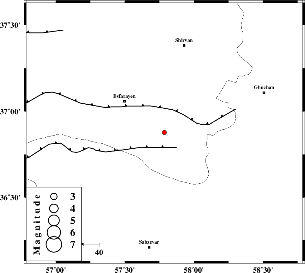
| Location | Lat:36.878 Lon: 57.786 |
| Region | Khorasan(north) Province, 33 km South-East of Esfarayen |
Nearest Cities |
|
| 15 km West of Bam, Khorasan(north) Province | |
| 25 km North West of Safiabad, Khorasan(north) Province | |
| 25 km East of Abbasabad, Khorasan(north) Province | |
| 27 km South East of Parkanlu, Khorasan(north) Province | |
| 32 km North East of Hokmabad, Khorasan(center) Province | |
| Depth | 17 km |
| Agency | |
Faults within 150 km: |
|
| ESFARAYEN_F (Length: 111 km) , Distance to epicenter: 5 km | |
| RIVAND_F (Length: 70 km) , Distance to epicenter: 10 km | |
| NAYSHABUR_F (Length: 74 km) , Distance to epicenter: 57 km | |
| Number of Phases | 6 |
| RMS | 0.2 |
| Number of Stations | 4 |
| Error in Latitude | >3.2 km |
| Error in Longitude | 9.4 km |
| Error in Depth | 8.3 km |
Download waveform in seisan format
to download seisan software Click here
to access information about IIEES stations Click here
Amplitude | ||||||||
| UID | Agency | Station | Component | Amplitude | Period | Arrival Time | Proccessing Time | Signal Clip |
| 101845 | IIEES | BJRD | E | 92.5 | 0.4 | 2015-10-18 03:05:54 | 2015-10-18 08:02:00 | n |
| 101846 | IIEES | BJRD | N | 89.4 | 0.23 | 2015-10-18 03:05:57 | 2015-10-18 08:02:00 | n |
| 101847 | IIEES | SHRO | N | 9.5 | 0.26 | 2015-10-18 03:06:19 | 2015-10-18 08:02:00 | n |
| 101848 | IIEES | SHRO | E | 8.5 | 0.38 | 2015-10-18 03:06:20 | 2015-10-18 08:02:00 | n |
Phase | ||||||||||||
| Agency | Station | Component | Phase Type | Phase Quality | First Motion | Observed Arrival Time | Time Residual | Loc. Flag | Input Weight | Distance | Azimuth | |
| IIEES | BJRD | Z | Pg | E | 2015-10-18 03:05:41 | 0.14 | y | 97.2 | 340 | |||
| IIEES | BJRD | E | Sg | E | 2015-10-18 03:05:53 | 0.13 | y | 97.2 | 340 | |||
| IIEES | MRVT | Z | Pg | E | 2015-10-18 03:05:52 | -0.43 | y | 174 | 300 | |||
| IIEES | SHRO | Z | Pg | E | 2015-10-18 03:05:54 | -0.05 | y | 186 | 239 | |||
| IIEES | SHRO | N | Sg | E | 2015-10-18 03:06:17 | 0.18 | y | 186 | 239 | |||
| IIEES | DAMV | Z | Pn | E | 2015-10-18 03:06:39 | 0.04 | y | 541 | 257 | |||