
Magnitude |
:2.7 |
| Date & Time (UTC) | 2015-10-13 16:09:36.4 |
| Date & Time (Local) | 1394/7/21 19:39:36.4 |
| Location | Lat:28.604 Lon: 58.253 |
| Region | Kerman Province, 51 km -East of Jiroft |
Nearest Cities |
|
| 19 km North East of Dahane-ye gomrokan, Kerman Province | |
| 29 km North of Mardehak, Kerman Province | |
| 30 km East of Mijan-e sofla, Kerman Province | |
| 34 km South West of Kruk, Kerman Province | |
| 36 km North East of Dosari, Kerman Province | |
| Depth | 14 km |
| Agency | |
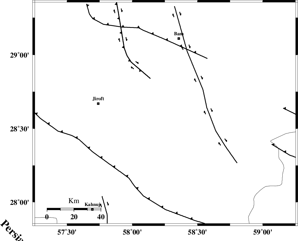
Faults within 150 km: |
|
| GOWK_F (Length: 152 km) , Distance to epicenter: 29 km | |
| BAM_F (Length: 118 km) , Distance to epicenter: 31 km | |
| SABZEVARAN_F (Length: 190 km) , Distance to epicenter: 53 km | |
| Number of Phases | 5 |
| RMS | 0.1 |
| Number of Stations | 3 |
| Error in Latitude | >5.8 km |
| Error in Longitude | 2 km |
| Error in Depth | 9.8 km |
Download waveform in seisan format
to download seisan software Click here
to access information about IIEES stations Click here
Amplitude | ||||||||
| UID | Agency | Station | Component | Amplitude | Period | Arrival Time | Proccessing Time | Signal Clip |
| 101714 | IIEES | KRBR | E | 76 | 0.3 | 2015-10-13 16:10:39 | 2015-10-14 08:48:00 | n |
| 101715 | IIEES | KRBR | N | 52 | 0.24 | 2015-10-13 16:10:39 | 2015-10-14 08:48:00 | n |
Phase | ||||||||||||
| Agency | Station | Component | Phase Type | Phase Quality | First Motion | Observed Arrival Time | Time Residual | Loc. Flag | Input Weight | Distance | Azimuth | |
| IIEES | KRBR | Z | Pn | E | 2015-10-13 16:10:10 | -0.03 | y | 211 | 317 | |||
| IIEES | KRBR | N | Sg | E | 2015-10-13 16:10:36 | -0.01 | y | 211 | 317 | |||
| IIEES | ZHSF | Z | Pn | E | 2015-10-13 16:10:17 | -0.08 | y | 270 | 65 | |||
| IIEES | BSRN | Z | Pn | E | 2015-10-13 16:10:31 | 0.16 | y | 382 | 12 | |||
| IIEES | BSRN | N | Sg | E | 2015-10-13 16:11:23 | -0.02 | y | 382 | 12 | |||