
Magnitude |
:1.7 |
| Date & Time (UTC) | 2015-10-11 14:36:44.4 |
| Date & Time (Local) | 1394/7/19 18:06:44.4 |
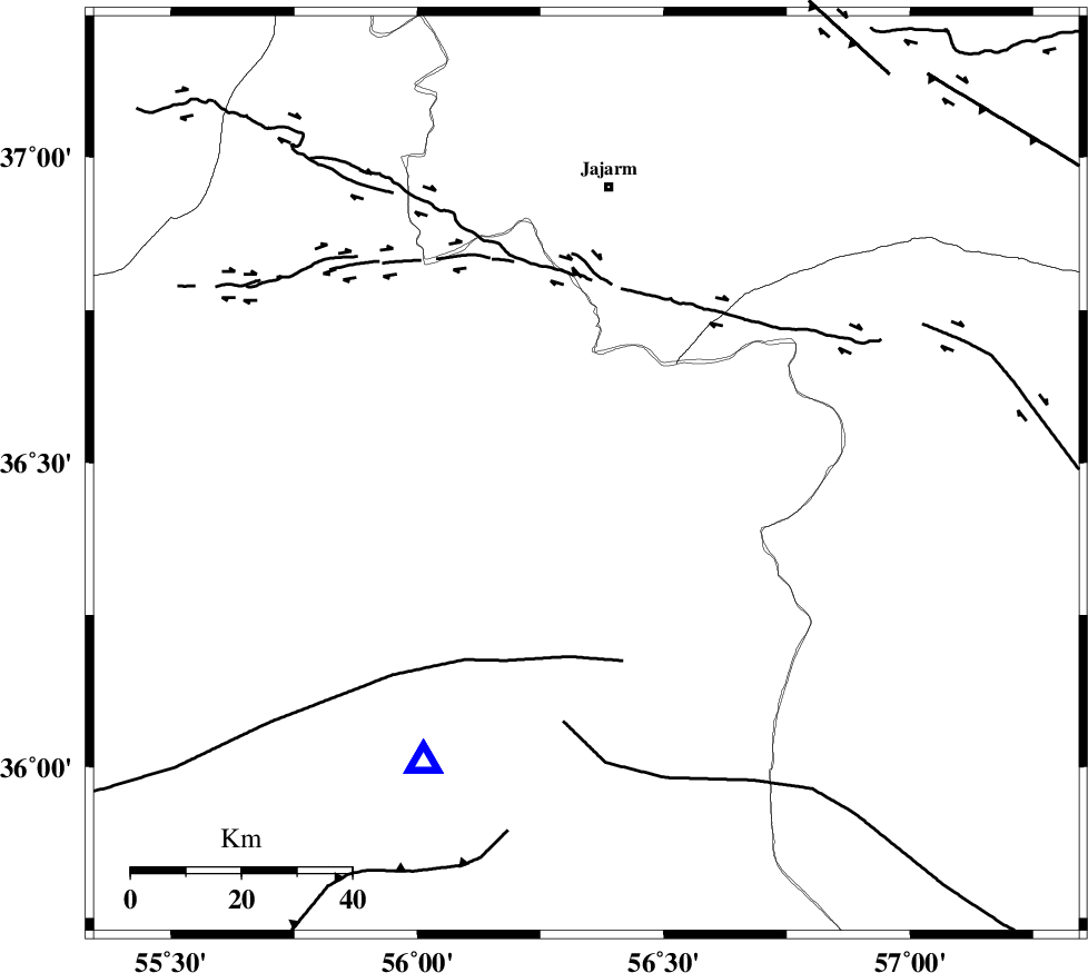
| Location | Lat:36.48 Lon: 56.343 |
| Region | Semnan Province, 53 km South of Jajarm |
Nearest Cities |
|
| 37 km West of Frumad, Semnan Province | |
| 50 km North West of Davarzan, Khorasan(center) Province | |
| 53 km South of Jajarm, Khorasan(north) Province | |
| 56 km South West of Farashiyan, Khorasan(center) Province | |
| 57 km South of Garmeh, Khorasan(north) Province | |
| Depth | 17 km |
| Agency | |
Faults within 150 km: |
|
| MEYAMEY_F (Length: 141 km) , Distance to epicenter: 8 km | |
| JOGHATAI_F (Length: 70 km) , Distance to epicenter: 10 km | |
| JAJARAM_F (Length: 77 km) , Distance to epicenter: 40 km | |
| Number of Phases | 4 |
| RMS | 0 |
| Number of Stations | 3 |
| Error in Latitude | >1.3 km |
| Error in Longitude | 3.5 km |
| Error in Depth | 8.2 km |
Download waveform in seisan format
to download seisan software Click here
to access information about IIEES stations Click here
Amplitude | ||||||||
| UID | Agency | Station | Component | Amplitude | Period | Arrival Time | Proccessing Time | Signal Clip |
| 101659 | IIEES | SHRO | N | 29.7 | 0.26 | 2015-10-11 14:37:06 | 2015-10-12 05:18:00 | n |
| 101660 | IIEES | MRVT | N | 17.9 | 0.19 | 2015-10-11 14:37:27 | 2015-10-12 05:18:00 | n |
| 101661 | IIEES | MRVT | E | 23 | 0.24 | 2015-10-11 14:37:28 | 2015-10-12 05:18:00 | n |
Phase | ||||||||||||
| Agency | Station | Component | Phase Type | Phase Quality | First Motion | Observed Arrival Time | Time Residual | Loc. Flag | Input Weight | Distance | Azimuth | |
| IIEES | SHRO | Z | Pg | E | 2015-10-11 14:36:55 | -0.01 | y | 60.2 | 210 | |||
| IIEES | MRVT | Z | P | E | 2015-10-11 14:37:06 | 0.01 | y | 133 | 350 | |||
| IIEES | MRVT | N | Sg | E | 2015-10-11 14:37:22 | 0 | y | 133 | 350 | |||
| IIEES | BJRD | Z | Pg | E | 2015-10-11 14:37:11 | 0 | y | 165 | 35 | |||