
Magnitude |
:2.3 |
| Date & Time (UTC) | 2015-09-20 13:28:48.8 |
| Date & Time (Local) | 1394/6/29 17:58:48.8 |
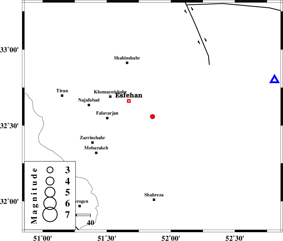
| Location | Lat:32.559 Lon: 51.857 |
| Region | Esfahan Province, 21 km South-East of Esfahan |
Nearest Cities |
|
| 8 km North of Dashti, Esfahan Province | |
| 9 km North of Dastjah, Esfahan Province | |
| 10 km North of Ziyar, Esfahan Province | |
| 12 km of Gurt, Esfahan Province | |
| 14 km East of Khorasegan, Esfahan Province | |
| Depth | 14 km |
| Agency | |
Faults within 150 km: |
|
| ZEFREH_F (Length: 124 km) , Distance to epicenter: 56 km | |
| CHAH_ZANGUL_F (Length: 123 km) , Distance to epicenter: 85 km | |
| MAIN_ZAGROS_R_F (Length: 1106 km) , Distance to epicenter: 96 km | |
| Number of Phases | 5 |
| RMS | 0.2 |
| Number of Stations | 3 |
| Error in Latitude | >6.8 km |
| Error in Longitude | 4.8 km |
| Error in Depth | 9.2 km |
Download waveform in seisan format
to download seisan software Click here
to access information about IIEES stations Click here
Amplitude | ||||||||
| UID | Agency | Station | Component | Amplitude | Period | Arrival Time | Proccessing Time | Signal Clip |
| 101527 | IIEES | NASN | E | 106 | 0.24 | 2015-09-20 13:29:18 | 2015-10-07 11:03:00 | n |
Phase | ||||||||||||
| Agency | Station | Component | Phase Type | Phase Quality | First Motion | Observed Arrival Time | Time Residual | Loc. Flag | Input Weight | Distance | Azimuth | |
| IIEES | NASN | Z | Pg | E | 2015-09-20 13:29:04 | -0.3 | y | 93.1 | 73 | |||
| IIEES | NASN | N | Sg | E | 2015-09-20 13:29:16 | 0.15 | y | 93.1 | 73 | |||
| IIEES | YZKH | Z | Pn | E | 2015-09-20 13:29:28 | 0.07 | y | 258 | 93 | |||
| IIEES | YZKH | N | Sg | E | 2015-09-20 13:30:01 | 0.05 | y | 258 | 93 | |||
| IIEES | ASAO | Z | Pn | E | 2015-09-20 13:29:31 | 0.04 | y | 279 | 323 | |||