
Magnitude |
:2 |
| Date & Time (UTC) | 2015-09-30 13:24:03.3 |
| Date & Time (Local) | 1394/7/8 16:54:03.3 |
| Location | Lat:30.942 Lon: 56.444 |
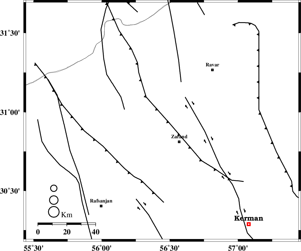
| Region | Kerman Province, 19 km North-West of Zarand |
Nearest Cities |
|
| 17 km South West of Dasht-e khak, Kerman Province | |
| 19 km North West of Zarand, Kerman Province | |
| 19 km West of Ahmadi, Kerman Province | |
| 20 km North West of Mohammadabad, Kerman Province | |
| 23 km South of Toghroljerd, Kerman Province | |
| Depth | 46 km |
| Agency | |
Faults within 150 km: |
|
| KUHBANAN_F (Length: 189 km) , Distance to epicenter: 9 km | |
| DARIVAN_F (Length: 131 km) , Distance to epicenter: 36 km | |
| CHATRUD_F (Length: 37 km) , Distance to epicenter: 61 km | |
| Number of Phases | 6 |
| RMS | 0.1 |
| Number of Stations | 4 |
| Error in Latitude | >3.1 km |
| Error in Longitude | 4 km |
| Error in Depth | 4.9 km |
Download waveform in seisan format
to download seisan software Click here
to access information about IIEES stations Click here
Amplitude | ||||||||
| UID | Agency | Station | Component | Amplitude | Period | Arrival Time | Proccessing Time | Signal Clip |
| 101494 | IIEES | YZKH | N | 10.1 | 0.36 | 2015-09-30 13:25:11 | 2015-10-06 08:27:00 | n |
| 101495 | IIEES | YZKH | E | 11.4 | 0.69 | 2015-09-30 13:25:14 | 2015-10-06 08:27:00 | n |
Phase | ||||||||||||
| Agency | Station | Component | Phase Type | Phase Quality | First Motion | Observed Arrival Time | Time Residual | Loc. Flag | Input Weight | Distance | Azimuth | |
| IIEES | KRBR | Z | Pg | E | 2015-09-30 13:24:22 | -0.27 | y | 111 | 164 | |||
| IIEES | KRBR | E | Sg | E | 2015-09-30 13:24:37 | 0.2 | y | 111 | 164 | |||
| IIEES | YZKH | Z | Pn | E | 2015-09-30 13:24:37 | 0 | y | 238 | 313 | |||
| IIEES | YZKH | N | Sg | E | 2015-09-30 13:25:09 | 0.02 | y | 238 | 313 | |||
| IIEES | BSRN | Z | Pn | E | 2015-09-30 13:24:42 | -0.01 | y | 279 | 65 | |||
| IIEES | TABS | Z | P | E | 2015-09-30 13:24:46 | 0.07 | y | 307 | 12 | |||