
Magnitude |
:2 |
| Date & Time (UTC) | 2015-09-30 15:40:33.6 |
| Date & Time (Local) | 1394/7/8 19:10:33.6 |
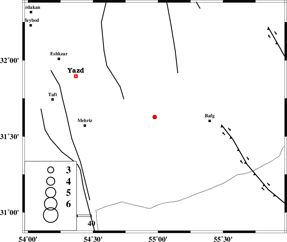
| Location | Lat:31.628 Lon: 54.974 |
| Region | Yazd Province, 40 km -West of Bafq |
Nearest Cities |
|
| 34 km North of Bahadoran, Yazd Province | |
| 40 km North West of Bafq, Yazd Province | |
| 44 km North West of Mobarake, Yazd Province | |
| 51 km North East of Mehriz, Yazd Province | |
| 55 km South East of Mohammadabad, Yazd Province | |
| Depth | 14 km |
| Agency | |
Faults within 150 km: |
|
| ANAR_F (Length: 127 km) , Distance to epicenter: 4 km | |
| ANAR_F (Length: 91 km) , Distance to epicenter: 9 km | |
| POSHT_E_BADAM_F (Length: 128 km) , Distance to epicenter: 56 km | |
| Number of Phases | 6 |
| RMS | 0.1 |
| Number of Stations | 4 |
| Error in Latitude | >2.2 km |
| Error in Longitude | 2.1 km |
| Error in Depth | 5 km |
Download waveform in seisan format
to download seisan software Click here
to access information about IIEES stations Click here
Amplitude | ||||||||
| UID | Agency | Station | Component | Amplitude | Period | Arrival Time | Proccessing Time | Signal Clip |
| 101492 | IIEES | KRBR | N | 10.2 | 0.52 | 2015-09-30 15:41:46 | 2015-10-06 08:27:00 | n |
| 101493 | IIEES | KRBR | E | 7 | 0.32 | 2015-09-30 15:41:47 | 2015-10-06 08:27:00 | n |
Phase | ||||||||||||
| Agency | Station | Component | Phase Type | Phase Quality | First Motion | Observed Arrival Time | Time Residual | Loc. Flag | Input Weight | Distance | Azimuth | |
| IIEES | YZKH | Z | Pg | E | 2015-09-30 15:40:49 | -0.14 | y | 91.9 | 337 | |||
| IIEES | YZKH | N | Sg | E | 2015-09-30 15:41:00 | 0 | y | 91.9 | 337 | |||
| IIEES | NASN | Z | Pn | E | 2015-09-30 15:41:11 | -0.03 | y | 242 | 303 | |||
| IIEES | NASN | N | Sg | E | 2015-09-30 15:41:42 | 0.08 | y | 242 | 303 | |||
| IIEES | KRBR | Z | Pn | E | 2015-09-30 15:41:12 | -0.01 | y | 250 | 136 | |||
| IIEES | TABS | Z | Pn | E | 2015-09-30 15:41:18 | 0.1 | y | 301 | 41 | |||