
Magnitude |
:2 |
| Date & Time (UTC) | 2015-10-01 13:27:32.4 |
| Date & Time (Local) | 1394/7/9 16:57:32.4 |
| Location | Lat:30.969 Lon: 56.354 |
| Region | Kerman Province, 27 km North-West of Zarand |
Nearest Cities |
|
| 21 km South of Toghroljerd, Kerman Province | |
| 22 km West of Dasht-e khak, Kerman Province | |
| 27 km West of Ahmadi, Kerman Province | |
| 27 km North West of Zarand, Kerman Province | |
| 28 km North West of Mohammadabad, Kerman Province | |
| Depth | 14 km |
| Agency | |
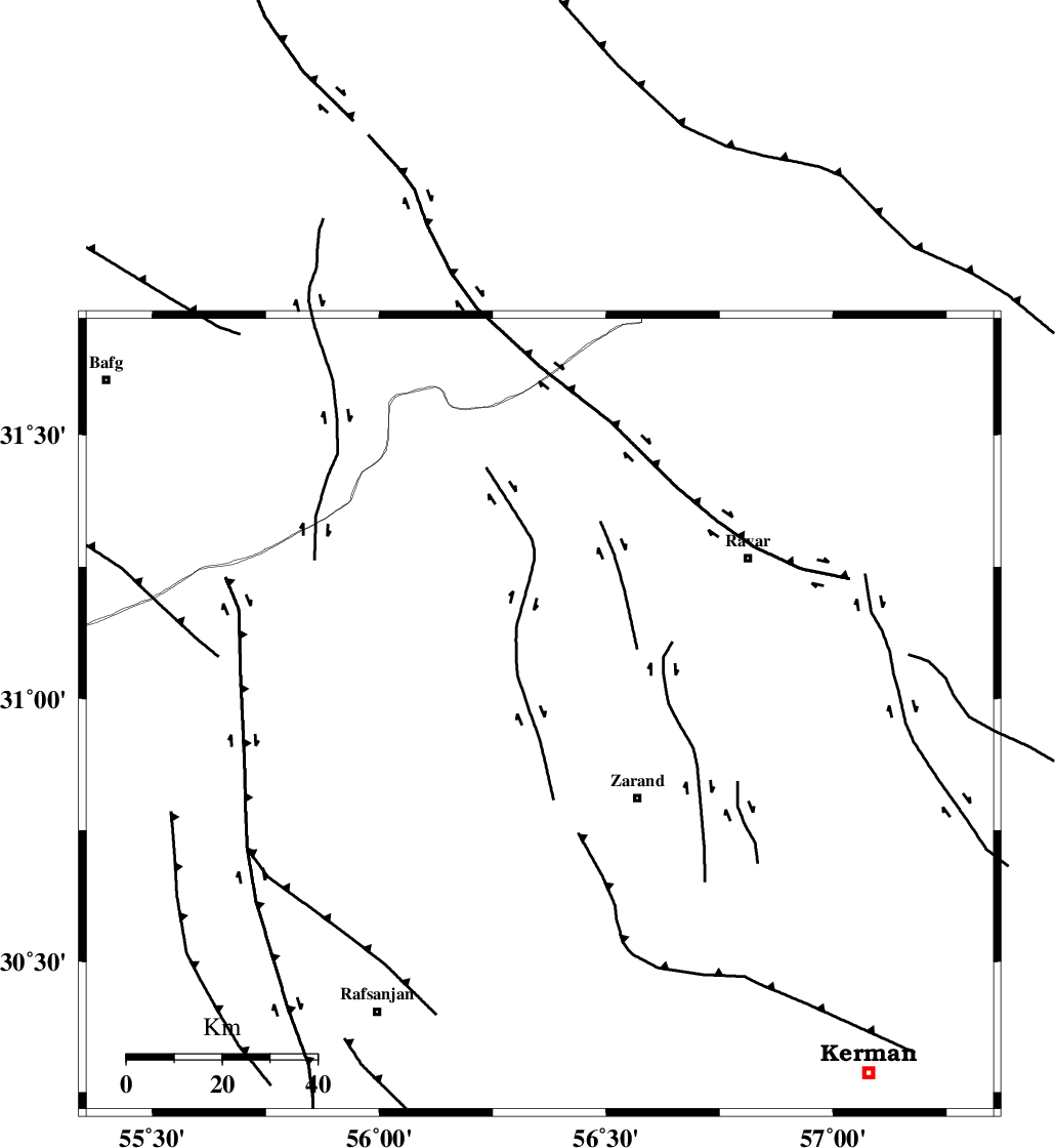
Faults within 150 km: |
|
| KUHBANAN_F (Length: 189 km) , Distance to epicenter: 14 km | |
| DARIVAN_F (Length: 131 km) , Distance to epicenter: 33 km | |
| CHATRUD_F (Length: 37 km) , Distance to epicenter: 70 km | |
| Number of Phases | 5 |
| RMS | 0.2 |
| Number of Stations | 3 |
| Error in Latitude | >4.1 km |
| Error in Longitude | 6 km |
| Error in Depth | 9.4 km |
Download waveform in seisan format
to download seisan software Click here
to access information about IIEES stations Click here
Amplitude | ||||||||
| UID | Agency | Station | Component | Amplitude | Period | Arrival Time | Proccessing Time | Signal Clip |
| 101480 | IIEES | YZKH | E | 7.6 | 0.62 | 2015-10-01 13:28:39 | 2015-10-06 08:27:00 | n |
| 101481 | IIEES | YZKH | N | 6.6 | 0.33 | 2015-10-01 13:28:41 | 2015-10-06 08:27:00 | n |
| 101482 | IIEES | BSRN | N | 9.2 | 0.22 | 2015-10-01 13:29:01 | 2015-10-06 08:27:00 | n |
| 101483 | IIEES | BSRN | E | 9.5 | 0.33 | 2015-10-01 13:29:01 | 2015-10-06 08:27:00 | n |
Phase | ||||||||||||
| Agency | Station | Component | Phase Type | Phase Quality | First Motion | Observed Arrival Time | Time Residual | Loc. Flag | Input Weight | Distance | Azimuth | |
| IIEES | KRBR | Z | Pg | E | 2015-10-01 13:27:51 | -0.43 | y | 116 | 160 | |||
| IIEES | KRBR | N | Sg | E | 2015-10-01 13:28:06 | 0.3 | y | 116 | 160 | |||
| IIEES | YZKH | Z | Pn | E | 2015-10-01 13:28:08 | 0.02 | y | 230 | 314 | |||
| IIEES | YZKH | E | Sg | E | 2015-10-01 13:28:37 | 0.05 | y | 230 | 314 | |||
| IIEES | BSRN | Z | Pn | E | 2015-10-01 13:28:15 | 0.06 | y | 286 | 67 | |||