
Magnitude |
:1.9 |
| Date & Time (UTC) | 2015-10-05 04:21:58.8 |
| Date & Time (Local) | 1394/7/13 07:51:58.8 |
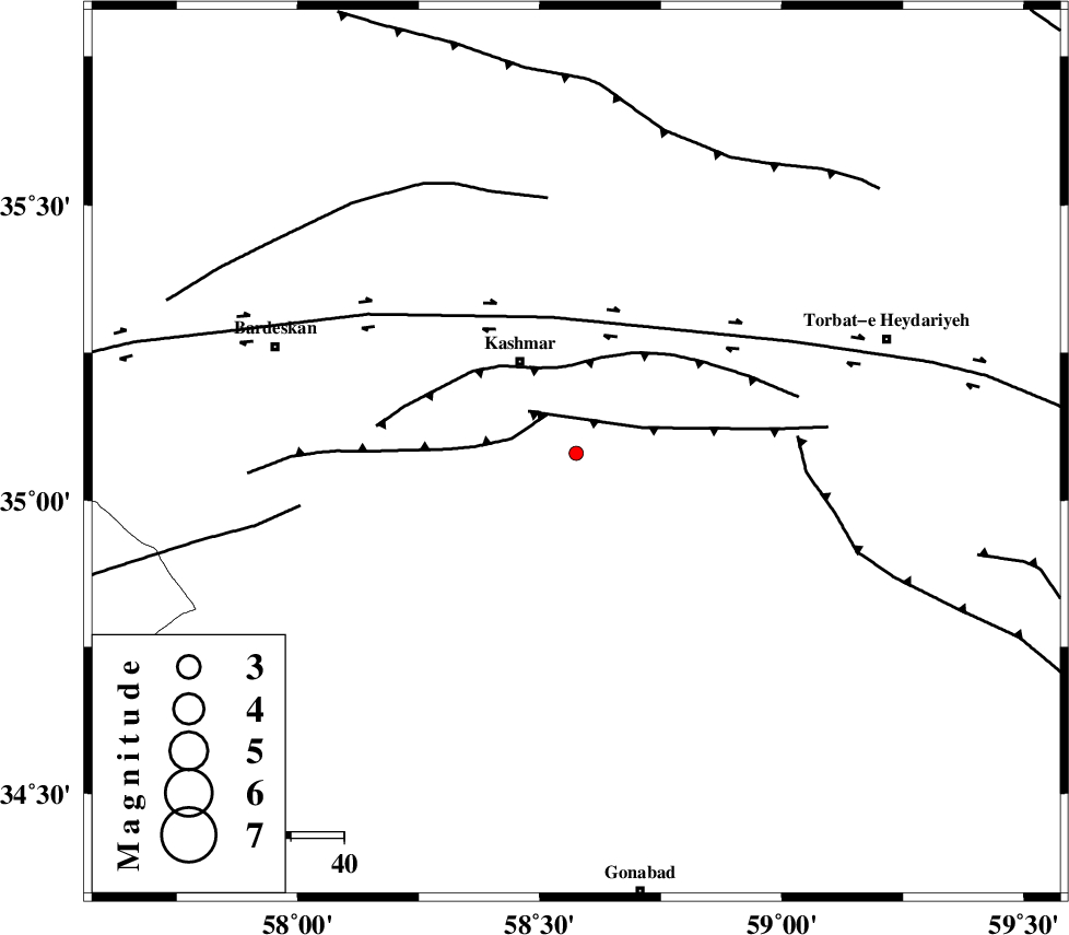
| Location | Lat:35.08 Lon: 58.575 |
| Region | Khorasan(center) Province, 20 km South-East of Kashmar |
Nearest Cities |
|
| 20 km North West of Feizabad, Khorasan(center) Province | |
| 20 km South East of Kashmar, Khorasan(center) Province | |
| 24 km South East of Kasrineh, Khorasan(center) Province | |
| 27 km North West of Mahneh, Khorasan(center) Province | |
| 31 km South East of Khalilabad, Khorasan(center) Province | |
| Depth | 14 km |
| Agency | |
Faults within 150 km: |
|
| MEHDIABAD_F (Length: 64 km) , Distance to epicenter: 9 km | |
| DUGHABAD_F (Length: 62 km) , Distance to epicenter: 12 km | |
| KASHMAR_F (Length: 91 km) , Distance to epicenter: 16 km | |
| Number of Phases | 6 |
| RMS | 0.1 |
| Number of Stations | 4 |
| Error in Latitude | >3.6 km |
| Error in Longitude | 1.9 km |
| Error in Depth | 6.4 km |
Download waveform in seisan format
to download seisan software Click here
to access information about IIEES stations Click here
Amplitude | ||||||||
| UID | Agency | Station | Component | Amplitude | Period | Arrival Time | Proccessing Time | Signal Clip |
| 101437 | IIEES | TABS | E | 4.8 | 0.48 | 2015-10-05 04:23:04 | 2015-10-05 07:36:00 | n |
| 101438 | IIEES | TABS | N | 9.9 | 0.35 | 2015-10-05 04:23:04 | 2015-10-05 07:36:00 | n |
| 101439 | IIEES | SHRT | E | 13.2 | 0.27 | 2015-10-05 04:23:08 | 2015-10-05 07:36:00 | n |
| 101440 | IIEES | SHRT | N | 9.6 | 0.35 | 2015-10-05 04:23:09 | 2015-10-05 07:36:00 | n |
Phase | ||||||||||||
| Agency | Station | Component | Phase Type | Phase Quality | First Motion | Observed Arrival Time | Time Residual | Loc. Flag | Input Weight | Distance | Azimuth | |
| IIEES | TABS | Z | Pn | E | 2015-10-05 04:22:32 | -0.15 | y | 208 | 221 | |||
| IIEES | TABS | N | Sg | E | 2015-10-05 04:22:57 | 0.08 | y | 208 | 221 | |||
| IIEES | SHRT | Z | Pn | E | 2015-10-05 04:22:34 | 0.28 | y | 224 | 135 | |||
| IIEES | SHRT | E | Sg | E | 2015-10-05 04:23:02 | -0.14 | y | 224 | 135 | |||
| IIEES | SHRO | Z | Pn | E | 2015-10-05 04:22:38 | -0.05 | y | 254 | 295 | |||
| IIEES | BSRN | Z | Pn | E | 2015-10-05 04:22:49 | -0.04 | y | 349 | 171 | |||