
Magnitude |
:2.1 |
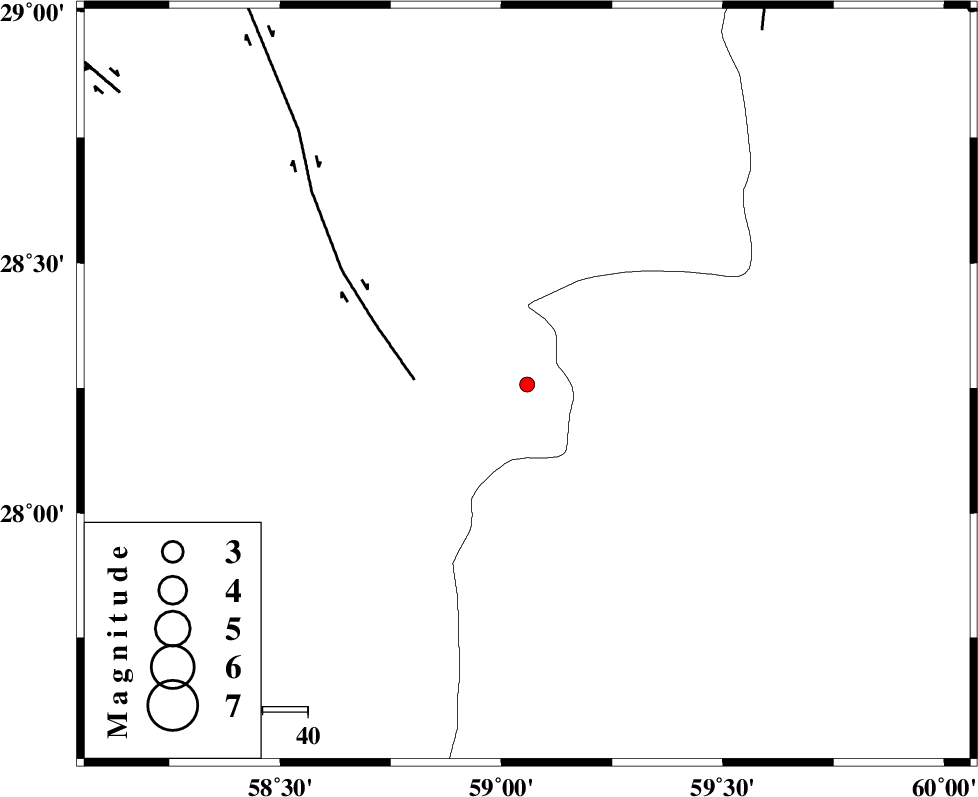
| Date & Time (UTC) | 2015-10-04 21:25:11.3 |
| Date & Time (Local) | 1394/7/13 00:55:11.3 |
| Location | Lat:28.257 Lon: 59.058 |
| Region | Kerman Province, 117 km South-East of Bam |
Nearest Cities |
|
| 50 km South of Hoseynabad, Kerman Province | |
| 54 km South East of Mohammadabad-e gonbaki, Kerman Province | |
| 59 km North East of Borj-e abbasabad, Kerman Province | |
| 70 km South East of Void, Kerman Province | |
| 80 km South East of Fahroj, Kerman Province | |
| Depth | 17 km |
| Agency | |
Faults within 150 km: |
|
| BAM_F (Length: 118 km) , Distance to epicenter: 25 km | |
| KANURAK_F (Length: 135 km) , Distance to epicenter: 94 km | |
| GOWK_F (Length: 152 km) , Distance to epicenter: 111 km | |
| Number of Phases | 5 |
| RMS | 0.2 |
| Number of Stations | 3 |
| Error in Latitude | >4.6 km |
| Error in Longitude | 4.1 km |
| Error in Depth | 9.3 km |
Download waveform in seisan format
to download seisan software Click here
to access information about IIEES stations Click here
Amplitude | ||||||||
| UID | Agency | Station | Component | Amplitude | Period | Arrival Time | Proccessing Time | Signal Clip |
| 101434 | IIEES | ZHSF | E | 22.8 | 0.36 | 2015-10-04 21:26:17 | 2015-10-05 07:36:00 | n |
| 101435 | IIEES | ZHSF | N | 15.5 | 0.31 | 2015-10-04 21:26:17 | 2015-10-05 07:36:00 | n |
| 101436 | IIEES | BSRN | E | 1.8 | 0.21 | 2015-10-04 21:27:11 | 2015-10-05 07:36:00 | n |
Phase | ||||||||||||
| Agency | Station | Component | Phase Type | Phase Quality | First Motion | Observed Arrival Time | Time Residual | Loc. Flag | Input Weight | Distance | Azimuth | |
| IIEES | ZHSF | Z | Pg | E | 2015-10-04 21:25:48 | 0.13 | y | 225 | 48 | |||
| IIEES | ZHSF | N | Sg | E | 2015-10-04 21:26:14 | -0.16 | y | 225 | 48 | |||
| IIEES | KRBR | Z | Pn | E | 2015-10-04 21:25:55 | -0.19 | y | 294 | 311 | |||
| IIEES | BSRN | Z | Pn | E | 2015-10-04 21:26:10 | 0.22 | y | 411 | 1 | |||
| IIEES | BSRN | N | Sg | E | 2015-10-04 21:27:06 | 0.04 | y | 411 | 1 | |||