
Magnitude |
:2.8 |
| Date & Time (UTC) | 2015-09-18 02:27:35.7 |
| Date & Time (Local) | 1394/6/27 06:57:35.7 |
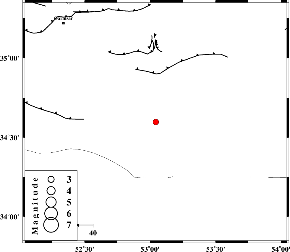
| Location | Lat:34.598 Lon: 53.044 |
| Region | Semnan Province, 94 km South-East of Garmsar |
Nearest Cities |
|
| 83 km South East of Kohanabad, Semnan Province | |
| 86 km South East of Gardovan, Semnan Province | |
| 86 km South East of Aradan, Semnan Province | |
| 86 km South East of Davarabad, Semnan Province | |
| 90 km South of Lasjerd, Semnan Province | |
| Depth | 14 km |
| Agency | |
Faults within 150 km: |
|
| KUH_E_GUGERD_F (Length: 73 km) , Distance to epicenter: 34 km | |
| SIAHKUH_F (Length: 154 km) , Distance to epicenter: 48 km | |
| KUH_E_GACHAB_F1 (Length: 53 km) , Distance to epicenter: 50 km | |
| Number of Phases | 6 |
| RMS | 0.3 |
| Number of Stations | 5 |
| Error in Latitude | >3.4 km |
| Error in Longitude | 7.8 km |
| Error in Depth | 8 km |
Download waveform in seisan format
to download seisan software Click here
to access information about IIEES stations Click here
Amplitude | ||||||||
| UID | Agency | Station | Component | Amplitude | Period | Arrival Time | Proccessing Time | Signal Clip |
| 101309 | IIEES | GHVR | N | 61.5 | 0.45 | 2015-09-18 02:28:25 | 2015-09-30 11:06:00 | n |
| 101310 | IIEES | YZKH | E | 53.3 | 0.44 | 2015-09-18 02:29:03 | 2015-09-30 11:06:00 | n |
| 101311 | IIEES | YZKH | N | 52.4 | 0.3 | 2015-09-18 02:29:06 | 2015-09-30 11:06:00 | n |
Phase | ||||||||||||
| Agency | Station | Component | Phase Type | Phase Quality | First Motion | Observed Arrival Time | Time Residual | Loc. Flag | Input Weight | Distance | Azimuth | |
| IIEES | DAMV | Z | Pg | E | 2015-09-18 02:28:00 | -0.09 | y | 151 | 320 | |||
| IIEES | GHVR | Z | Pg | E | 2015-09-18 02:28:02 | -0.33 | y | 166 | 266 | |||
| IIEES | NASN | Z | Pn | E | 2015-09-18 02:28:08 | -0.31 | y | 201 | 186 | |||
| IIEES | NASN | N | Sg | E | 2015-09-18 02:28:33 | 0.08 | y | 201 | 186 | |||
| IIEES | ASAO | Z | Pn | E | 2015-09-18 02:28:18 | 0.59 | y | 277 | 270 | |||
| IIEES | YZKH | Z | Pn | E | 2015-09-18 02:28:19 | 0.1 | y | 284 | 149 | |||