
Magnitude |
:2.5 |
| Date & Time (UTC) | 2015-09-29 14:05:07.4 |
| Date & Time (Local) | 1394/7/7 17:35:07.4 |
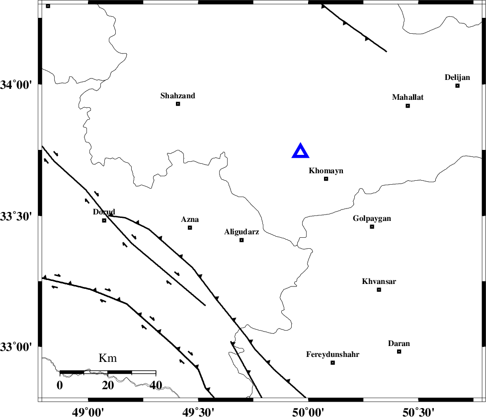
| Location | Lat:33.553 Lon: 49.789 |
| Region | Markazi Province, 18 km North of Aligudarz |
Nearest Cities |
|
| 7 km of Javadiyeh, Markazi Province | |
| 12 km North of Khameh sofla, Lorestan Province | |
| 13 km South of Qorchibashi, Markazi Province | |
| 16 km North West of Dehnu, Markazi Province | |
| 17 km North West of Farnaq, Markazi Province | |
| Depth | 14 km |
| Agency | |
Faults within 150 km: |
|
| MAIN_ZAGROS_R_F (Length: 1106 km) , Distance to epicenter: 40 km | |
| DORUD (Length: 100 km) , Distance to epicenter: 50 km | |
| ARDAL_F (Length: 170 km) , Distance to epicenter: 61 km | |
| Number of Phases | 8 |
| RMS | 0.3 |
| Number of Stations | 5 |
| Error in Latitude | >4.7 km |
| Error in Longitude | 7.4 km |
| Error in Depth | 9.8 km |
Download waveform in seisan format
to download seisan software Click here
to access information about IIEES stations Click here
Amplitude | ||||||||
| UID | Agency | Station | Component | Amplitude | Period | Arrival Time | Proccessing Time | Signal Clip |
| 101276 | IIEES | GHVR | E | 37.8 | 0.5 | 2015-09-29 14:06:00 | 2015-09-30 08:21:00 | n |
| 101277 | IIEES | GHVR | N | 72.1 | 0.45 | 2015-09-29 14:06:03 | 2015-09-30 08:21:00 | n |
| 101278 | IIEES | NASN | N | 21.5 | 0.78 | 2015-09-29 14:06:31 | 2015-09-30 08:21:00 | n |
Phase | ||||||||||||
| Agency | Station | Component | Phase Type | Phase Quality | First Motion | Observed Arrival Time | Time Residual | Loc. Flag | Input Weight | Distance | Azimuth | |
| IIEES | ASAO | Z | Pg | E | 2015-09-29 14:05:25 | -0.55 | y | 113 | 11 | |||
| IIEES | ASAO | E | Sg | E | 2015-09-29 14:05:40 | -0.02 | y | 113 | 11 | |||
| IIEES | GHVR | Z | Pg | E | 2015-09-29 14:05:35 | 0.12 | y | 169 | 52 | |||
| IIEES | GHVR | E | Sg | E | 2015-09-29 14:05:56 | 0.34 | y | 169 | 52 | |||
| IIEES | CHTH | Z | Pn | E | 2015-09-29 14:05:51 | 0.16 | y | 289 | 25 | |||
| IIEES | NASN | Z | Pn | E | 2015-09-29 14:05:52 | 0.38 | y | 294 | 106 | |||
| IIEES | NASN | E | Sg | E | 2015-09-29 14:06:29 | -0.5 | y | 294 | 106 | |||
| IIEES | YZKH | Z | Pn | E | 2015-09-29 14:06:13 | 0.12 | y | 467 | 105 | |||