
Magnitude |
:1.8 |
| Date & Time (UTC) | 2015-09-28 14:19:07.5 |
| Date & Time (Local) | 1394/7/6 17:49:07.5 |
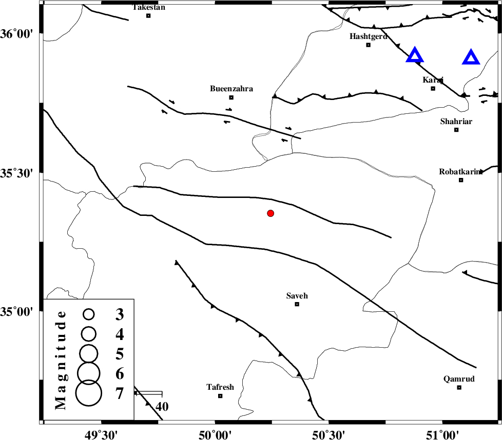
| Location | Lat:35.353 Lon: 50.244 |
| Region | Markazi Province, 38 km North-West of Saveh |
Nearest Cities |
|
| 10 km of Khoshkrud, Markazi Province | |
| 25 km North West of Hakimabad, Markazi Province | |
| 26 km North East of Razegian, Markazi Province | |
| 27 km North West of Memunieh, Markazi Province | |
| 28 km West of Zaviyeh, Markazi Province | |
| Depth | 14 km |
| Agency | |
Faults within 150 km: |
|
| S_PARANDAK_F (Length: 116 km) , Distance to epicenter: 6 km | |
| KUSHK_E_NOSRAT_F (Length: 230 km) , Distance to epicenter: 15 km | |
| IPAK_F (Length: 80 km) , Distance to epicenter: 32 km | |
| Number of Phases | 5 |
| RMS | 0.2 |
| Number of Stations | 4 |
| Error in Latitude | >2 km |
| Error in Longitude | 2.8 km |
| Error in Depth | 6.3 km |
Download waveform in seisan format
to download seisan software Click here
to access information about IIEES stations Click here
Amplitude | ||||||||
| UID | Agency | Station | Component | Amplitude | Period | Arrival Time | Proccessing Time | Signal Clip |
| 101221 | IIEES | ASAO | E | 66.4 | 0.27 | 2015-09-28 14:19:43 | 2015-09-29 07:10:00 | n |
| 101222 | IIEES | ASAO | N | 61.1 | 0.42 | 2015-09-28 14:19:47 | 2015-09-29 07:10:00 | n |
| 101223 | IIEES | GHVR | N | 12.4 | 0.43 | 2015-09-28 14:19:55 | 2015-09-29 07:10:00 | n |
| 101224 | IIEES | ZNJK | N | 5.6 | 0.44 | 2015-09-28 14:20:09 | 2015-09-29 07:10:00 | n |
Phase | ||||||||||||
| Agency | Station | Component | Phase Type | Phase Quality | First Motion | Observed Arrival Time | Time Residual | Loc. Flag | Input Weight | Distance | Azimuth | |
| IIEES | ASAO | Z | Pg | E | 2015-09-28 14:19:23 | -0.04 | y | 91.5 | 193 | |||
| IIEES | CHTH | Z | Pg | E | 2015-09-28 14:19:24 | -0.04 | y | 101 | 52 | |||
| IIEES | GHVR | Z | Pg | E | 2015-09-28 14:19:29 | -0.05 | y | 133 | 136 | |||
| IIEES | ZNJK | Z | Pn | E | 2015-09-28 14:19:40 | 0.33 | y | 203 | 317 | |||
| IIEES | ZNJK | E | Sg | E | 2015-09-28 14:20:05 | -0.2 | y | 203 | 317 | |||