
Magnitude |
:2.1 |
| Date & Time (UTC) | 2015-09-27 13:25:00.1 |
| Date & Time (Local) | 1394/7/5 16:55:00.1 |
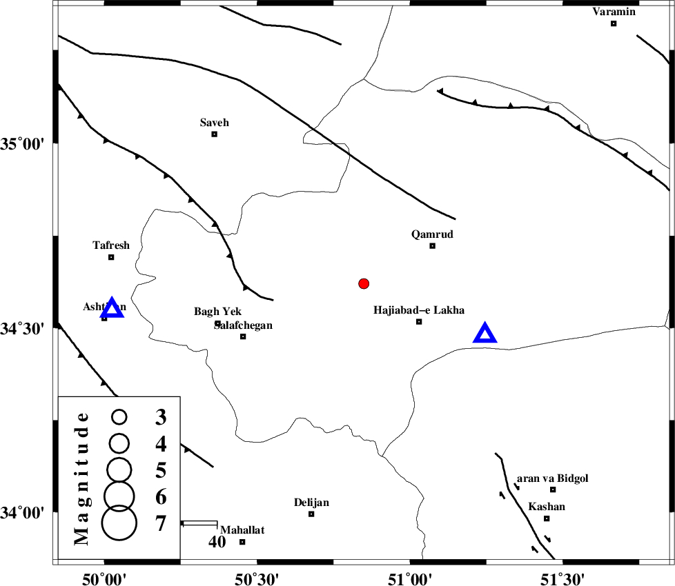
| Location | Lat:34.62 Lon: 50.849 |
| Region | Qom Province, 4 km of Qom |
Nearest Cities |
|
| 4 km of Qom, Qom Province | |
| 20 km North West of Hajiabad-e lakha, Qom Province | |
| 24 km South West of Qamrud, Qom Province | |
| 27 km North of Kahak, Qom Province | |
| 34 km South East of Gazran, Qom Province | |
| Depth | 14 km |
| Agency | |
Faults within 150 km: |
|
| INDES_F (Length: 98 km) , Distance to epicenter: 28 km | |
| KUSHK_E_NOSRAT_F (Length: 230 km) , Distance to epicenter: 30 km | |
| SIAHKUH_F (Length: 154 km) , Distance to epicenter: 63 km | |
| Number of Phases | 6 |
| RMS | 0.1 |
| Number of Stations | 5 |
| Error in Latitude | >1.2 km |
| Error in Longitude | 1.5 km |
| Error in Depth | 3.3 km |
Download waveform in seisan format
to download seisan software Click here
to access information about IIEES stations Click here
Amplitude | ||||||||
| UID | Agency | Station | Component | Amplitude | Period | Arrival Time | Proccessing Time | Signal Clip |
| 101195 | IIEES | GHVR | N | 436.4 | 0.46 | 2015-09-27 13:25:16 | 2015-09-28 07:33:00 | n |
| 101196 | IIEES | GHVR | E | 306.2 | 0.4 | 2015-09-27 13:25:16 | 2015-09-28 07:33:00 | n |
| 101197 | IIEES | NASN | E | 4.6 | 0.35 | 2015-09-27 13:26:17 | 2015-09-28 07:33:00 | n |
| 101198 | IIEES | SNGE | N | 2.9 | 0.57 | 2015-09-27 13:26:53 | 2015-09-28 07:33:00 | n |
Phase | ||||||||||||
| Agency | Station | Component | Phase Type | Phase Quality | First Motion | Observed Arrival Time | Time Residual | Loc. Flag | Input Weight | Distance | Azimuth | |
| IIEES | GHVR | Z | Pg | E | 2015-09-27 13:25:07 | -0.04 | y | 39.5 | 113 | |||
| IIEES | ASAO | Z | Pg | E | 2015-09-27 13:25:13 | -0.06 | y | 76 | 264 | |||
| IIEES | CHTH | Z | Pg | E | 2015-09-27 13:25:24 | -0.08 | y | 145 | 10 | |||
| IIEES | CHTH | E | Sg | E | 2015-09-27 13:25:42 | 0.07 | y | 145 | 10 | |||
| IIEES | NASN | Z | Pn | E | 2015-09-27 13:25:41 | 0.05 | y | 272 | 137 | |||
| IIEES | SNGE | Z | Pn | E | 2015-09-27 13:25:48 | 0.07 | y | 325 | 280 | |||