
Magnitude |
:2 |
| Date & Time (UTC) | 2015-09-28 01:04:18.6 |
| Date & Time (Local) | 1394/7/6 04:34:18.6 |
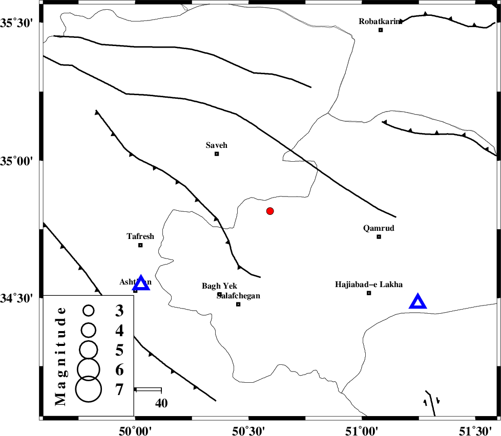
| Location | Lat:34.816 Lon: 50.594 |
| Region | Qom Province, 31 km North-West of Qom |
Nearest Cities |
|
| 7 km North of Gazran, Qom Province | |
| 17 km South of Taraznahid, Markazi Province | |
| 23 km East of Qareh chay, Markazi Province | |
| 30 km South East of Yalabad, Markazi Province | |
| 31 km North West of Qom, Qom Province | |
| Depth | 15 km |
| Agency | |
Faults within 150 km: |
|
| INDES_F (Length: 98 km) , Distance to epicenter: 21 km | |
| KUSHK_E_NOSRAT_F (Length: 230 km) , Distance to epicenter: 27 km | |
| S_PARANDAK_F (Length: 116 km) , Distance to epicenter: 53 km | |
| Number of Phases | 7 |
| RMS | 0.4 |
| Number of Stations | 5 |
| Error in Latitude | >4 km |
| Error in Longitude | 2.9 km |
| Error in Depth | 9 km |
Download waveform in seisan format
to download seisan software Click here
to access information about IIEES stations Click here
Amplitude | ||||||||
| UID | Agency | Station | Component | Amplitude | Period | Arrival Time | Proccessing Time | Signal Clip |
| 101182 | IIEES | CHTH | E | 25 | 0.28 | 2015-09-28 01:05:01 | 2015-09-28 06:39:00 | n |
| 101183 | IIEES | SNGE | N | 5.8 | 0.48 | 2015-09-28 01:05:46 | 2015-09-28 06:39:00 | n |
| 101184 | IIEES | SNGE | E | 5.7 | 0.35 | 2015-09-28 01:05:50 | 2015-09-28 06:39:00 | n |
Phase | ||||||||||||
| Agency | Station | Component | Phase Type | Phase Quality | First Motion | Observed Arrival Time | Time Residual | Loc. Flag | Input Weight | Distance | Azimuth | |
| IIEES | ASAO | Z | Pg | E | 2015-09-28 01:04:28 | -0.4 | y | 60 | 240 | |||
| IIEES | ASAO | E | Sg | E | 2015-09-28 01:04:37 | 0.61 | y | 60 | 240 | |||
| IIEES | GHVR | Z | Pg | E | 2015-09-28 01:04:30 | 0.04 | y | 70.4 | 122 | |||
| IIEES | GHVR | E | Sg | E | 2015-09-28 01:04:40 | 0.25 | y | 70.4 | 122 | |||
| IIEES | CHTH | Z | Pg | E | 2015-09-28 01:04:40 | -0.01 | y | 130 | 22 | |||
| IIEES | KHMZ | Z | Pg | E | 2015-09-28 01:04:40 | -0.64 | y | 133 | 206 | |||
| IIEES | SNGE | Z | Pn | E | 2015-09-28 01:05:03 | 0.14 | y | 298 | 277 | |||