
Magnitude |
:1.7 |
| Date & Time (UTC) | 2015-09-26 00:02:14.9 |
| Date & Time (Local) | 1394/7/4 03:32:14.9 |
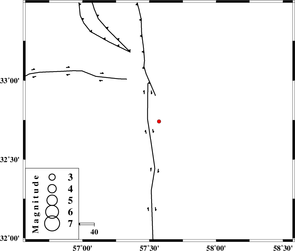
| Location | Lat:32.741 Lon: 57.572 |
| Region | Yazd Province, 113 km South-East of Tabas |
Nearest Cities |
|
| 37 km South West of Arababad, Yazd Province | |
| 62 km South of Dihuk, Yazd Province | |
| 66 km North East of Hoz-e qorban, Yazd Province | |
| 84 km South West of Hur, Khorasan(south) Province | |
| 99 km South East of Kerit, Yazd Province | |
| Depth | 15 km |
| Agency | |
Faults within 150 km: |
|
| NAYBAND_F (Length: 258 km) , Distance to epicenter: 8 km | |
| ESFARDIAR_F (Length: 94 km) , Distance to epicenter: 18 km | |
| CHESHMEH_ROSTAM_ (Length: 142 km) , Distance to epicenter: 37 km | |
| Number of Phases | 5 |
| RMS | 0 |
| Number of Stations | 3 |
| Error in Latitude | >1.7 km |
| Error in Longitude | 1.8 km |
| Error in Depth | 5.1 km |
Download waveform in seisan format
to download seisan software Click here
to access information about IIEES stations Click here
Amplitude | ||||||||
| UID | Agency | Station | Component | Amplitude | Period | Arrival Time | Proccessing Time | Signal Clip |
| 101170 | IIEES | YZKH | N | 3.1 | 0.5 | 2015-09-26 00:03:36 | 2015-09-27 11:09:00 | n |
| 101171 | IIEES | YZKH | E | 3.9 | 0.33 | 2015-09-26 00:03:38 | 2015-09-27 11:09:00 | n |
Phase | ||||||||||||
| Agency | Station | Component | Phase Type | Phase Quality | First Motion | Observed Arrival Time | Time Residual | Loc. Flag | Input Weight | Distance | Azimuth | |
| IIEES | TABS | Z | Pg | E | 2015-09-26 00:02:33 | 0.01 | y | 109 | 337 | |||
| IIEES | TABS | N | Sg | E | 2015-09-26 00:02:46 | -0.01 | y | 109 | 337 | |||
| IIEES | BSRN | Z | Pn | E | 2015-09-26 00:02:43 | 0 | y | 170 | 120 | |||
| IIEES | YZKH | Z | Pn | E | 2015-09-26 00:02:57 | 0 | y | 283 | 263 | |||
| IIEES | YZKH | N | Sg | E | 2015-09-26 00:03:34 | 0 | y | 283 | 263 | |||