
Magnitude |
:2.7 |
| Date & Time (UTC) | 2015-09-23 12:26:53.8 |
| Date & Time (Local) | 1394/7/1 15:56:53.8 |
| Location | Lat:30.124 Lon: 55.148 |
| Region | Kerman Province, 2 km of Shahr-e babak |
Nearest Cities |
|
| 2 km North of Shahr-e babak, Kerman Province | |
| 8 km of Khorsand, Kerman Province | |
| 24 km West of Meimand, Kerman Province | |
| 30 km North West of Khatunabad, Kerman Province | |
| 33 km South West of Marj, Kerman Province | |
| Depth | 14 km |
| Agency | |
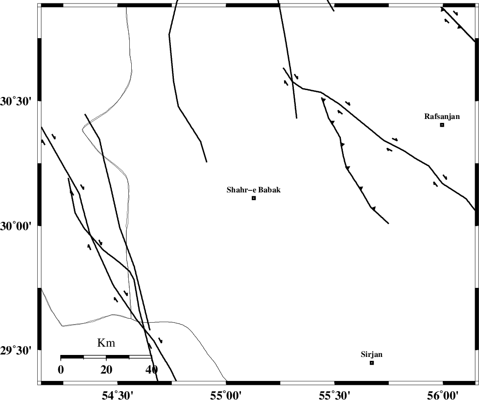
Faults within 150 km: |
|
| SHAHR_E_BABAK_F2 (Length: 272 km) , Distance to epicenter: 7 km | |
| RAFSANJAN_F (Length: 129 km) , Distance to epicenter: 51 km | |
| ANAR_F (Length: 127 km) , Distance to epicenter: 72 km | |
| Number of Phases | 5 |
| RMS | 0.1 |
| Number of Stations | 3 |
| Error in Latitude | >3.1 km |
| Error in Longitude | 3.6 km |
| Error in Depth | 7.1 km |
Download waveform in seisan format
to download seisan software Click here
to access information about IIEES stations Click here
Amplitude | ||||||||
| UID | Agency | Station | Component | Amplitude | Period | Arrival Time | Proccessing Time | Signal Clip |
| 101133 | IIEES | KRBR | E | 118.4 | 0.32 | 2015-09-23 12:27:42 | 2015-09-26 12:25:00 | n |
| 101134 | IIEES | KRBR | N | 99.8 | 0.23 | 2015-09-23 12:27:45 | 2015-09-26 12:25:00 | n |
Phase | ||||||||||||
| Agency | Station | Component | Phase Type | Phase Quality | First Motion | Observed Arrival Time | Time Residual | Loc. Flag | Input Weight | Distance | Azimuth | |
| IIEES | KRBR | Z | Pg | E | 2015-09-23 12:27:19 | -0.13 | y | 156 | 95 | |||
| IIEES | KRBR | E | Sg | E | 2015-09-23 12:27:39 | 0.1 | y | 156 | 95 | |||
| IIEES | YZKH | Z | Pn | E | 2015-09-23 12:27:33 | 0.03 | y | 257 | 348 | |||
| IIEES | BSRN | Z | Pn | E | 2015-09-23 12:27:55 | 0.07 | y | 431 | 61 | |||
| IIEES | BSRN | E | Sg | E | 2015-09-23 12:28:54 | -0.06 | y | 431 | 61 | |||