
Magnitude |
:2.1 |
| Date & Time (UTC) | 2015-09-16 07:47:47.4 |
| Date & Time (Local) | 1394/6/25 12:17:47.4 |
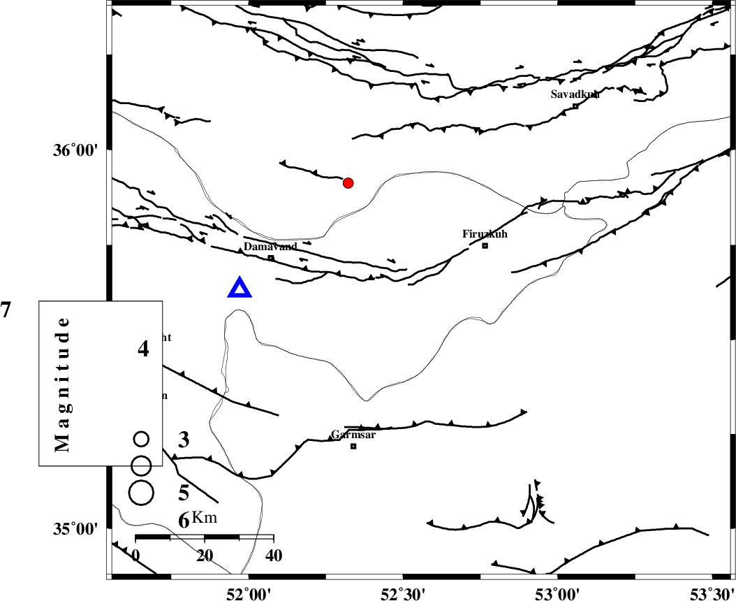
| Location | Lat:35.628 Lon: 52.558 |
| Region | Tehran Province, 23 km South-West of Firuzkuh |
Nearest Cities |
|
| 7 km North of Atashan, Tehran Province | |
| 20 km South of Arjomand, Tehran Province | |
| 22 km South West of Shahrabad, Tehran Province | |
| 23 km East of Sarbandan, Tehran Province | |
| 23 km South West of Firuzkuh, Tehran Province | |
| Depth | 18 km |
| Agency | |
Faults within 150 km: |
|
| MOSHA_F (Length: 234 km) , Distance to epicenter: 10 km | |
| ATARI_F (Length: 185 km) , Distance to epicenter: 37 km | |
| GARMSAR_F (Length: 77 km) , Distance to epicenter: 37 km | |
| Number of Phases | 6 |
| RMS | 0.2 |
| Number of Stations | 4 |
| Error in Latitude | >2.7 km |
| Error in Longitude | 6.9 km |
| Error in Depth | 6 km |
Download waveform in seisan format
to download seisan software Click here
to access information about IIEES stations Click here
Amplitude | ||||||||
| UID | Agency | Station | Component | Amplitude | Period | Arrival Time | Proccessing Time | Signal Clip |
| 101095 | IIEES | CHTH | E | 53.5 | 0.28 | 2015-09-16 07:48:27 | 2015-09-21 09:32:00 | n |
| 101096 | IIEES | GHVR | N | 14.4 | 0.31 | 2015-09-16 07:48:42 | 2015-09-21 09:32:00 | n |
Phase | ||||||||||||
| Agency | Station | Component | Phase Type | Phase Quality | First Motion | Observed Arrival Time | Time Residual | Loc. Flag | Input Weight | Distance | Azimuth | |
| IIEES | DAMV | Z | Pg | E | 2015-09-16 07:47:57 | -0.2 | y | 53.2 | 270 | |||
| IIEES | CHTH | Z | Pg | E | 2015-09-16 07:48:10 | 0.27 | y | 133 | 284 | |||
| IIEES | CHTH | E | Sg | E | 2015-09-16 07:48:26 | -0.09 | y | 133 | 284 | |||
| IIEES | GHVR | Z | Pn | E | 2015-09-16 07:48:16 | -0.22 | y | 175 | 224 | |||
| IIEES | GHVR | N | Sg | E | 2015-09-16 07:48:37 | 0.07 | y | 175 | 224 | |||
| IIEES | ASAO | Z | Pn | E | 2015-09-16 07:48:27 | 0.17 | y | 260 | 243 | |||