
Magnitude |
:1.7 |
| Date & Time (UTC) | 2015-09-15 17:20:24.9 |
| Date & Time (Local) | 1394/6/24 21:50:24.9 |
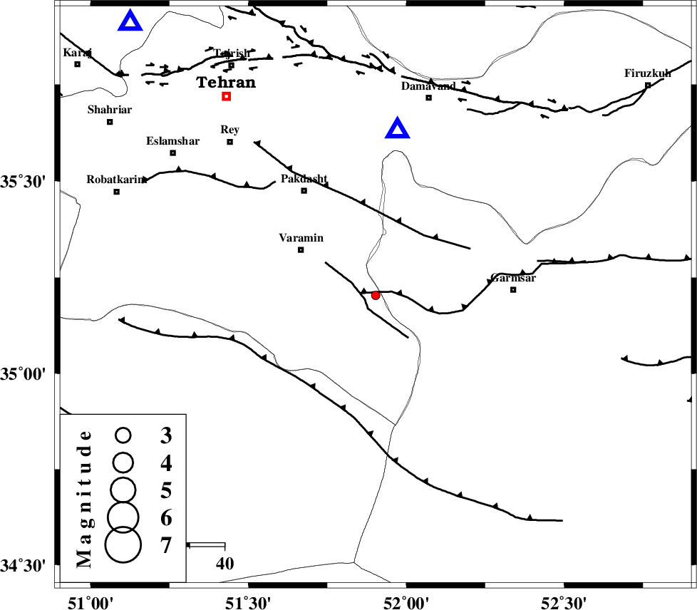
| Location | Lat:35.203 Lon: 51.903 |
| Region | Tehran Province, 25 km South-East of Varamin |
Nearest Cities |
|
| 9 km of Shorqazi, Semnan Province | |
| 13 km of Cheshmeh nadi, Semnan Province | |
| 19 km South East of Pishva, Tehran Province | |
| 21 km South West of Evanekay, Semnan Province | |
| 21 km South East of Khalilabad, Tehran Province | |
| Depth | 14 km |
| Agency | |
Faults within 150 km: |
|
| GARMSAR_F (Length: 77 km) , Distance to epicenter: 1 km | |
| PISHAV_F (Length: 34 km) , Distance to epicenter: 3 km | |
| EYVANEKEY_F (Length: 74 km) , Distance to epicenter: 22 km | |
| Number of Phases | 7 |
| RMS | 0.2 |
| Number of Stations | 5 |
| Error in Latitude | >2 km |
| Error in Longitude | 3.9 km |
| Error in Depth | 8.9 km |
Download waveform in seisan format
to download seisan software Click here
to access information about IIEES stations Click here
Amplitude | ||||||||
| UID | Agency | Station | Component | Amplitude | Period | Arrival Time | Proccessing Time | Signal Clip |
| 101005 | IIEES | GHVR | N | 22.1 | 0.31 | 2015-09-15 17:20:59 | 2015-09-19 11:13:00 | n |
Phase | ||||||||||||
| Agency | Station | Component | Phase Type | Phase Quality | First Motion | Observed Arrival Time | Time Residual | Loc. Flag | Input Weight | Distance | Azimuth | |
| IIEES | DAMV | Z | Pg | E | 2015-09-15 17:20:33 | -0.11 | y | 47.7 | 7 | |||
| IIEES | GHVR | Z | Pg | E | 2015-09-15 17:20:41 | -0.16 | y | 100 | 217 | |||
| IIEES | GHVR | N | Sg | E | 2015-09-15 17:20:54 | 0.22 | y | 100 | 217 | |||
| IIEES | CHTH | Z | Pg | E | 2015-09-15 17:20:43 | 0.22 | y | 105 | 318 | |||
| IIEES | ASAO | Z | Pg | E | 2015-09-15 17:20:55 | 0.03 | y | 186 | 248 | |||
| IIEES | ASAO | N | Sg | E | 2015-09-15 17:21:18 | -0.2 | y | 186 | 248 | |||
| IIEES | SHRO | Z | Pn | E | 2015-09-15 17:21:20 | 0 | y | 383 | 75 | |||