
Magnitude |
:1.7 |
| Date & Time (UTC) | 2015-09-18 12:30:12.3 |
| Date & Time (Local) | 1394/6/27 17:00:12.3 |
| Location | Lat:31.022 Lon: 56.44 |
| Region | Kerman Province, 26 km North-West of Zarand |
Nearest Cities |
|
| 12 km West of Dasht-e khak, Kerman Province | |
| 14 km South of Toghroljerd, Kerman Province | |
| 18 km North West of Ahmadi, Kerman Province | |
| 26 km North West of Zarand, Kerman Province | |
| 29 km North West of Mohammadabad, Kerman Province | |
| Depth | 14 km |
| Agency | |
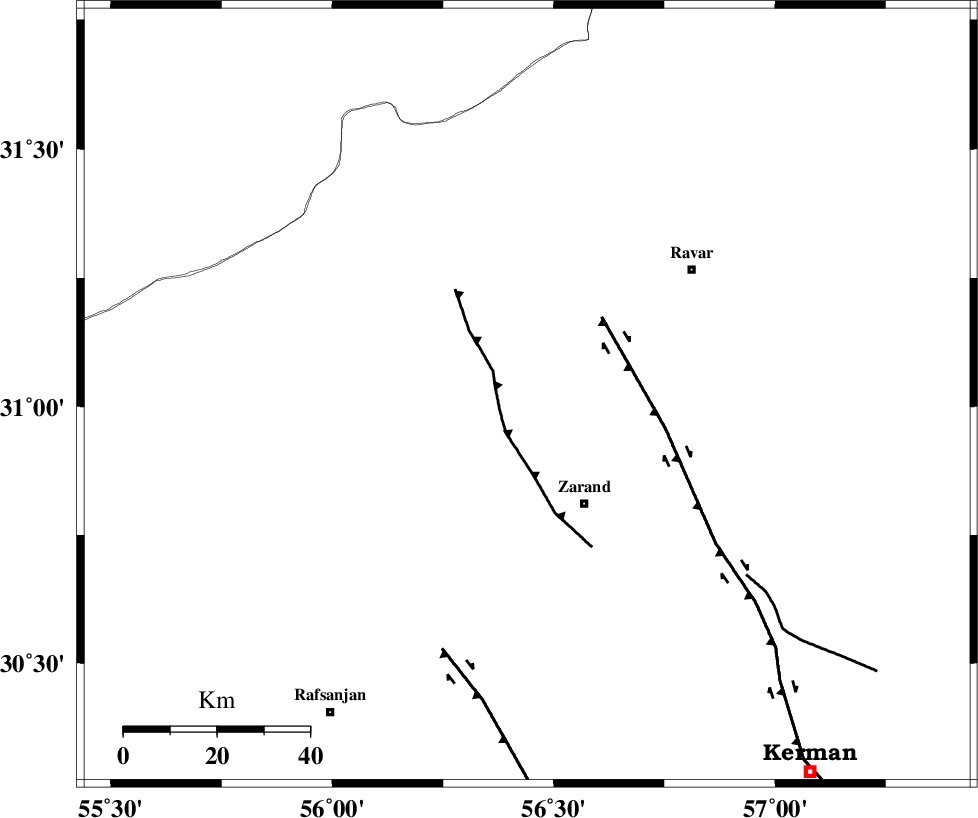
Faults within 150 km: |
|
| KUHBANAN_F (Length: 189 km) , Distance to epicenter: 6 km | |
| DARIVAN_F (Length: 131 km) , Distance to epicenter: 42 km | |
| CHATRUD_F (Length: 37 km) , Distance to epicenter: 67 km | |
| Number of Phases | 4 |
| RMS | 0 |
| Number of Stations | 3 |
| Error in Latitude | >2.5 km |
| Error in Longitude | 3.1 km |
| Error in Depth | 4.9 km |
Download waveform in seisan format
to download seisan software Click here
to access information about IIEES stations Click here
Amplitude | ||||||||
| UID | Agency | Station | Component | Amplitude | Period | Arrival Time | Proccessing Time | Signal Clip |
| 100997 | IIEES | YZKH | N | 4.9 | 0.35 | 2015-09-18 12:31:22 | 2015-09-19 08:59:00 | n |
| 100998 | IIEES | YZKH | E | 6.1 | 0.46 | 2015-09-18 12:31:23 | 2015-09-19 08:59:00 | n |
Phase | ||||||||||||
| Agency | Station | Component | Phase Type | Phase Quality | First Motion | Observed Arrival Time | Time Residual | Loc. Flag | Input Weight | Distance | Azimuth | |
| IIEES | KRBR | Z | Pg | E | 2015-09-18 12:30:32 | 0 | y | 119 | 165 | |||
| IIEES | YZKH | Z | Pn | E | 2015-09-18 12:30:49 | 0 | y | 232 | 311 | |||
| IIEES | YZKH | N | Sg | E | 2015-09-18 12:31:18 | 0 | y | 232 | 311 | |||
| IIEES | BSRN | Z | Pn | E | 2015-09-18 12:30:54 | 0 | y | 276 | 67 | |||