
Magnitude |
:2.6 |
| Date & Time (UTC) | 2015-09-19 00:53:21.6 |
| Date & Time (Local) | 1394/6/28 05:23:21.6 |
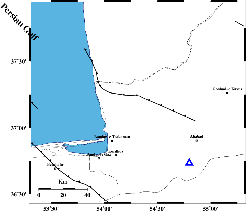
| Location | Lat:37.192 Lon: 54.313 |
| Region | Golestan Province, 24 km North-West of Aq Qaleh |
Nearest Cities |
|
| 22 km North of Banavar, Golestan Province | |
| 23 km North East of Gomishtappeh, Golestan Province | |
| 24 km North West of Aq Qaleh, Golestan Province | |
| 26 km North West of Qanqarmeh, Golestan Province | |
| 34 km North West of Nodeh malek, Golestan Province | |
| Depth | 14 km |
| Agency | |
Faults within 150 km: |
|
| KHAZAR_F (Length: 523 km) , Distance to epicenter: 41 km | |
| N_ALBORZ_F (Length: 360 km) , Distance to epicenter: 65 km | |
| SHAVAR_F (Length: 87 km) , Distance to epicenter: 70 km | |
| Number of Phases | 5 |
| RMS | 0.3 |
| Number of Stations | 3 |
| Error in Latitude | >3.4 km |
| Error in Longitude | 8.8 km |
| Error in Depth | 9.9 km |
Download waveform in seisan format
to download seisan software Click here
to access information about IIEES stations Click here
Amplitude | ||||||||
| UID | Agency | Station | Component | Amplitude | Period | Arrival Time | Proccessing Time | Signal Clip |
| 100985 | IIEES | MRVT | E | 123.8 | 0.23 | 2015-09-19 00:54:11 | 2015-09-19 08:14:00 | n |
| 100986 | IIEES | SHRO | N | 37.5 | 0.22 | 2015-09-19 00:54:26 | 2015-09-19 08:14:00 | n |
Phase | ||||||||||||
| Agency | Station | Component | Phase Type | Phase Quality | First Motion | Observed Arrival Time | Time Residual | Loc. Flag | Input Weight | Distance | Azimuth | |
| IIEES | MRVT | Z | Pg | E | 2015-09-19 00:53:49 | 0.34 | y | 166 | 71 | |||
| IIEES | MRVT | N | Sg | E | 2015-09-19 00:54:08 | -0.21 | y | 166 | 71 | |||
| IIEES | SHRO | Z | Pg | E | 2015-09-19 00:53:54 | -0.37 | y | 201 | 130 | |||
| IIEES | SHRO | E | Sg | E | 2015-09-19 00:54:19 | 0.22 | y | 201 | 130 | |||
| IIEES | BJRD | Z | Pn | E | 2015-09-19 00:54:04 | 0.03 | y | 280 | 77 | |||