
Magnitude |
:2 |
| Date & Time (UTC) | 2015-09-14 13:30:42.2 |
| Date & Time (Local) | 1394/6/23 18:00:42.2 |
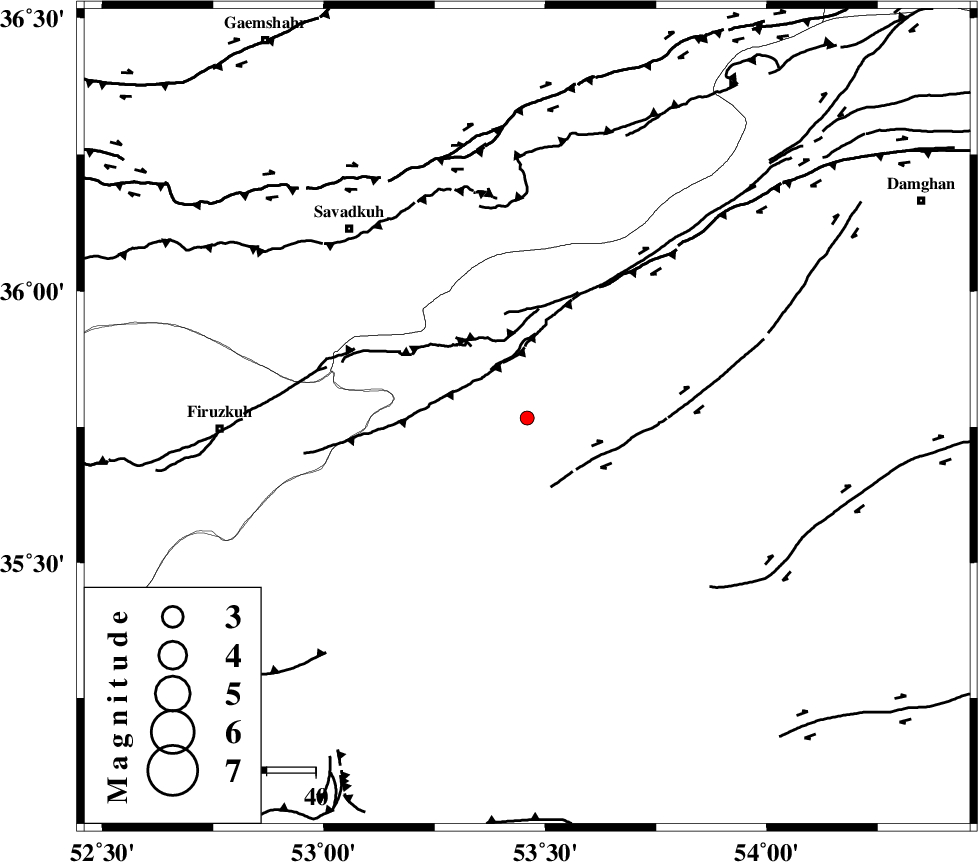
| Location | Lat:35.767 Lon: 53.459 |
| Region | Semnan Province, 23 km North of Semnan |
Nearest Cities |
|
| 12 km North East of Shahmirzad, Semnan Province | |
| 13 km North East of Mehdishahr, Semnan Province | |
| 22 km South East of Chashem, Semnan Province | |
| 23 km North of Semnan, Semnan Province | |
| 26 km North of Alae, Semnan Province | |
| Depth | 18 km |
| Agency | |
Faults within 150 km: |
|
| ATARI_F (Length: 185 km) , Distance to epicenter: 4 km | |
| KUH_E_GACHAB_F2 (Length: 31 km) , Distance to epicenter: 53 km | |
| DAMGHAN_F (Length: 95 km) , Distance to epicenter: 54 km | |
| Number of Phases | 5 |
| RMS | 0.1 |
| Number of Stations | 4 |
| Error in Latitude | >6.8 km |
| Error in Longitude | 3 km |
| Error in Depth | 8.7 km |
Download waveform in seisan format
to download seisan software Click here
to access information about IIEES stations Click here
Amplitude | ||||||||
| UID | Agency | Station | Component | Amplitude | Period | Arrival Time | Proccessing Time | Signal Clip |
| 100930 | IIEES | GHVR | N | 10.7 | 0.36 | 2015-09-14 13:32:03 | 2015-09-15 09:30:00 | n |
| 100931 | IIEES | GHVR | E | 9.9 | 0.26 | 2015-09-14 13:32:04 | 2015-09-15 09:30:00 | n |
Phase | ||||||||||||
| Agency | Station | Component | Phase Type | Phase Quality | First Motion | Observed Arrival Time | Time Residual | Loc. Flag | Input Weight | Distance | Azimuth | |
| IIEES | CHTH | Z | Pn | E | 2015-09-14 13:31:16 | 0.09 | y | 211 | 275 | |||
| IIEES | SHRO | Z | Pn | E | 2015-09-14 13:31:18 | 0.02 | y | 232 | 83 | |||
| IIEES | GHVR | Z | Pn | E | 2015-09-14 13:31:20 | 0.07 | y | 247 | 235 | |||
| IIEES | GHVR | N | Sg | E | 2015-09-14 13:31:52 | 0.04 | y | 247 | 235 | |||
| IIEES | ASAO | Z | Pn | E | 2015-09-14 13:31:31 | -0.25 | y | 341 | 248 | |||