
Magnitude |
:2.3 |
| Date & Time (UTC) | 2015-09-09 20:50:19.0 |
| Date & Time (Local) | 1394/6/19 01:20:19.0 |
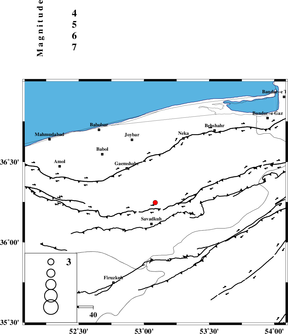
| Location | Lat:36.247 Lon: 53.086 |
| Region | Mazandaran Province, 15 km North of Pol-E-Sefid |
Nearest Cities |
|
| 6 km North of Utu, Mazandaran Province | |
| 13 km North East of Zirab, Mazandaran Province | |
| 15 km North of Pol-E-Sefid, Mazandaran Province | |
| 18 km North of Shurmast-e peyrudbar, Mazandaran Province | |
| 19 km East of Shirgah, Mazandaran Province | |
| Depth | 18 km |
| Agency | |
Faults within 150 km: |
|
| N_ALBORZ_F (Length: 360 km) , Distance to epicenter: 5 km | |
| KHAZAR_F (Length: 523 km) , Distance to epicenter: 27 km | |
| ATARI_F (Length: 185 km) , Distance to epicenter: 61 km | |
| Number of Phases | 5 |
| RMS | 0.1 |
| Number of Stations | 4 |
| Error in Latitude | >3.5 km |
| Error in Longitude | 3.4 km |
| Error in Depth | 5.2 km |
Download waveform in seisan format
to download seisan software Click here
to access information about IIEES stations Click here
Amplitude | ||||||||
| UID | Agency | Station | Component | Amplitude | Period | Arrival Time | Proccessing Time | Signal Clip |
| 100891 | IIEES | GHVR | N | 19 | 0.51 | 2015-09-09 20:51:36 | 2015-09-13 08:31:00 | n |
| 100892 | IIEES | GHVR | E | 19.9 | 0.42 | 2015-09-09 20:51:39 | 2015-09-13 08:31:00 | n |
| 100893 | IIEES | ASAO | E | 6 | 0.46 | 2015-09-09 20:51:54 | 2015-09-13 08:31:00 | n |
Phase | ||||||||||||
| Agency | Station | Component | Phase Type | Phase Quality | First Motion | Observed Arrival Time | Time Residual | Loc. Flag | Input Weight | Distance | Azimuth | |
| IIEES | CHTH | Z | Pg | E | 2015-09-09 20:50:48 | -0.03 | y | 181 | 259 | |||
| IIEES | GHVR | Z | Pn | E | 2015-09-09 20:50:58 | -0.19 | y | 258 | 221 | |||
| IIEES | GHVR | N | Sg | E | 2015-09-09 20:51:31 | 0.04 | y | 258 | 221 | |||
| IIEES | SHRO | Z | Pn | E | 2015-09-09 20:50:59 | 0.02 | y | 265 | 95 | |||
| IIEES | ASAO | Z | Pn | E | 2015-09-09 20:51:08 | 0.19 | y | 336 | 237 | |||