
Magnitude |
:2.8 |
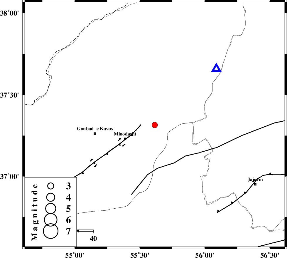
| Date & Time (UTC) | 2015-09-11 13:13:37.0 |
| Date & Time (Local) | 1394/6/20 17:43:37.0 |
| Location | Lat:37.315 Lon: 55.615 |
| Region | Golestan Province, 13 km -East of Kalaleh |
Nearest Cities |
|
| 6 km of Aq qamish, Golestan Province | |
| 9 km North of Farsian, Golestan Province | |
| 13 km South of Ajen sangarli, Golestan Province | |
| 13 km East of Kalaleh, Golestan Province | |
| 17 km North East of Galikesh, Golestan Province | |
| Depth | 14 km |
| Agency | |
Faults within 150 km: |
|
| ROBATE_QARABIL_F (Length: 168 km) , Distance to epicenter: 29 km | |
| KHAZAR_F (Length: 523 km) , Distance to epicenter: 67 km | |
| SHAVAR_F (Length: 87 km) , Distance to epicenter: 70 km | |
| Number of Phases | 5 |
| RMS | 0.2 |
| Number of Stations | 4 |
| Error in Latitude | >3.2 km |
| Error in Longitude | 13.6 km |
| Error in Depth | 8.9 km |
Download waveform in seisan format
to download seisan software Click here
to access information about IIEES stations Click here
Amplitude | ||||||||
| UID | Agency | Station | Component | Amplitude | Period | Arrival Time | Proccessing Time | Signal Clip |
| 100840 | IIEES | SHRO | E | 170 | 0.4 | 2015-09-11 13:14:20 | 2015-09-12 11:48:00 | n |
| 100841 | IIEES | SHRO | N | 136.5 | 0.24 | 2015-09-11 13:14:24 | 2015-09-12 11:48:00 | n |
Phase | ||||||||||||
| Agency | Station | Component | Phase Type | Phase Quality | First Motion | Observed Arrival Time | Time Residual | Loc. Flag | Input Weight | Distance | Azimuth | |
| IIEES | MRVT | Z | Pg | E | 2015-09-11 13:13:47 | -0.05 | y | 56.7 | 47 | |||
| IIEES | SHRO | Z | Pg | E | 2015-09-11 13:14:01 | -0.31 | y | 149 | 166 | |||
| IIEES | SHRO | E | Sg | E | 2015-09-11 13:14:20 | 0.04 | y | 149 | 166 | |||
| IIEES | BJRD | Z | Pg | E | 2015-09-11 13:14:04 | 0.03 | y | 164 | 74 | |||
| IIEES | TABS | Z | Pn | E | 2015-09-11 13:14:38 | 0.39 | y | 429 | 161 | |||