
Magnitude |
:2.7 |
| Date & Time (UTC) | 2015-09-06 20:41:36.4 |
| Date & Time (Local) | 1394/6/16 01:11:36.4 |
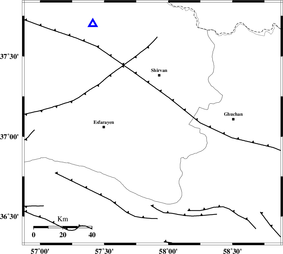
| Location | Lat:37.083 Lon: 57.877 |
| Region | Khorasan(center) Province, 34 km South of Shirvan |
Nearest Cities |
|
| 16 km South of Geliyan, Khorasan(north) Province | |
| 20 km South West of Maviyan, Khorasan(center) Province | |
| 20 km North of Bam, Khorasan(north) Province | |
| 25 km North East of Parkanlu, Khorasan(north) Province | |
| 27 km West of Chari, Khorasan(center) Province | |
| Depth | 17 km |
| Agency | |
Faults within 150 km: |
|
| ESFARAYEN_F (Length: 111 km) , Distance to epicenter: 20 km | |
| RIVAND_F (Length: 70 km) , Distance to epicenter: 34 km | |
| BAGHAN_GERMAB_F (Length: 79 km) , Distance to epicenter: 38 km | |
| Number of Phases | 7 |
| RMS | 0.3 |
| Number of Stations | 5 |
| Error in Latitude | >3.1 km |
| Error in Longitude | 5 km |
| Error in Depth | 9.3 km |
Download waveform in seisan format
to download seisan software Click here
to access information about IIEES stations Click here
Amplitude | ||||||||
| UID | Agency | Station | Component | Amplitude | Period | Arrival Time | Proccessing Time | Signal Clip |
| 100779 | IIEES | MRVT | E | 105.6 | 0.33 | 2015-09-06 20:42:29 | 2015-09-07 07:02:00 | n |
| 100780 | IIEES | MRVT | N | 74.4 | 0.52 | 2015-09-06 20:42:31 | 2015-09-07 07:02:00 | n |
Phase | ||||||||||||
| Agency | Station | Component | Phase Type | Phase Quality | First Motion | Observed Arrival Time | Time Residual | Loc. Flag | Input Weight | Distance | Azimuth | |
| IIEES | BJRD | Z | Pg | E | 2015-09-06 20:41:50 | -0.18 | y | 80 | 329 | |||
| IIEES | MRVT | Z | Pg | E | 2015-09-06 20:42:04 | 0.17 | y | 171 | 293 | |||
| IIEES | MRVT | N | Sg | E | 2015-09-06 20:42:25 | 0.12 | y | 171 | 293 | |||
| IIEES | SHRO | Z | Pn | E | 2015-09-06 20:42:09 | -0.32 | y | 205 | 235 | |||
| IIEES | SHRO | N | Sg | E | 2015-09-06 20:42:34 | -0.11 | y | 205 | 235 | |||
| IIEES | TABS | Z | Pn | E | 2015-09-06 20:42:32 | 0.51 | y | 387 | 190 | |||
| IIEES | SHRT | Z | Pn | E | 2015-09-06 20:42:38 | -0.13 | y | 440 | 149 | |||