
Magnitude |
:3.2 |
| Date & Time (UTC) | 2015-09-05 14:32:28.4 |
| Date & Time (Local) | 1394/6/14 19:02:28.4 |
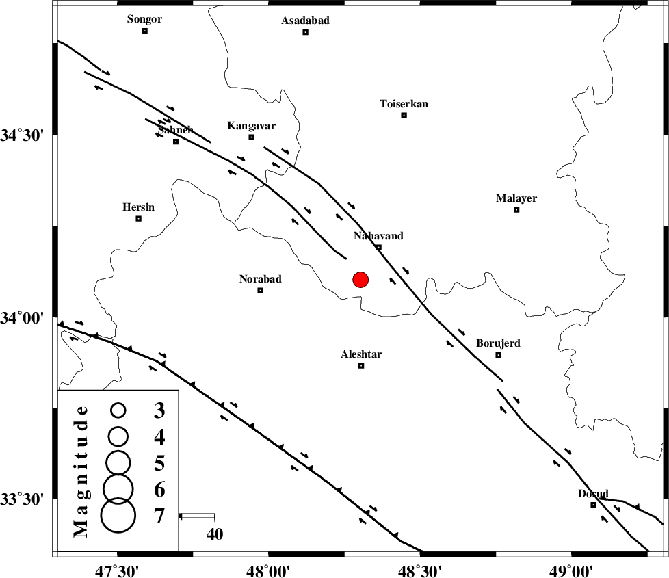
| Location | Lat:34.103 Lon: 48.303 |
| Region | Hamedan Province, 11 km of Nahavand |
Nearest Cities |
|
| 10 km of Gian, Hamedan Province | |
| 11 km of Nahavand, Hamedan Province | |
| 14 km South of Barzul, Hamedan Province | |
| 15 km South of Dehghul, Hamedan Province | |
| 15 km North West of Babaqasem, Hamedan Province | |
| Depth | 15 km |
| Agency | |
Faults within 150 km: |
|
| SAHANEH_F (Length: 77 km) , Distance to epicenter: 8 km | |
| NAHAVAND_F (Length: 102 km) , Distance to epicenter: 10 km | |
| DORUD (Length: 100 km) , Distance to epicenter: 53 km | |
| Number of Phases | 6 |
| RMS | 0.3 |
| Number of Stations | 7 |
| Error in Latitude | >9.8 km |
| Error in Longitude | 3.7 km |
| Error in Depth | 0 km |
Download waveform in seisan format
to download seisan software Click here
to access information about IIEES stations Click here
Amplitude | ||||||||
| UID | Agency | Station | Component | Amplitude | Period | Arrival Time | Proccessing Time | Signal Clip |
| 100729 | IIEES | ASAO | E | 200.5 | 0.63 | 2015-09-05 14:33:19 | 2015-09-06 05:55:00 | n |
| 100730 | IIEES | ASAO | N | 261.6 | 0.52 | 2015-09-05 14:33:26 | 2015-09-06 05:55:00 | n |
| 100731 | IIEES | GHVR | E | 155.8 | 0.68 | 2015-09-05 14:33:47 | 2015-09-06 05:55:00 | n |
| 100732 | IIEES | GHVR | N | 130.5 | 0.53 | 2015-09-05 14:33:53 | 2015-09-06 05:55:00 | n |
Phase | ||||||||||||
| Agency | Station | Component | Phase Type | Phase Quality | First Motion | Observed Arrival Time | Time Residual | Loc. Flag | Input Weight | Distance | Azimuth | |
| IIEES | GHVR | Z | Pn | E | 2015-09-05 14:33:10 | 0.16 | y | 274 | 80 | |||
| IIEES | ZNJK | Z | Pn | E | 2015-09-05 14:33:11 | -0.11 | y | 287 | 7 | |||
| IIEES | CHTH | Z | Pn | E | 2015-09-05 14:33:16 | -0.52 | y | 326 | 51 | |||
| IIEES | DAMV | Z | Pn | E | 2015-09-05 14:33:23 | 0.49 | y | 376 | 62 | |||
| IIEES | NASN | Z | Pn | E | 2015-09-05 14:33:31 | -0.17 | y | 443 | 108 | |||
| IIEES | GRMI | Z | Pn | E | 2015-09-05 14:33:41 | 0.22 | y | 524 | 356 | |||