
Magnitude |
:2.2 |
| Date & Time (UTC) | 2015-09-05 01:11:11.8 |
| Date & Time (Local) | 1394/6/14 05:41:11.8 |
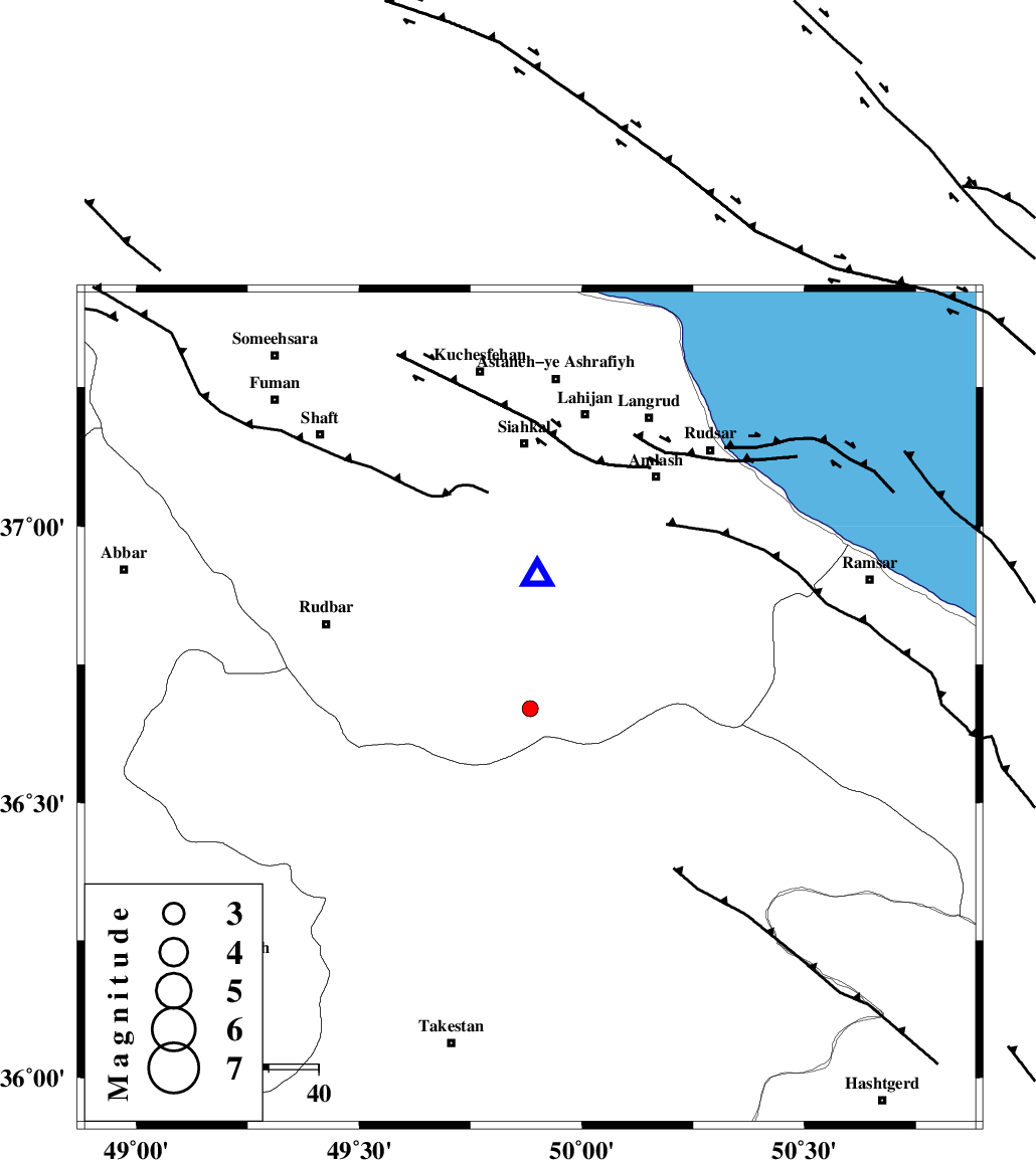
| Location | Lat:36.67 Lon: 49.884 |
| Region | Gilan Province, 53 km South of Siahkal |
Nearest Cities |
|
| 9 km of Jirhandeh, Gilan Province | |
| 11 km of Kelishom, Gilan Province | |
| 21 km South of Barresar, Gilan Province | |
| 29 km South East of Dashtvil, Gilan Province | |
| 32 km North East of Kuhgir-e sofla, Ghazvin Province | |
| Depth | 14 km |
| Agency | |
Faults within 150 km: |
|
| RUDBAR_F (Length: 93 km) , Distance to epicenter: 0 km | |
| ALAMUTRUD_F (Length: 140 km) , Distance to epicenter: 11 km | |
| BONAN_F (Length: 74 km) , Distance to epicenter: 24 km | |
| Number of Phases | 6 |
| RMS | 0.1 |
| Number of Stations | 6 |
| Error in Latitude | >5.7 km |
| Error in Longitude | 3.1 km |
| Error in Depth | 3.6 km |
Download waveform in seisan format
to download seisan software Click here
to access information about IIEES stations Click here
Amplitude | ||||||||
| UID | Agency | Station | Component | Amplitude | Period | Arrival Time | Proccessing Time | Signal Clip |
| 100715 | IIEES | ZNJK | N | 60.3 | 0.17 | 2015-09-05 01:11:43 | 2015-09-05 11:28:00 | n |
| 100716 | IIEES | THKV | N | 43.9 | 0.11 | 2015-09-05 01:11:45 | 2015-09-05 11:28:00 | n |
| 100717 | IIEES | ASAO | N | 18.8 | 0.2 | 2015-09-05 01:12:24 | 2015-09-05 11:28:00 | n |
| 100718 | IIEES | ASAO | E | 17 | 0.56 | 2015-09-05 01:12:26 | 2015-09-05 11:28:00 | n |
Phase | ||||||||||||
| Agency | Station | Component | Phase Type | Phase Quality | First Motion | Observed Arrival Time | Time Residual | Loc. Flag | Input Weight | Distance | Azimuth | |
| IIEES | ZNJK | Z | Pg | E | 2015-09-05 01:11:29 | -0.08 | y | 107 | 270 | |||
| IIEES | CHTH | Z | Pg | E | 2015-09-05 01:11:35 | -0.11 | y | 140 | 127 | |||
| IIEES | CHTH | E | Sg | E | 2015-09-05 01:11:52 | -0.1 | y | 140 | 127 | |||
| IIEES | DAMV | Z | Pn | E | 2015-09-05 01:11:47 | 0.1 | y | 220 | 121 | |||
| IIEES | ASAO | Z | Pn | E | 2015-09-05 01:11:48 | -0.04 | y | 236 | 177 | |||
| IIEES | GHVR | Z | Pn | E | 2015-09-05 01:11:53 | 0.24 | y | 273 | 153 | |||