
Magnitude |
:3 |
| Date & Time (UTC) | 2015-08-30 12:19:13.1 |
| Date & Time (Local) | 1394/6/8 16:49:13.1 |
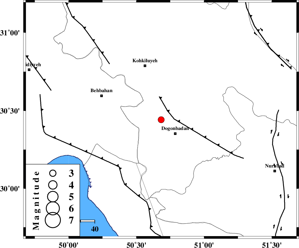
| Location | Lat:30.442 Lon: 50.683 |
| Region | Kohkiluieh va boyerahmad Province, 14 km -West of Dogonbadan |
Nearest Cities |
|
| 14 km North West of Dogonbadan, Kohkiluieh va boyerahmad Province | |
| 35 km West of Abdehgah, Kohkiluieh va boyerahmad Province | |
| 40 km South East of Dehdasht, Kohkiluieh va boyerahmad Province | |
| 42 km South East of Mansuriyeh, Khoozestan Province | |
| 45 km South East of Behbahan, Khoozestan Province | |
| Depth | 14 km |
| Agency | |
Faults within 150 km: |
|
| MISHAN_F (Length: 76 km) , Distance to epicenter: 8 km | |
| ZFF3 (Length: 125 km) , Distance to epicenter: 45 km | |
| RAG_E_SEFID_F (Length: 84 km) , Distance to epicenter: 45 km | |
| Number of Phases | 7 |
| RMS | 0.1 |
| Number of Stations | 6 |
| Error in Latitude | >4.6 km |
| Error in Longitude | 4.5 km |
| Error in Depth | 13.7 km |
Download waveform in seisan format
to download seisan software Click here
to access information about IIEES stations Click here
Amplitude | ||||||||
| UID | Agency | Station | Component | Amplitude | Period | Arrival Time | Proccessing Time | Signal Clip |
| 100617 | IIEES | AHRM | E | 172.1 | 0.42 | 2015-08-30 12:20:09 | 2015-08-31 05:47:00 | n |
| 100618 | IIEES | AHRM | N | 130.3 | 0.56 | 2015-08-30 12:20:09 | 2015-08-31 05:47:00 | n |
| 100619 | IIEES | NASN | N | 81.1 | 0.25 | 2015-08-30 12:20:40 | 2015-08-31 05:47:00 | n |
Phase | ||||||||||||
| Agency | Station | Component | Phase Type | Phase Quality | First Motion | Observed Arrival Time | Time Residual | Loc. Flag | Input Weight | Distance | Azimuth | |
| IIEES | AHRM | Z | Pg | E | 2015-08-30 12:19:43 | -0.07 | y | 185 | 161 | |||
| IIEES | AHRM | N | Sg | E | 2015-08-30 12:20:05 | 0.05 | y | 185 | 161 | |||
| IIEES | NASN | Z | Pn | E | 2015-08-30 12:20:02 | 0 | y | 330 | 37 | |||
| IIEES | KHMZ | Z | Pn | E | 2015-08-30 12:20:07 | -0.05 | y | 372 | 350 | |||
| IIEES | YZKH | Z | Pn | E | 2015-08-30 12:20:14 | 0 | y | 430 | 59 | |||
| IIEES | GHVR | Z | P | E | 2015-08-30 12:20:16 | -0.03 | y | 451 | 7 | |||
| IIEES | ASAO | Z | P | E | 2015-08-30 12:20:18 | 0.12 | y | 460 | 352 | |||