
Magnitude |
:2.5 |
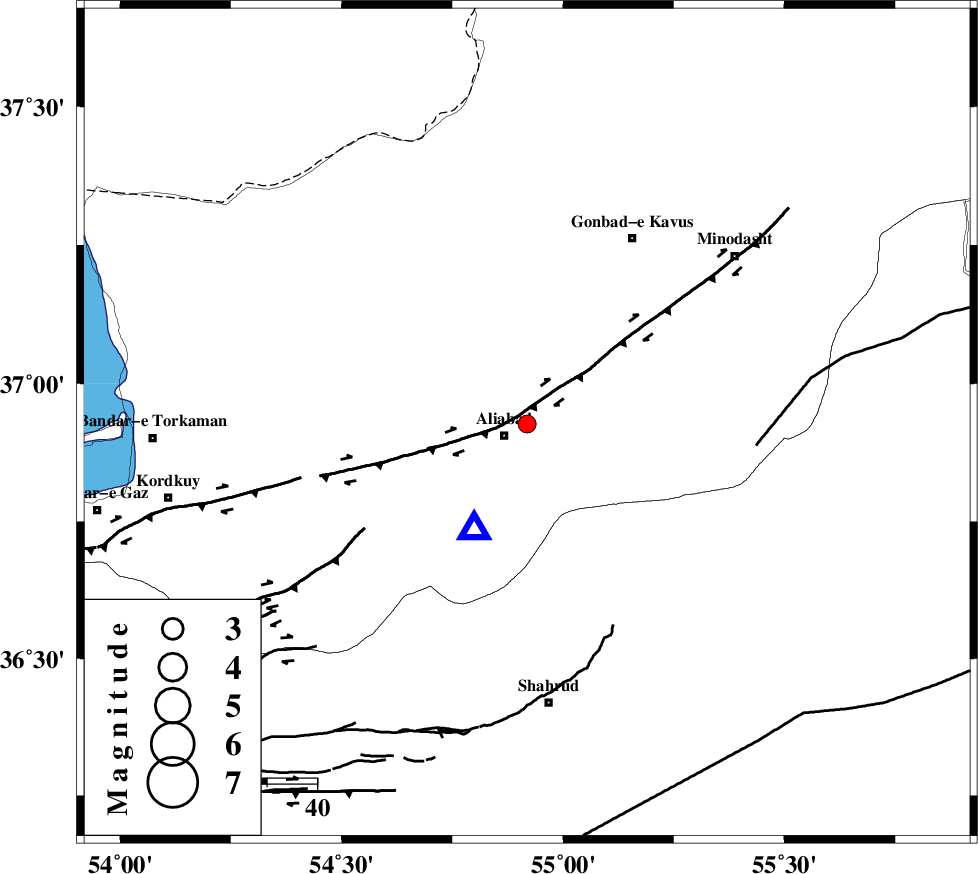
| Date & Time (UTC) | 2015-08-24 19:49:20.6 |
| Date & Time (Local) | 1394/6/3 00:19:20.6 |
| Location | Lat:36.927 Lon: 54.919 |
| Region | Golestan Province, 5 km of Ali Abad |
Nearest Cities |
|
| 5 km North of Ali Abad, Golestan Province | |
| 11 km of Khanbebin, Golestan Province | |
| 17 km South West of Deland, Golestan Province | |
| 22 km West of Ramian, Golestan Province | |
| 24 km South East of Gariduji, Golestan Province | |
| Depth | 18 km |
| Agency | |
Faults within 150 km: |
|
| KHAZAR_F (Length: 523 km) , Distance to epicenter: 10 km | |
| SHAVAR_F (Length: 87 km) , Distance to epicenter: 28 km | |
| ROBATE_QARABIL_F (Length: 168 km) , Distance to epicenter: 46 km | |
| Number of Phases | 6 |
| RMS | 0.2 |
| Number of Stations | 5 |
| Error in Latitude | >2.4 km |
| Error in Longitude | 4.9 km |
| Error in Depth | 9.2 km |
Download waveform in seisan format
to download seisan software Click here
to access information about IIEES stations Click here
Amplitude | ||||||||
| UID | Agency | Station | Component | Amplitude | Period | Arrival Time | Proccessing Time | Signal Clip |
| 100465 | IIEES | MRVT | N | 66.5 | 0.27 | 2015-08-24 19:50:08 | 2015-08-25 11:53:00 | n |
| 100466 | IIEES | MRVT | E | 68.8 | 0.15 | 2015-08-24 19:50:09 | 2015-08-25 11:53:00 | n |
| 100467 | IIEES | BJRD | E | 76.1 | 0.16 | 2015-08-24 19:50:33 | 2015-08-25 11:53:00 | n |
Phase | ||||||||||||
| Agency | Station | Component | Phase Type | Phase Quality | First Motion | Observed Arrival Time | Time Residual | Loc. Flag | Input Weight | Distance | Azimuth | |
| IIEES | SHRO | Z | Pg | E | 2015-08-24 19:49:44 | 0.36 | y | 141 | 136 | |||
| IIEES | SHRO | N | Sg | E | 2015-08-24 19:50:01 | -0.17 | y | 141 | 136 | |||
| IIEES | BJRD | Z | Pg | E | 2015-08-24 19:49:59 | -0.25 | y | 237 | 68 | |||
| IIEES | BJRD | E | Sg | E | 2015-08-24 19:50:27 | 0.14 | y | 237 | 68 | |||
| IIEES | DAMV | Z | Pn | E | 2015-08-24 19:50:05 | 0.01 | y | 301 | 242 | |||
| IIEES | TABS | Z | Pn | E | 2015-08-24 19:50:19 | -0.11 | y | 415 | 151 | |||