
Magnitude |
:2.5 |
| Date & Time (UTC) | 2015-08-22 11:58:02.7 |
| Date & Time (Local) | 1394/5/31 16:28:02.7 |
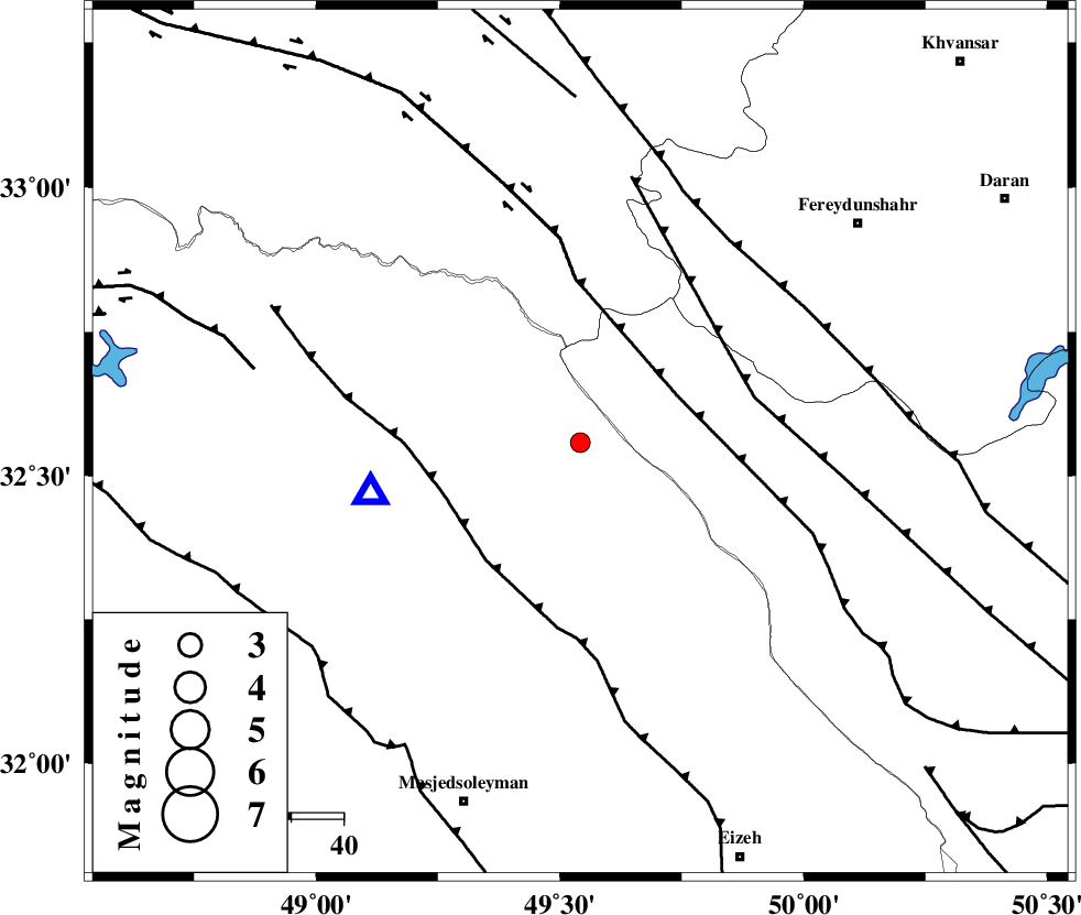
| Location | Lat:32.558 Lon: 49.542 |
| Region | Khoozestan Province, 45 km North-East of Lali |
Nearest Cities |
|
| 30 km North of Paabshalal, Khoozestan Province | |
| 34 km South West of Durak, Chaharmahal Bakhtiari Province | |
| 39 km South of Parchal, Lorestan Province | |
| 40 km North East of Qale-yekhvaju, Khoozestan Province | |
| 43 km South West of Masir, Esfahan Province | |
| Depth | 16 km |
| Agency | |
Faults within 150 km: |
|
| ZARDKUH_F (Length: 139 km) , Distance to epicenter: 21 km | |
| MFF2 (Length: 205 km) , Distance to epicenter: 28 km | |
| HZF4 (Length: 492 km) , Distance to epicenter: 32 km | |
| Number of Phases | 7 |
| RMS | 0.1 |
| Number of Stations | 6 |
| Error in Latitude | >3.9 km |
| Error in Longitude | 3.1 km |
| Error in Depth | 6.2 km |
Download waveform in seisan format
to download seisan software Click here
to access information about IIEES stations Click here
Amplitude | ||||||||
| UID | Agency | Station | Component | Amplitude | Period | Arrival Time | Proccessing Time | Signal Clip |
| 100430 | IIEES | GHVR | N | 25.2 | 0.77 | 2015-08-22 11:59:20 | 2015-08-23 07:22:00 | n |
Phase | ||||||||||||
| Agency | Station | Component | Phase Type | Phase Quality | First Motion | Observed Arrival Time | Time Residual | Loc. Flag | Input Weight | Distance | Azimuth | |
| IIEES | KHMZ | Z | Pg | E | 2015-08-22 11:58:25 | 0.01 | y | 137 | 17 | |||
| IIEES | GHVR | Z | Pn | E | 2015-08-22 11:58:43 | -0.07 | y | 265 | 36 | |||
| IIEES | GHVR | N | Sg | E | 2015-08-22 11:59:17 | -0.01 | y | 265 | 36 | |||
| IIEES | NASN | Z | Pn | E | 2015-08-22 11:58:48 | 0.24 | y | 307 | 84 | |||
| IIEES | SNGE | Z | Pn | E | 2015-08-22 11:58:53 | 0 | y | 347 | 325 | |||
| IIEES | CHTH | Z | Pn | E | 2015-08-22 11:59:00 | 0.04 | y | 399 | 21 | |||
| IIEES | YZKH | Z | Pn | E | 2015-08-22 11:59:09 | -0.26 | y | 475 | 91 | |||