
Magnitude |
:2.6 |
| Date & Time (UTC) | 2015-08-18 05:49:01.6 |
| Date & Time (Local) | 1394/5/27 10:19:01.6 |
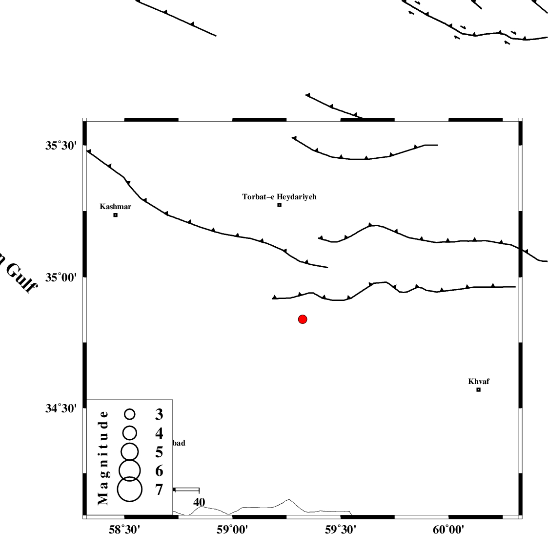
| Location | Lat:34.839 Lon: 59.324 |
| Region | Khorasan(center) Province, 49 km South-East of Torbat-e heydariyeh |
Nearest Cities |
|
| 18 km North East of Jangal, Khorasan(center) Province | |
| 30 km South West of Basfar, Khorasan(center) Province | |
| 30 km South West of Rashtkhvar, Khorasan(center) Province | |
| 33 km South West of Hoseynabad, Khorasan(center) Province | |
| 43 km South East of Booriabad, Khorasan(center) Province | |
| Depth | 15 km |
| Agency | |
Faults within 150 km: |
|
| JANGAL_F (Length: 111 km) , Distance to epicenter: 4 km | |
| KHAF_F (Length: 58 km) , Distance to epicenter: 11 km | |
| DUGHABAD_F (Length: 62 km) , Distance to epicenter: 38 km | |
| Number of Phases | 7 |
| RMS | 0.1 |
| Number of Stations | 5 |
| Error in Latitude | >3.7 km |
| Error in Longitude | 6.8 km |
| Error in Depth | 11.7 km |
Download waveform in seisan format
to download seisan software Click here
to access information about IIEES stations Click here
Amplitude | ||||||||
| UID | Agency | Station | Component | Amplitude | Period | Arrival Time | Proccessing Time | Signal Clip |
| 100396 | IIEES | TABS | E | 74.6 | 0.4 | 2015-08-18 05:50:15 | 2015-08-19 07:43:00 | n |
| 100397 | IIEES | TABS | N | 19.9 | 0.35 | 2015-08-18 05:50:17 | 2015-08-19 07:43:00 | n |
Phase | ||||||||||||
| Agency | Station | Component | Phase Type | Phase Quality | First Motion | Observed Arrival Time | Time Residual | Loc. Flag | Input Weight | Distance | Azimuth | |
| IIEES | TABS | Z | Pn | E | 2015-08-18 05:49:39 | -0.04 | y | 242 | 238 | |||
| IIEES | TABS | E | Sg | E | 2015-08-18 05:50:10 | -0.03 | y | 242 | 238 | |||
| IIEES | BSRN | Z | Pn | E | 2015-08-18 05:49:49 | 0.05 | y | 319 | 183 | |||
| IIEES | SHRO | Z | Pn | E | 2015-08-18 05:49:49 | -0.02 | y | 327 | 294 | |||
| IIEES | YZKH | Z | Pn | E | 2015-08-18 05:50:13 | 0.14 | y | 516 | 240 | |||
| IIEES | YZKH | E | Sg | E | 2015-08-18 05:51:25 | 0.05 | y | 516 | 240 | |||
| IIEES | KRBR | Z | Pn | E | 2015-08-18 05:50:22 | -0.14 | y | 590 | 205 | |||